

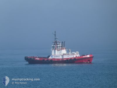
PROTECTOR
Tug

Current Trip
US^0U5P>0U5Q
| Time Travelled | 2 mins |
|---|---|
| Remaining Time | --- |
| Distance Travelled | --- |
| Remaining Distance | --- |
| AVG Speed | --- |
| MAX Speed | --- |
| AVG Wind | --- |
| MAX Wind | --- |
| MIN Temp | --- |
| MAX Temp | --- |
| Draught | 0 m |
| Position Received | 1 m ago |
Current Position
| Longitude | -122.61579° |
|---|---|
| Latitude | 48.52435° |
| Status | Under way using engine |
| Speed | 2.6 Knots |
| Course | 251° |
| Area | The Coastal Waters of Southeast Alaska and British Columbia |
| Station | T-AIS |
| Position Received | 1 m ago |
Information
The current position of PROTECTOR is in The Coastal Waters of Southeast Alaska and British Columbia with coordinates 48.52435° / -122.61579° as reported on 2025-05-28 16:39 by AIS to our vessel tracker app. The vessel's current speed is 2.6 Knots
The vessel PROTECTOR (IMO: 9139828, MMSI: 366887970) is a Tug that was built in 1996 ( 29 years old ). It's sailing under the flag of [US] USA.
In this page you can find informations about the vessels current position, last detected port calls, and current voyage information. If the vessels is not in coverage by AIS you will find the latest position.
The current position of PROTECTOR is detected by our AIS receivers and we are not responsible for the reliability of the data. The last position was recorded while the vessel was in Coverage by the Ais receivers of our vessel tracking app.
Weather
| Temperature | 15.9°C / 60.62°F |
|---|---|
| Wind Speed | 2 knots |
| Direction | 212° SSW |
| Pressure | 1011.7 hPa |
| Humidity | 72.9 % |
| Cloud Coverage | 23 % |


Featured Company
Last Port Calls
| Port | Arrival | Departure | Time In Port |
|---|---|---|---|
| 2025-05-28 03:18 | 2025-05-28 09:38 | 6 h | |
| 2025-05-27 21:51 | 2025-05-27 22:49 | 57 m | |
| 2025-05-27 17:03 | 2025-05-27 17:59 | 56 m | |
| 2025-05-27 09:47 | 2025-05-27 10:10 | 23 m | |
| 2025-05-26 13:51 | 2025-05-27 09:09 | 19 h | |
| 2025-05-26 12:40 | 2025-05-26 13:32 | 52 m | |
| 2025-05-26 09:32 | 2025-05-26 10:20 | 47 m | |
| 2025-05-26 06:40 | 2025-05-26 07:13 | 32 m | |
| 2025-05-25 06:07 | 2025-05-25 06:59 | 52 m | |
| 2025-05-24 18:08 | 2025-05-24 19:21 | 1 h |
Most Visited Ports (Last year)
| Port | Arrivals | |
|---|---|---|
| 154 | ||
| 123 | ||
| 73 | ||
| 66 | ||
| 46 | ||
| 42 |
Last Trips
| Origin | Departure | Destination | Arrival | Distance | |
|---|---|---|---|---|---|
| 2025-05-27 22:49 | 2025-05-28 03:18 | 39.82 nm | |||
| 2025-05-27 17:59 | 2025-05-27 21:51 | 5.03 nm | |||
| 2025-05-27 10:10 | 2025-05-27 17:03 | 20.81 nm | |||
| 2025-05-27 09:09 | 2025-05-27 09:47 | 1.74 nm | |||
| 2025-05-26 13:32 | 2025-05-26 13:51 | 1.47 nm | |||
| 2025-05-26 10:20 | 2025-05-26 12:40 | 22.94 nm | |||
| 2025-05-26 07:13 | 2025-05-26 09:32 | 3.70 nm | |||
| 2025-05-25 06:59 | 2025-05-26 06:40 | 78.33 nm | |||
| 2025-05-24 19:21 | 2025-05-25 06:07 | 6.40 nm | |||
| 2025-05-24 13:12 | 2025-05-24 18:08 | 23.79 nm |
Events
| Time | Event | Details | Position / Dest | Info |
|---|---|---|---|---|
| 2025-05-28 16:38 | PORT DEPARTURE |
|
48.52435 / -122.61579
US^0U5P>0U5Q
|
Speed: 2.5 kn Course: 250° |
| 2025-05-28 10:19 | STOP Moving |
48.52186 / -122.61532
[US] ANACORTES
|
Speed: 0.3 kn Course: 71° |
|
| 2025-05-28 10:18 | PORT ARRIVAL |
|
48.52228 / -122.61571
[US] ANACORTES
|
Speed: 1.1 kn Course: 31° |
| 2025-05-28 09:21 | Destination Changed | US^0U5P>0U5Q US^0U5P>016C |
48.46386 / -122.72395
US^0U5P>0U5Q
|
Speed: 8.4 kn Course: 3.8° |
| 2025-05-28 05:49 | PORT DEPARTURE |
|
48.85469 / -122.75842
US^0U5P>016C
|
Speed: 9.2 kn Course: 171° |
| 2025-05-28 05:47 | START Moving |
48.86050 / -122.75935
[US] CHERRY POINT
|
Speed: 3.7 kn Course: 176° |
|
| 2025-05-28 05:41 | Destination Changed | US^0U5P>016C US^0U5P> |
48.86071 / -122.75940
[US] CHERRY POINT
|
Speed: Course: 219° |
| 2025-05-28 04:52 | STOP Moving |
48.85778 / -122.75639
[US] CHERRY POINT
|
Speed: 0.3 kn Course: 223° |
|
| 2025-05-28 04:51 | PORT ARRIVAL |
|
48.85777 / -122.75639
[US] CHERRY POINT
|
Speed: 1 kn Course: 249° |
| 2025-05-28 03:33 | START Moving | 0.95 nm, South of FERNDALE |
48.80947 / -122.72294
US^0U5P>
|
Speed: 3.9 kn Course: 269° |