
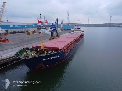
RIX ELEONORA
General Cargo
Current Trip
| Trip Time | 1 day |
|---|---|
| Trip Distance | 351.41 nm |
| AVG Speed | 8.5 Knots |
| MAX Speed | 9.9 Knots |
| Draught | 5 m |
| AVG Wind | 21.8 knots |
| MAX Wind | 30.8 knots |
| MIN Temp | 2.7°C / 36.86°F |
| MAX Temp | 4.6°C / 40.28°F |
| Position Received | 6 h, 7 m ago |
Current Position
| Longitude | 0.20061° |
|---|---|
| Latitude | 52.77629° |
| Status | Moored |
| Speed | |
| Course | 19° |
| Area | North Sea |
| Station | T-AIS |
| Position Received | 6 h, 7 m ago |
Info
Information
The current position of RIX ELEONORA is in North Sea with coordinates 52.77629° / 0.20061° as reported on 2025-02-13 19:12 by AIS to our vessel tracker app. The vessel's current speed is 0 Knots and is currently inside the port of SUTTON BRIDGE.
The vessel RIX ELEONORA (IMO: 9194830, MMSI: 255805993) is a General Cargo that was built in 1998 ( 27 years old ). It's sailing under the flag of [PT] Portugal.
In this page you can find informations about the vessels current position, last detected port calls, and current voyage information. If the vessels is not in coverage by AIS you will find the latest position.
The current position of RIX ELEONORA is detected by our AIS receivers and we are not responsible for the reliability of the data. The last position was recorded while the vessel was in Coverage by the Ais receivers of our vessel tracking app.
The current draught of RIX ELEONORA as reported by AIS is 5 meters
Weather
| Temperature | 2°C / 35.6°F |
|---|---|
| Wind Speed | 6 knots |
| Direction | 98° E |
| Pressure | 1025.7 hPa |
| Humidity | 69.2 % |
| Cloud Coverage | 97 % |
Featured Company
Last Port Calls
| Port | Arrival | Departure | Time In Port |
|---|---|---|---|
| 2025-02-13 06:41 | |||
| 2025-02-09 08:04 | 2025-02-11 12:08 | 2 d | |
| 2025-02-06 20:21 | 2025-02-07 19:59 | 23 h | |
| 2025-02-02 21:51 | 2025-02-03 16:22 | 18 h | |
| 2025-01-31 13:41 | 2025-02-01 15:54 | 1 d | |
| 2025-01-29 11:38 | 2025-01-29 21:08 | 9 h | |
| 2025-01-22 20:29 | 2025-01-27 20:52 | 5 d | |
| 2025-01-12 18:40 | 2025-01-15 00:28 | 2 d | |
| 2025-01-09 22:49 | 2025-01-10 02:38 | 3 h | |
| 2025-01-08 06:36 | 2025-01-09 22:00 | 1 d |
Most Visited Ports (Last year)
| Port | Arrivals | |
|---|---|---|
| 4 | ||
| 3 | ||
| 3 | ||
| 3 | ||
| 2 | ||
| 2 |
Last Trips
| Origin | Departure | Destination | Arrival | Distance | |
|---|---|---|---|---|---|
| 2025-02-11 12:08 | 2025-02-13 06:41 | 351.41 nm | |||
| 2025-02-07 19:59 | 2025-02-09 08:04 | 304.95 nm | |||
| 2025-02-03 16:22 | 2025-02-06 20:21 | 560.59 nm | |||
| 2025-02-01 15:54 | 2025-02-02 21:51 | 308.80 nm | |||
| 2025-01-29 21:08 | 2025-01-31 13:41 | 364.21 nm | |||
| 2025-01-27 20:52 | 2025-01-29 11:38 | 341.19 nm | |||
| 2025-01-15 00:28 | 2025-01-22 20:29 | 1562.90 nm | |||
| 2025-01-10 02:38 | 2025-01-12 18:40 | 545.26 nm | |||
| 2025-01-09 22:00 | 2025-01-09 22:49 | 5.21 nm | |||
| 2025-01-08 06:10 | 2025-01-08 06:36 | 1.30 nm |
Events
| Time | Event | Details | Position / Dest | Info |
|---|---|---|---|---|
| 2025-02-13 19:19 | Status Changed | Default Moored |
52.77629 / .20061
[GB] SUTTON BRIDGE
|
Speed: Course: 19° |
| 2025-02-13 19:12 | Status Changed | Moored Default |
52.77629 / .20061
[GB] SUTTON BRIDGE
|
Speed: Course: 19° |
| 2025-02-13 19:12 | IN Coverage |
52.77629 / .20061
North Sea
[GB] SUTTON BRIDGE
|
Speed: Course: 10° |
|
| 2025-02-13 19:12 | OUT of Coverage |
52.77629 / .20061
North Sea
[GB] SUTTON BRIDGE
|
Speed: Course: 10° |
|
| 2025-02-13 06:45 | STOP Moving |
52.77628 / .20069
[GB] SUTTON BRIDGE
|
Speed: 0.3 kn Course: 18° |
|
| 2025-02-13 06:41 | PORT ARRIVAL |
|
52.77694 / .20121
[GB] SUTTON BRIDGE
|
Speed: 3.2 kn Course: 17° |
| 2025-02-13 04:45 | START Moving | 9.11 nm, North of SUTTON BRIDGE |
52.91956 / .25958
GBPSB
|
Speed: 5.7 kn Course: 194° |
| 2025-02-13 01:37 | STOP Moving | 9.45 nm, North of SUTTON BRIDGE |
52.92513 / .26119
GBPSB
|
Speed: 0.3 kn Course: 23° |
| 2025-02-12 17:24 | Status Changed | Default Under way using engine |
53.88246 / 1.19941
GBPSB
|
Speed: 9.4 kn Course: 220.6° |
| 2025-02-12 17:19 | OUT of Coverage |
53.89198 / 1.21330
North Sea
GBPSB
|
Speed: 9.4 kn Course: 220.6° |