
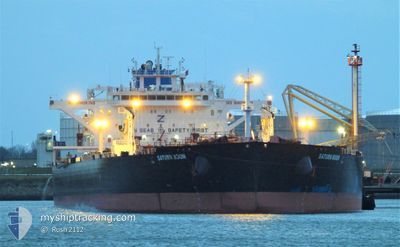
SATURN MOON
Tanker
Current Trip
| Time Travelled | 41 days |
|---|---|
| Remaining Time | 5 days |
| Distance Travelled | 5912.22 nm |
| Remaining Distance | 1894.01 nm |
| AVG Speed | 10.9 Knots |
| MAX Speed | 10.9 Knots |
| AVG Wind | 9 knots |
| MAX Wind | 25 knots |
| MIN Temp | 6.1°C / 42.98°F |
| MAX Temp | 20.5°C / 68.9°F |
| Draught | 15.2 m |
| Position Received | 2 d ago |
Current Position
| Longitude | 13.87177° |
|---|---|
| Latitude | 36.56709° |
| Status | Under way using engine |
| Speed | 12.1 Knots |
| Course | 288.9° |
| Area | Mediterranean Sea - Eastern Basin |
| Station | T-AIS |
| Position Received | 2 d ago |
Info
Information
The current position of SATURN MOON is in Mediterranean Sea - Eastern Basin with coordinates 36.56709° / 13.87177° as reported on 2025-12-13 19:56 by AIS to our vessel tracker app. The vessel's current speed is 12.1 Knots and is heading at the port of LE HAVRE. The estimated time of arrival as calculated by MyShipTracking vessel tracking app is 2025-12-21 08:18 LT
The vessel SATURN MOON (IMO: 9814430, MMSI: 636019541) is a Tanker It's sailing under the flag of [LR] Liberia.
In this page you can find informations about the vessels current position, last detected port calls, and current voyage information. If the vessels is not in coverage by AIS you will find the latest position.
The current position of SATURN MOON is detected by our AIS receivers and we are not responsible for the reliability of the data. The last position was recorded while the vessel was in Coverage by the Ais receivers of our vessel tracking app.
The current draught of SATURN MOON as reported by AIS is 15.2 meters
Weather
| Temperature | 16.1°C / 60.98°F |
|---|---|
| Wind Speed | 13 knots |
| Direction | 201° SSW |
| Pressure | 1009.2 hPa |
| Humidity | 74.8 % |
| Cloud Coverage | 100 % |
Featured Company
Last Port Calls
| Port | Arrival | Departure | Time In Port |
|---|---|---|---|
| 2025-11-01 08:26 | 2025-11-04 15:46 | 3 d |
Last Trips
| Origin | Departure | Destination | Arrival | Distance | |
|---|---|---|---|---|---|
| 2025-09-18 20:04 | 2025-11-01 08:26 | 6094.17 nm |
Events
| Time | Event | Details | Position / Dest | Info |
|---|---|---|---|---|
| 2025-12-13 20:01 | Status Changed | Default Under way using engine |
36.57201 / 13.85247
FRLEH
|
Speed: 12.1 kn Course: 288.9° |
| 2025-12-13 19:56 | OUT of Coverage |
36.56709 / 13.87177
Mediterranean Sea - Eastern Basin
FRLEH
|
Speed: 12.1 kn Course: 288.9° |
|
| 2025-12-13 17:59 | Detected in Sea | Italian part of the Mediterranean Sea - Eastern Basin |
36.46163 / 14.34934
Mediterranean Sea - Eastern Basin
FRLEH
|
Speed: 12.2 kn Course: 286° |
| 2025-12-13 17:59 | Status Changed | Under way using engine Default |
36.46163 / 14.34934
FRLEH
|
Speed: 12.1 kn Course: 286° |
| 2025-12-13 17:49 | IN Coverage |
36.46163 / 14.34934
Mediterranean Sea - Eastern Basin
FRLEH
|
Speed: 12.2 kn Course: 286° |
|
| 2025-12-12 10:15 | Status Changed | Default Under way using engine |
35.99971 / 22.46518
FRLEH
|
Speed: 11.3 kn Course: 263.8° |
| 2025-12-12 09:52 | OUT of Coverage |
36.00856 / 22.55510
Mediterranean Sea - Eastern Basin
FRLEH
|
Speed: 11.3 kn Course: 263.8° |
|
| 2025-12-12 09:51 | Status Changed | Under way using engine Default |
36.00886 / 22.55888
FRLEH
|
Speed: 11.4 kn Course: 273° |
| 2025-12-12 09:38 | Status Changed | Default Under way using engine |
36.00902 / 22.61184
FRLEH
|
Speed: 11.4 kn Course: 273.1° |
| 2025-12-12 07:22 | Change Sea Area | Greek part of the Mediterranean Sea - Eastern Basin Greek part of the Aegean Sea |
36.03576 / 23.14193
Mediterranean Sea - Eastern Basin
FRLEH
|
Speed: 12 kn Course: 227.1° |