

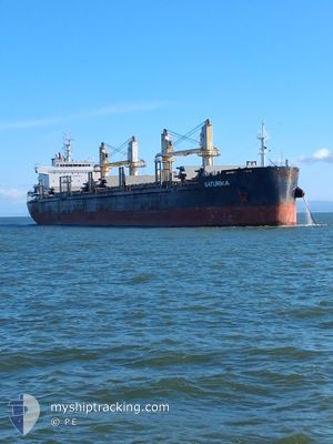
SATURNIA
Cargo

Current Trip
| Time Travelled | 4 days |
|---|---|
| Remaining Time | --- |
| Distance Travelled | 1167.06 nm |
| Remaining Distance | --- |
| AVG Speed | 10.2 Knots |
| MAX Speed | 11.9 Knots |
| AVG Wind | 16.4 knots |
| MAX Wind | 31 knots |
| MIN Temp | 15.1°C / 59.18°F |
| MAX Temp | 29.6°C / 85.28°F |
| Draught | 10.5 m |
| Position Received | 4 d ago |
Current Position
| Longitude | 129.18981° |
|---|---|
| Latitude | 34.64247° |
| Status | Under way using engine |
| Speed | 9.5 Knots |
| Course | 218.4° |
| Area | Japan Sea |
| Station | T-AIS |
| Position Received | 4 d ago |
Information
The current position of SATURNIA is in Japan Sea with coordinates 34.64247° / 129.18981° as reported on 2025-05-23 13:40 by AIS to our vessel tracker app. The vessel's current speed is 9.5 Knots and is heading at the port of MUMBAI. The estimated time of arrival as calculated by MyShipTracking vessel tracking app is 2025-06-12 09:30 LT
The vessel SATURNIA (IMO: 9725380, MMSI: 256402000) is a Cargo It's sailing under the flag of [MT] Malta.
In this page you can find informations about the vessels current position, last detected port calls, and current voyage information. If the vessels is not in coverage by AIS you will find the latest position.
The current position of SATURNIA is detected by our AIS receivers and we are not responsible for the reliability of the data. The last position was recorded while the vessel was in Coverage by the Ais receivers of our vessel tracking app.
The current draught of SATURNIA as reported by AIS is 10.5 meters
Weather
| Temperature | 29.5°C / 85.1°F |
|---|---|
| Wind Speed | 19 knots |
| Direction | 95° E |
| Pressure | 1009 hPa |
| Humidity | 78.6 % |
| Cloud Coverage | 100 % |


Featured Company
Last Port Calls
| Port | Arrival | Departure | Time In Port |
|---|---|---|---|
| 2025-05-21 12:44 | 2025-05-23 11:51 | 1 d | |
| 2025-05-17 19:32 | 2025-05-20 17:10 | 2 d | |
| 2025-04-30 07:30 | 2025-05-03 11:41 | 3 d | |
| 2025-04-26 06:30 | 2025-04-26 20:18 | 13 h | |
| 2025-04-21 06:38 | 2025-04-23 22:22 | 2 d | |
| 2025-03-12 17:57 | 2025-03-28 23:36 | 16 d | |
| 2025-03-05 20:30 |
Last Trips
| Origin | Departure | Destination | Arrival | Distance | |
|---|---|---|---|---|---|
| 2025-05-20 17:10 | 2025-05-21 12:44 | 204.94 nm | |||
| 2025-05-03 11:41 | 2025-05-17 19:32 | 1174.91 nm | |||
| 2025-04-26 20:18 | 2025-04-30 07:30 | 241.50 nm | |||
| 2025-04-23 22:22 | 2025-04-26 06:30 | 10.75 nm | |||
| 2025-03-28 23:36 | 2025-04-21 06:38 | 3866.26 nm | |||
| 2025-03-05 20:30 | 2025-03-12 17:57 | 672.28 nm |
Events
| Time | Event | Details | Position / Dest | Info |
|---|---|---|---|---|
| 2025-05-23 13:50 | Status Changed | Default Under way using engine |
34.62201 / 129.17012
INBOM
|
Speed: 9.5 kn Course: 218.4° |
| 2025-05-23 13:40 | OUT of Coverage |
34.64247 / 129.18981
Japan Sea
INBOM
|
Speed: 9.5 kn Course: 218.4° |
|
| 2025-05-23 13:36 | Status Changed | Under way using engine Default |
34.65237 / 129.19941
INBOM
|
Speed: 9.5 kn Course: 221° |
| 2025-05-23 13:22 | Status Changed | Default Under way using engine |
34.67945 / 129.22807
INBOM
|
Speed: 9.3 kn Course: 221.8° |
| 2025-05-23 13:14 | Status Changed | Under way using engine Default |
34.69564 / 129.24558
INBOM
|
Speed: 9.3 kn Course: 222° |
| 2025-05-23 12:43 | Status Changed | Default Under way using engine |
34.75914 / 129.31102
INBOM
|
Speed: 9.7 kn Course: 215.6° |
| 2025-05-23 12:36 | Change Sea Area | Japanese part of the Japan Sea South Korean part of the Japan Sea |
34.77375 / 129.32399
Japan Sea
INBOM
|
Speed: 9.7 kn Course: 215.6° |
| 2025-05-23 12:36 | Status Changed | Under way using engine Default |
34.77375 / 129.32399
INBOM
|
Speed: 9.7 kn Course: 215° |
| 2025-05-23 12:26 | IN Coverage |
34.77375 / 129.32399
Japan Sea
INBOM
|
Speed: 9.7 kn Course: 215.6° |
|
| 2025-05-23 04:41 | OUT of Coverage |
35.98445 / 129.70885
Japan Sea
INBOM
|
Speed: 11.2 kn Course: 144.6° |