

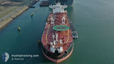
SCOTT SPIRIT
Oil Products Tanker

Current Trip
| Time Travelled | 38 days |
|---|---|
| Remaining Time | --- |
| Distance Travelled | 4233.71 nm |
| Remaining Distance | --- |
| AVG Speed | 9.6 Knots |
| MAX Speed | 15.9 Knots |
| AVG Wind | 12 knots |
| MAX Wind | 29.7 knots |
| MIN Temp | 3.2°C / 37.76°F |
| MAX Temp | 16.3°C / 61.34°F |
| Draught | 9.5 m |
| Position Received | 3 m ago |
Current Position
| Longitude | -3.01323° |
|---|---|
| Latitude | 58.88631° |
| Status | At anchor |
| Speed | 0.3 Knots |
| Course | 109° |
| Area | North Sea |
| Station | T-AIS |
| Position Received | 3 m ago |
Information
The current position of SCOTT SPIRIT is in North Sea with coordinates 58.88631° / -3.01323° as reported on 2025-04-25 16:10 by AIS to our vessel tracker app. The vessel's current speed is 0.3 Knots
The vessel SCOTT SPIRIT (IMO: 9466142, MMSI: 311027400) is a Oil Products Tanker that was built in 2011 ( 14 years old ). It's sailing under the flag of [BS] Bahamas.
In this page you can find informations about the vessels current position, last detected port calls, and current voyage information. If the vessels is not in coverage by AIS you will find the latest position.
The current position of SCOTT SPIRIT is detected by our AIS receivers and we are not responsible for the reliability of the data. The last position was recorded while the vessel was in Coverage by the Ais receivers of our vessel tracking app.
The current draught of SCOTT SPIRIT as reported by AIS is 9.5 meters
Weather
| Temperature | 7.9°C / 46.22°F |
|---|---|
| Wind Speed | 21 knots |
| Direction | 132° SE |
| Pressure | 1022.1 hPa |
| Humidity | 80.8 % |
| Cloud Coverage | 70 % |


Featured Company
Last Port Calls
| Port | Arrival | Departure | Time In Port |
|---|---|---|---|
| 2025-03-15 05:56 | 2025-03-17 18:45 | 2 d | |
| 2025-03-14 04:06 | 2025-03-15 05:36 | 1 d | |
| 2025-02-28 04:10 | 2025-03-03 13:31 | 3 d | |
| 2025-02-16 20:33 | 2025-02-18 18:59 | 1 d | |
| 2025-02-04 23:54 | 2025-02-06 05:39 | 1 d |
Most Visited Ports (Last year)
| Port | Arrivals | |
|---|---|---|
| 12 | ||
| 4 | ||
| 3 | ||
| 2 | ||
| 1 | ||
| 1 |
Last Trips
| Origin | Departure | Destination | Arrival | Distance | |
|---|---|---|---|---|---|
| 2025-03-15 05:36 | 2025-03-15 05:56 | 1.94 nm | |||
| 2025-03-03 13:31 | 2025-03-14 04:06 | 1165.91 nm | |||
| 2025-02-18 18:59 | 2025-02-28 04:10 | 1398.39 nm | |||
| 2025-02-06 05:39 | 2025-02-16 20:33 | 1554.38 nm | |||
| 2025-01-08 13:56 | 2025-02-04 23:54 | 1941.57 nm |
Events
| Time | Event | Details | Position / Dest | Info |
|---|---|---|---|---|
| 2025-04-25 09:49 | Status Changed | At anchor Default |
58.88674 / -3.01335
GB SCF
|
Speed: 0.3 kn Course: 121° |
| 2025-04-25 09:47 | Status Changed | Default At anchor |
58.88653 / -3.01349
GB SCF
|
Speed: 0.3 kn Course: 121° |
| 2025-04-25 00:01 | Status Changed | At anchor Default |
58.88638 / -3.01340
GB SCF
|
Speed: 0.2 kn Course: 112° |
| 2025-04-24 23:58 | Status Changed | Default At anchor |
58.88620 / -3.01358
GB SCF
|
Speed: 0.3 kn Course: 110° |
| 2025-04-24 20:10 | Status Changed | At anchor Under way using engine |
58.88626 / -3.01323
GB SCF
|
Speed: 0.4 kn Course: 112° |
| 2025-04-24 19:50 | STOP Moving | 3.55 nm, North West of ST MARGARET'S HOPE |
58.88475 / -3.01150
GB SCF
|
Speed: 0.3 kn Course: 120° |
| 2025-04-24 19:22 | START Moving | 3 nm, South West of SCAPA |
58.91618 / -3.02821
GB SCF
|
Speed: 4.1 kn Course: 198° |
| 2025-04-24 19:03 | Status Changed | Under way using engine Moored |
58.92046 / -3.02413
GB SCF
|
Speed: Course: 138° |
| 2025-04-24 18:23 | Status Changed | Moored Default |
58.92013 / -3.02451
GB SCF
|
Speed: Course: 132° |
| 2025-04-24 18:20 | Status Changed | Default Moored |
58.92006 / -3.02446
GB SCF
|
Speed: Course: 135° |