

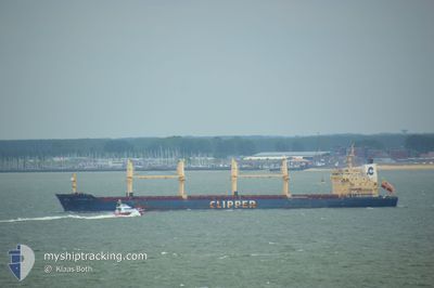
SEASTAR TROJAN
Bulk Carrier

Current Trip
| Time Travelled | 19 days |
|---|---|
| Remaining Time | 5 days |
| Distance Travelled | 5020.08 nm |
| Remaining Distance | 1530.00 nm |
| AVG Speed | 10.9 Knots |
| MAX Speed | 14 Knots |
| AVG Wind | 9.5 knots |
| MAX Wind | 25.9 knots |
| MIN Temp | 16°C / 60.8°F |
| MAX Temp | 30.2°C / 86.36°F |
| Draught | 10.1 m |
| Position Received | 8 d ago |
Current Position
| Longitude | 101.99281° |
|---|---|
| Latitude | 2.17870° |
| Status | Under way using engine |
| Speed | 10.4 Knots |
| Course | 307.6° |
| Area | Malacca Strait |
| Station | T-AIS |
| Position Received | 8 d ago |
Information
The current position of SEASTAR TROJAN is in Malacca Strait with coordinates 2.17870° / 101.99281° as reported on 2025-05-30 14:30 by AIS to our vessel tracker app. The vessel's current speed is 10.4 Knots and is heading at the port of MOMBASA. The estimated time of arrival as calculated by MyShipTracking vessel tracking app is 2025-06-14 05:22 LT
The vessel SEASTAR TROJAN (IMO: 9406116, MMSI: 236710000) is a Bulk Carrier that was built in 2010 ( 15 years old ). It's sailing under the flag of [GI] Gibraltar.
In this page you can find informations about the vessels current position, last detected port calls, and current voyage information. If the vessels is not in coverage by AIS you will find the latest position.
The current position of SEASTAR TROJAN is detected by our AIS receivers and we are not responsible for the reliability of the data. The last position was recorded while the vessel was in Coverage by the Ais receivers of our vessel tracking app.
The current draught of SEASTAR TROJAN as reported by AIS is 10.1 meters
Weather
| Temperature | 28.7°C / 83.66°F |
|---|---|
| Wind Speed | 7 knots |
| Direction | 193° SSW |
| Pressure | 1010.9 hPa |
| Humidity | 73.2 % |
| Cloud Coverage | 100 % |


Featured Company
Last Port Calls
| Port | Arrival | Departure | Time In Port |
|---|---|---|---|
| 2025-05-09 13:26 | 2025-05-20 12:46 | 10 d | |
| 2025-04-21 10:18 | 2025-04-25 01:58 | 3 d |
Last Trips
| Origin | Departure | Destination | Arrival | Distance | |
|---|---|---|---|---|---|
| 2025-04-25 09:58 | 2025-05-09 21:26 | 1056.89 nm | |||
| 2025-03-26 21:19 | 2025-04-21 18:18 | 6422.31 nm |
Events
| Time | Event | Details | Position / Dest | Info |
|---|---|---|---|---|
| 2025-05-30 14:38 | Status Changed | Default Under way using engine |
2.19371 / 101.97362
KE MBA
|
Speed: 10.4 kn Course: 307.6° |
| 2025-05-30 14:30 | OUT of Coverage |
2.17870 / 101.99281
Malacca Strait
KE MBA
|
Speed: 10.4 kn Course: 307.6° |
|
| 2025-05-30 14:21 | Status Changed | Under way using engine Default |
2.16318 / 102.01252
KE MBA
|
Speed: 10.3 kn Course: 309° |
| 2025-05-30 14:18 | Status Changed | Default Under way using engine |
2.15774 / 102.01931
KE MBA
|
Speed: 10.4 kn Course: 309.9° |
| 2025-05-30 14:12 | Status Changed | Under way using engine Default |
2.14612 / 102.03299
KE MBA
|
Speed: 10.4 kn Course: 310° |
| 2025-05-30 13:46 | Status Changed | Default Under way using engine |
2.09600 / 102.09035
KE MBA
|
Speed: 10.4 kn Course: 305.5° |
| 2025-05-30 13:32 | Status Changed | Under way using engine Default |
2.06869 / 102.12381
KE MBA
|
Speed: 10.5 kn Course: 311° |
| 2025-05-30 13:26 | IN Coverage |
2.07481 / 102.11676
Malacca Strait
KE MBA
|
Speed: 10.6 kn Course: 311.1° |
|
| 2025-05-30 05:38 | Status Changed | Default Under way using engine |
1.24255 / 103.41333
KE MBA
|
Speed: 10 kn Course: 283° |
| 2025-05-30 05:38 | OUT of Coverage |
1.24242 / 103.41383
Malacca Strait
KE MBA
|
Speed: 10 kn Course: 283° |