
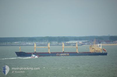
SEASTAR TROJAN
Bulk Carrier
Current Trip
| Trip Time | 16 days |
|---|---|
| Trip Distance | 308.30 nm |
| AVG Speed | 11.1 Knopen |
| MAX Speed | 11.1 Knopen |
| Diepgang | 5.9 M |
| AVG Wind | 10.9 knots |
| MAX Wind | 38 knots |
| MIN Temp | 3.4°C / 38.12°F |
| MAX Temp | 14.2°C / 57.56°F |
| Positie ontvangen | 4 h, 26 m geleden |
Current Position
| Lengtegraad | -122.25778° |
|---|---|
| Breedtegraat | 38.06235° |
| Status | Under way using engine |
| Snelheid | 14.8 Knopen |
| Koers | 83.1° |
| Gebied | North Pacific Ocean |
| Station | T-AIS |
| Positie ontvangen | 4 h, 26 m geleden |
Info
Information
The current position of SEASTAR TROJAN is in North Pacific Ocean with coordinates 38.06235° / -122.25778° as reported on 2025-02-13 09:55 by AIS to our vessel tracker app. The vessel's current speed is 14.8 Knopen and is currently inside the port of BENICIA.
The vessel SEASTAR TROJAN (IMO: 9406116, MMSI: 236710000) is a Bulk Carrier that was built in 2010 ( 15 Jaar oud ). It's sailing under the flag of [GI] Gibraltar.
In this page you can find informations about the vessels current position, last detected port calls, and current voyage information. If the vessels is not in coverage by AIS you will find the latest position.
The current position of SEASTAR TROJAN is detected by our AIS receivers and we are not responsible for the reliability of the data. The last position was recorded while the vessel was in Coverage by the Ais receivers of our vessel tracking app.
The current draught of SEASTAR TROJAN as reported by AIS is 5.9 meters
Weather
| Temperature | 11.5°C / 52.7°F |
|---|---|
| Wind Speed | 17 knots |
| Direction | 223° SW |
| Pressure | 999 hPa |
| Humidity | 95.3 % |
| Cloud Coverage | 100 % |
Featured Company
Events
| Tijd | Evenement | Details | Positie / Bestemming | Info |
|---|---|---|---|---|
| 2025-02-13 10:47 | Stop beweging |
38.04284 / -122.13185
[US] BENICIA
|
Snelheid: 0.3 kn Koers: 229° |
|
| 2025-02-13 10:43 | Aankomsthaven |
|
38.04248 / -122.13167
[US] BENICIA
|
Snelheid: 1.1 kn Koers: 236° |
| 2025-02-13 10:03 | Status Changed | Default Under way using engine |
38.06142 / -122.21485
US SFO
|
Snelheid: 14.8 kn Koers: 83.1° |
| 2025-02-13 09:55 | Buitenbereik |
38.06235 / -122.25778
North Pacific Ocean
[US] BENICIA
|
Snelheid: 14.8 kn Koers: 83.1° |
|
| 2025-02-13 07:51 | Start beweging | 4.97 nm, South East of SAN FRANCISCO |
37.69915 / -122.32512
US SFO
|
Snelheid: 3.2 kn Koers: 26° |
| 2025-02-13 07:45 | Status Changed | Under way using engine At anchor |
37.69817 / -122.32576
US SFO
|
Snelheid: 0.6 kn Koers: 22° |
| 2025-02-13 06:03 | Status Changed | At anchor Default |
37.69728 / -122.32413
US SFO
|
Snelheid: Koers: 21° |
| 2025-02-13 05:57 | Status Changed | Default At anchor |
37.69719 / -122.32430
US SFO
|
Snelheid: Koers: 22° |
| 2025-02-13 05:42 | Status Changed | At anchor Default |
37.69730 / -122.32416
US SFO
|
Snelheid: Koers: 14° |
| 2025-02-13 05:39 | Status Changed | Default At anchor |
37.69729 / -122.32410
US SFO
|
Snelheid: Koers: 8° |