
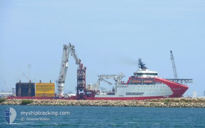
SEVEN OCEANIC
Offshore Supply Ship
Current Trip
LOKTA
| Time Travelled | 39 days |
|---|---|
| Remaining Time | --- |
| Distance Travelled | 1916.51 nm |
| Remaining Distance | --- |
| AVG Speed | 12 Knots |
| MAX Speed | 16.3 Knots |
| AVG Wind | 19.6 knots |
| MAX Wind | 34 knots |
| MIN Temp | -4.1°C / 24.62°F |
| MAX Temp | 11°C / 51.8°F |
| Draught | 7.7 m |
| Position Received | 1 m ago |
Current Position
| Longitude | 12.71288° |
|---|---|
| Latitude | 66.19530° |
| Status | Restricted manoeuverability |
| Speed | |
| Course | 155° |
| Area | Norwegian Sea |
| Station | T-AIS |
| Position Received | 1 m ago |
Info
Information
The current position of SEVEN OCEANIC is in Norwegian Sea with coordinates 66.19530° / 12.71288° as reported on 2025-12-14 13:32 by AIS to our vessel tracker app. The vessel's current speed is 0 Knots
The vessel SEVEN OCEANIC (IMO: 9468205, MMSI: 232026676) is a Offshore Supply Ship that was built in 2011 ( 14 years old ). It's sailing under the flag of [GB] United Kingdom.
In this page you can find informations about the vessels current position, last detected port calls, and current voyage information. If the vessels is not in coverage by AIS you will find the latest position.
The current position of SEVEN OCEANIC is detected by our AIS receivers and we are not responsible for the reliability of the data. The last position was recorded while the vessel was in Coverage by the Ais receivers of our vessel tracking app.
The current draught of SEVEN OCEANIC as reported by AIS is 7.7 meters
Weather
| Temperature | 4°C / 39.2°F |
|---|---|
| Wind Speed | 21 knots |
| Direction | 153° SSE |
| Pressure | 992.6 hPa |
| Humidity | 84.1 % |
| Cloud Coverage | 100 % |
Featured Company
Last Port Calls
| Port | Arrival | Departure | Time In Port |
|---|---|---|---|
| 2025-11-03 09:01 | 2025-11-05 12:53 | 2 d | |
| 2025-10-11 14:40 | 2025-10-15 13:56 | 3 d | |
| 2025-10-09 00:34 | 2025-10-10 08:43 | 1 d |
Last Trips
| Origin | Departure | Destination | Arrival | Distance | |
|---|---|---|---|---|---|
| 2025-10-15 13:56 | 2025-11-03 09:01 | 1155.62 nm | |||
| 2025-10-10 08:43 | 2025-10-11 14:40 | 355.45 nm | |||
| 2025-09-28 18:42 | 2025-10-09 00:34 | 2278.59 nm |
Events
| Time | Event | Details | Position / Dest | Info |
|---|---|---|---|---|
| 2025-12-13 11:07 | Status Changed | Restricted manoeuverability Under way using engine |
66.19563 / 12.71307
LOKTA
|
Speed: 0.2 kn Course: 69° |
| 2025-12-13 11:05 | STOP Moving | 7.22 nm, West of NESNA |
66.19567 / 12.71306
LOKTA
|
Speed: 0.1 kn Course: 66° |
| 2025-12-13 08:54 | Status Changed | Under way using engine Restricted manoeuverability |
66.28874 / 12.20036
LOKTA
|
Speed: 8.4 kn Course: 105.9° |
| 2025-12-13 08:40 | START Moving | 7.25 nm, South West of LOVUND |
66.29566 / 12.12897
LOKTA
|
Speed: 4.2 kn Course: 103° |
| 2025-12-13 02:38 | Status Changed | Restricted manoeuverability Under way using engine |
66.29416 / 12.12336
LOKTA
|
Speed: 0.2 kn Course: 137° |
| 2025-12-13 02:36 | STOP Moving | 7.42 nm, South West of LOVUND |
66.29415 / 12.12334
LOKTA
|
Speed: 0.2 kn Course: 137° |
| 2025-12-12 15:30 | Destination Changed | LOKTA SKARV |
66.02657 / 8.48348
LOKTA
|
Speed: 7.8 kn Course: 78.7° |
| 2025-12-12 15:28 | IN Coverage |
66.02657 / 8.48348
Norwegian Sea
|
Speed: 7.8 kn Course: 78.7° |
|
| 2025-12-12 07:24 | OUT of Coverage |
66.00011 / 7.80195
Norwegian Sea
|
Speed: Course: 29.4° |
|
| 2025-12-12 05:35 | STOP Moving |
66.00108 / 7.80172
SKARV
|
Speed: 0.1 kn Course: 130° |