
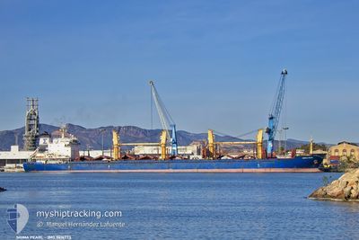
SIGMA PEARL
Bulk Carrier
Current Trip
| Time Travelled | 37 days |
|---|---|
| Remaining Time | --- |
| Distance Travelled | 1092.66 nm |
| Remaining Distance | --- |
| AVG Speed | 7.9 Knots |
| MAX Speed | 12.1 Knots |
| AVG Wind | 10.7 knots |
| MAX Wind | 22.9 knots |
| MIN Temp | 9.3°C / 48.74°F |
| MAX Temp | 18.2°C / 64.76°F |
| Draught | 9 m |
| Position Received | 8 d ago |
Current Position
| Longitude | -15.25640° |
|---|---|
| Latitude | 27.64463° |
| Status | Under way using engine |
| Speed | 10.6 Knots |
| Course | 185.2° |
| Area | North Atlantic Ocean |
| Station | T-AIS |
| Position Received | 8 d ago |
Info
Information
The current position of SIGMA PEARL is in North Atlantic Ocean with coordinates 27.64463° / -15.25640° as reported on 2025-03-06 02:27 by AIS to our vessel tracker app. The vessel's current speed is 10.6 Knots
The vessel SIGMA PEARL (IMO: 9414773, MMSI: 538011096) is a Bulk Carrier that was built in 2010 ( 15 years old ). It's sailing under the flag of [MH] Marshall Is.
In this page you can find informations about the vessels current position, last detected port calls, and current voyage information. If the vessels is not in coverage by AIS you will find the latest position.
The current position of SIGMA PEARL is detected by our AIS receivers and we are not responsible for the reliability of the data. The last position was recorded while the vessel was in Coverage by the Ais receivers of our vessel tracking app.
The current draught of SIGMA PEARL as reported by AIS is 9 meters
Weather
| Temperature | 18.2°C / 64.76°F |
|---|---|
| Wind Speed | 11 knots |
| Direction | 345° NNW |
| Pressure | 1014.4 hPa |
| Humidity | 65.8 % |
| Cloud Coverage | --- |
Featured Company
Last Port Calls
| Port | Arrival | Departure | Time In Port |
|---|---|---|---|
| 2025-01-31 16:00 | 2025-02-05 01:07 | 4 d | |
| 2025-01-20 15:32 | 2025-01-24 14:30 | 3 d | |
| 2025-01-01 17:01 | 2025-01-06 21:20 | 5 d |
Most Visited Ports (Last year)
| Port | Arrivals | |
|---|---|---|
| 1 | ||
| 1 | ||
| 1 | ||
| 1 | ||
| 1 | ||
| 1 |
Last Trips
| Origin | Departure | Destination | Arrival | Distance | |
|---|---|---|---|---|---|
| 2025-01-24 14:30 | 2025-01-31 16:00 | 954.69 nm | |||
| 2025-01-06 21:20 | 2025-01-20 15:32 | 581.48 nm | |||
| 2024-12-27 22:41 | 2025-01-01 17:01 | 1256.75 nm |
Events
| Time | Event | Details | Position / Dest | Info |
|---|---|---|---|---|
| 2025-03-06 02:27 | OUT of Coverage |
27.64463 / -15.25640
North Atlantic Ocean
CIA BJ
|
Speed: 10.6 kn Course: 185.2° |
|
| 2025-03-05 23:11 | START Moving | 1.22 nm, South East of LAS PALMAS |
28.11132 / -15.40082
CIA BJ
|
Speed: 3.1 kn Course: 30° |
| 2025-03-05 23:09 | Status Changed | Under way using engine At anchor |
28.11071 / -15.40160
CIA BJ
|
Speed: 0.4 kn Course: 325° |
| 2025-03-05 22:44 | Draught Changed | 9 8.9 |
28.10771 / -15.40178
CIA BJ
|
Speed: 0.1 kn Course: 313° |
| 2025-03-05 22:44 | Destination Changed | CIA BJ ES LPA |
28.10771 / -15.40178
CIA BJ
|
Speed: 0.1 kn Course: 313° |
| 2025-03-05 22:44 | ETA Changed | 2025/03/14 12:00 2025/03/05 23:00 |
28.10771 / -15.40178
CIA BJ
|
Speed: 0.1 kn Course: 313° |
| 2025-03-05 11:22 | STOP Moving | 1.39 nm, South East of LAS PALMAS |
28.10746 / -15.40137
ES LPA
|
Speed: 0.3 kn Course: 318° |
| 2025-03-05 11:01 | Status Changed | At anchor Under way using engine |
28.10906 / -15.40102
ES LPA
|
Speed: 0.8 kn Course: 275° |
| 2025-03-05 06:08 | Draught Changed | 8.9 6.5 |
28.42316 / -14.85451
ES LPA
|
Speed: 9.9 kn Course: 232.7° |
| 2025-03-05 06:08 | Destination Changed | ES LPA MA SFI |
28.42316 / -14.85451
ES LPA
|
Speed: 9.9 kn Course: 232.7° |