

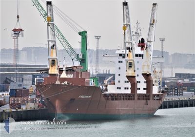
SINGELGRACHT
General Cargo

Current Trip
| Time Travelled | 4 days |
|---|---|
| Remaining Time | 4 days |
| Distance Travelled | 1710.98 nm |
| Remaining Distance | 1643.29 nm |
| AVG Speed | 14.9 Knots |
| MAX Speed | 21.6 Knots |
| AVG Wind | 12.8 knots |
| MAX Wind | 31.8 knots |
| MIN Temp | 8.6°C / 47.48°F |
| MAX Temp | 16.7°C / 62.06°F |
| Draught | 10.4 m |
| Position Received | 4 d ago |
Current Position
| Longitude | -6.27043° |
|---|---|
| Latitude | 55.44138° |
| Status | Under way using engine |
| Speed | 18.8 Knots |
| Course | 283.1° |
| Area | Inner Seas off the West Coast of Scotland |
| Station | T-AIS |
| Position Received | 4 d ago |
Information
The current position of SINGELGRACHT is in Inner Seas off the West Coast of Scotland with coordinates 55.44138° / -6.27043° as reported on 2025-05-29 04:15 by AIS to our vessel tracker app. The vessel's current speed is 18.8 Knots and is heading at the port of BALTIMORE. The estimated time of arrival as calculated by MyShipTracking vessel tracking app is 2025-06-06 21:51 LT
The vessel SINGELGRACHT (IMO: 9197375, MMSI: 245546000) is a General Cargo that was built in 2000 ( 25 years old ). It's sailing under the flag of [NL] Netherlands.
In this page you can find informations about the vessels current position, last detected port calls, and current voyage information. If the vessels is not in coverage by AIS you will find the latest position.
The current position of SINGELGRACHT is detected by our AIS receivers and we are not responsible for the reliability of the data. The last position was recorded while the vessel was in Coverage by the Ais receivers of our vessel tracking app.
The current draught of SINGELGRACHT as reported by AIS is 10.4 meters
Weather
| Temperature | 16.4°C / 61.52°F |
|---|---|
| Wind Speed | 14 knots |
| Direction | 215° SW |
| Pressure | 1029.4 hPa |
| Humidity | 98.2 % |
| Cloud Coverage | 21 % |


Featured Company
Last Port Calls
| Port | Arrival | Departure | Time In Port |
|---|---|---|---|
| 2025-05-27 22:09 | 2025-05-28 23:30 | 1 d | |
| 2025-05-23 08:42 | 2025-05-23 22:16 | 13 h | |
| 2025-05-13 17:51 | 2025-05-19 20:20 | 6 d | |
| 2025-04-25 19:24 | 2025-04-28 22:26 | 3 d | |
| 2025-04-09 13:30 | 2025-04-12 09:34 | 2 d | |
| 2025-04-05 19:00 | 2025-04-07 11:07 | 1 d |
Most Visited Ports (Last year)
| Port | Arrivals | |
|---|---|---|
| 5 | ||
| 5 | ||
| 4 | ||
| 4 | ||
| 2 | ||
| 2 |
Last Trips
| Origin | Departure | Destination | Arrival | Distance | |
|---|---|---|---|---|---|
| 2025-05-23 22:16 | 2025-05-27 22:09 | 1020.63 nm | |||
| 2025-05-19 20:20 | 2025-05-23 08:42 | 1209.40 nm | |||
| 2025-04-28 22:26 | 2025-05-13 17:51 | 4387.67 nm | |||
| 2025-04-12 09:34 | 2025-04-25 19:24 | 4629.88 nm | |||
| 2025-04-07 11:07 | 2025-04-09 13:30 | 870.95 nm | |||
| 2025-03-31 18:36 | 2025-04-05 19:00 | 1710.05 nm |
Events
| Time | Event | Details | Position / Dest | Info |
|---|---|---|---|---|
| 2025-05-29 04:21 | Status Changed | Default Under way using engine |
55.44847 / -6.32093
USBAL
|
Speed: 18.8 kn Course: 283.1° |
| 2025-05-29 04:15 | Status Changed | Under way using engine Default |
55.44138 / -6.27043
USBAL
|
Speed: 18.9 kn Course: 281° |
| 2025-05-29 04:15 | OUT of Coverage |
55.44138 / -6.27043
Inner Seas off the West Coast of Scotland
USBAL
|
Speed: 18.8 kn Course: 283.1° |
|
| 2025-05-29 04:00 | IN Coverage |
55.44138 / -6.27043
Inner Seas off the West Coast of Scotland
USBAL
|
Speed: 18.8 kn Course: 283.1° |
|
| 2025-05-29 01:29 | Status Changed | Default Under way using engine |
55.39797 / -5.05227
USBAL
|
Speed: 15.9 kn Course: 191.9° |
| 2025-05-29 01:20 | OUT of Coverage |
55.42111 / -5.00074
Inner Seas off the West Coast of Scotland
USBAL
|
Speed: 15.9 kn Course: 191.9° |
|
| 2025-05-28 22:32 | START Moving | 0.99 nm, North West of GREENOCK |
55.96086 / -4.76218
USBAL
|
Speed: 3.1 kn Course: 171° |
| 2025-05-28 22:30 | PORT DEPARTURE |
|
55.95935 / -4.76191
USBAL
|
Speed: 2.4 kn Course: 161° |
| 2025-05-28 22:19 | Status Changed | Under way using engine Moored |
55.95582 / -4.76082
[GB] GREENOCK
|
Speed: Course: 136° |
| 2025-05-28 07:39 | Status Changed | Moored Under way using engine |
55.95577 / -4.76086
[GB] GREENOCK
|
Speed: Course: 136° |