
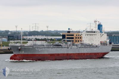
SOUTHERN QUOKKA
Tanker
Current Trip
US MSY
| Time Travelled | 13 days |
|---|---|
| Remaining Time | --- |
| Distance Travelled | 53.56 nm |
| Remaining Distance | --- |
| AVG Speed | 7.5 Knots |
| MAX Speed | 9.2 Knots |
| AVG Wind | 5.9 knots |
| MAX Wind | 10.9 knots |
| MIN Temp | 18.5°C / 65.3°F |
| MAX Temp | 34.7°C / 94.46°F |
| Draught | 10.1 m |
| Position Received | 5 d ago |
Current Position
| Longitude | -90.68981° |
|---|---|
| Latitude | 30.03847° |
| Status | At anchor |
| Speed | 0.1 Knots |
| Course | 231° |
| Area | Gulf of Mexico |
| Station | T-AIS |
| Position Received | 5 d ago |
Information
The current position of SOUTHERN QUOKKA is in Gulf of Mexico with coordinates 30.03847° / -90.68981° as reported on 2025-06-03 09:38 by AIS to our vessel tracker app. The vessel's current speed is 0.1 Knots
The vessel SOUTHERN QUOKKA (IMO: 9792010, MMSI: 636017742) is a Tanker It's sailing under the flag of [LR] Liberia.
In this page you can find informations about the vessels current position, last detected port calls, and current voyage information. If the vessels is not in coverage by AIS you will find the latest position.
The current position of SOUTHERN QUOKKA is detected by our AIS receivers and we are not responsible for the reliability of the data. The last position was recorded while the vessel was in Coverage by the Ais receivers of our vessel tracking app.
The current draught of SOUTHERN QUOKKA as reported by AIS is 10.1 meters
Weather
| Temperature | 25.4°C / 77.72°F |
|---|---|
| Wind Speed | 7 knots |
| Direction | 213° SSW |
| Pressure | 1011.4 hPa |
| Humidity | 84 % |
| Cloud Coverage | --- |
Featured Company
Last Port Calls
| Port | Arrival | Departure | Time In Port |
|---|---|---|---|
| 2025-05-26 21:04 | 2025-05-27 02:44 | 5 h | |
| 2025-05-17 16:12 | 2025-05-18 16:39 | 1 d | |
| 2025-05-13 01:28 | 2025-05-15 06:09 | 2 d | |
| 2025-05-10 18:44 | 2025-05-13 00:15 | 2 d | |
| 2025-04-23 17:11 | 2025-04-26 00:11 | 2 d | |
| 2025-04-09 12:51 | 2025-04-10 03:31 | 14 h | |
| 2025-04-03 23:12 | 2025-04-06 01:37 | 2 d |
Most Visited Ports (Last year)
| Port | Arrivals | |
|---|---|---|
| 11 | ||
| 5 | ||
| 5 | ||
| 4 | ||
| 2 | ||
| 2 |
Last Trips
| Origin | Departure | Destination | Arrival | Distance | |
|---|---|---|---|---|---|
| 2025-05-18 11:39 | 2025-05-26 16:04 | 601.75 nm | |||
| 2025-05-15 01:09 | 2025-05-17 11:12 | 52.51 nm | |||
| 2025-05-12 19:15 | 2025-05-12 20:28 | 8.71 nm | |||
| 2025-04-25 21:11 | 2025-05-10 13:44 | 4750.61 nm | |||
| 2025-04-10 00:31 | 2025-04-23 14:11 | 1963.02 nm | |||
| 2025-04-05 22:37 | 2025-04-09 09:51 | 404.82 nm | |||
| 2025-03-13 08:49 | 2025-04-03 20:12 | 4462.30 nm |
Events
| Time | Event | Details | Position / Dest | Info |
|---|---|---|---|---|
| 2025-06-07 21:09 | STOP Moving | 5.2 nm, North West of BURNSIDE |
30.17620 / -91.00668
US MSY
|
Speed: Course: 326° |
| 2025-06-07 16:37 | START Moving | 0.19 nm, South of LUTCHER |
30.03258 / -90.69433
US MSY
|
Speed: 4.6 kn Course: 228° |
| 2025-06-03 09:44 | Status Changed | Default At anchor |
30.03850 / -90.68986
US MSY
|
Speed: 0.1 kn Course: 231° |
| 2025-06-03 09:38 | Status Changed | At anchor Default |
30.03847 / -90.68981
US MSY
|
Speed: 0.1 kn Course: 231° |
| 2025-06-03 09:38 | OUT of Coverage |
30.03847 / -90.68981
Gulf of Mexico
|
Speed: 0.1 kn Course: 61.4° |
|
| 2025-06-03 09:26 | Status Changed | Default At anchor |
30.03848 / -90.68980
US MSY
|
Speed: 0.1 kn Course: 232° |
| 2025-06-03 09:17 | Status Changed | At anchor Default |
30.03851 / -90.68985
US MSY
|
Speed: Course: 229° |
| 2025-06-03 09:08 | IN Coverage |
30.03851 / -90.68985
Gulf of Mexico
|
Speed: 0.2 kn Course: 173.7° |
|
| 2025-05-30 23:56 | Status Changed | Default At anchor |
30.03829 / -90.68994
US MSY
|
Speed: 0.1 kn Course: 225° |
| 2025-05-30 23:50 | OUT of Coverage |
30.03836 / -90.68997
Gulf of Mexico
|
Speed: 0.1 kn Course: 171.1° |