
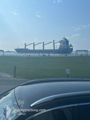
STAR DALMATIA
General Cargo
Current Trip
| Time Travelled | 4 days |
|---|---|
| Remaining Time | --- |
| Distance Travelled | 1207.56 nm |
| Remaining Distance | 3954.12 nm |
| AVG Speed | 11.5 Knots |
| MAX Speed | 15.1 Knots |
| AVG Wind | 5.5 knots |
| MAX Wind | 13 knots |
| MIN Temp | 4°C / 39.2°F |
| MAX Temp | 26.7°C / 80.06°F |
| Draught | 7 m |
| Position Received | 4 d ago |
Current Position
| Longitude | -90.00335° |
|---|---|
| Latitude | 29.80750° |
| Status | Under way using engine |
| Speed | 14.3 Knots |
| Course | 192° |
| Area | Gulf of Mexico |
| Station | T-AIS |
| Position Received | 4 d ago |
Info
Information
The current position of STAR DALMATIA is in Gulf of Mexico with coordinates 29.80750° / -90.00335° as reported on 2025-12-31 13:16 by AIS to our vessel tracker app. The vessel's current speed is 14.3 Knots and is heading at the port of PORTOCEL. The estimated time of arrival as calculated by MyShipTracking vessel tracking app is 2026-01-20 05:00 LT
The vessel STAR DALMATIA (IMO: 9548835, MMSI: 538007655) is a General Cargo that was built in 2011 ( 15 years old ). It's sailing under the flag of [MH] Marshall Is.
In this page you can find informations about the vessels current position, last detected port calls, and current voyage information. If the vessels is not in coverage by AIS you will find the latest position.
The current position of STAR DALMATIA is detected by our AIS receivers and we are not responsible for the reliability of the data. The last position was recorded while the vessel was in Coverage by the Ais receivers of our vessel tracking app.
The current draught of STAR DALMATIA as reported by AIS is 7 meters
Weather
| Temperature | 25.9°C / 78.62°F |
|---|---|
| Wind Speed | 8 knots |
| Direction | 324° NW |
| Pressure | 1012.1 hPa |
| Humidity | 77.6 % |
| Cloud Coverage | 100 % |
Featured Company
Last Port Calls
| Port | Arrival | Departure | Time In Port |
|---|---|---|---|
| 2025-12-26 04:50 | 2025-12-31 07:30 | 5 d | |
| 2025-12-19 18:11 | 2025-12-24 15:23 | 4 d | |
| 2025-12-07 04:20 | 2025-12-11 21:02 | 4 d |
Most Visited Ports (Last year)
| Port | Arrivals | |
|---|---|---|
| 2 | ||
| 2 | ||
| 1 | ||
| 1 | ||
| 1 | ||
| 1 |
Events
| Time | Event | Details | Position / Dest | Info |
|---|---|---|---|---|
| 2025-12-31 13:30 | PORT DEPARTURE |
|
29.75223 / -90.02138
BRPCL
|
Speed: 13.9 kn Course: 179° |
| 2025-12-31 13:23 | Status Changed | Default Under way using engine |
29.78222 / -90.01648
[US] NEW ORLEANS
|
Speed: 14.3 kn Course: 192° |
| 2025-12-31 13:16 | OUT of Coverage |
29.80750 / -90.00335
Gulf of Mexico
BRPCL
|
Speed: 14.3 kn Course: 192.2° |
|
| 2025-12-31 12:41 | Status Changed | Under way using engine Default |
29.86605 / -89.91268
[US] NEW ORLEANS
|
Speed: 13.8 kn Course: 221° |
| 2025-12-31 12:35 | Status Changed | Default Under way using engine |
29.88750 / -89.90285
[US] NEW ORLEANS
|
Speed: 13.1 kn Course: 155° |
| 2025-12-31 12:01 | START Moving |
29.93715 / -89.99650
[US] NEW ORLEANS
|
Speed: 3.1 kn Course: 133° |
|
| 2025-12-31 11:06 | Status Changed | Under way using engine Moored |
29.94317 / -89.99675
[US] NEW ORLEANS
|
Speed: Course: 353° |
| 2025-12-31 09:46 | Draught Changed | 7 7.1 |
29.94319 / -89.99674
[US] NEW ORLEANS
|
Speed: Course: 353° |
| 2025-12-30 23:29 | ETA Changed | 2026/01/20 08:00 2025/12/25 22:00 |
29.94318 / -89.99672
[US] NEW ORLEANS
|
Speed: Course: 354° |
| 2025-12-30 23:29 | Destination Changed | BRPCL USMSY |
29.94318 / -89.99672
[US] NEW ORLEANS
|
Speed: Course: 354° |