
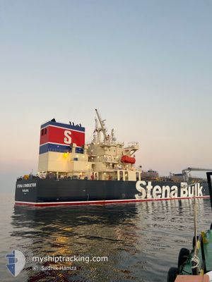
STENA CONDUCTOR
Tanker
Current Trip
USCRP
| Time Travelled | 14 days |
|---|---|
| Remaining Time | --- |
| Distance Travelled | 3721.87 nm |
| Remaining Distance | --- |
| AVG Speed | 11.2 Knots |
| MAX Speed | 13.5 Knots |
| AVG Wind | 14.8 knots |
| MAX Wind | 20.3 knots |
| MIN Temp | 22°C / 71.6°F |
| MAX Temp | 27.5°C / 81.5°F |
| Draught | 8.2 m |
| Position Received | 5 d ago |
Current Position
| Longitude | -61.33362° |
|---|---|
| Latitude | 11.68106° |
| Status | Under way using engine |
| Speed | 11.4 Knots |
| Course | 90.9° |
| Area | Caribbean Sea |
| Station | T-AIS |
| Position Received | 5 d ago |
Info
Information
The current position of STENA CONDUCTOR is in Caribbean Sea with coordinates 11.68106° / -61.33362° as reported on 2025-12-30 21:55 by AIS to our vessel tracker app. The vessel's current speed is 11.4 Knots
The vessel STENA CONDUCTOR (IMO: 9934888, MMSI: 352001328) is a Tanker It's sailing under the flag of [PA] Panama.
In this page you can find informations about the vessels current position, last detected port calls, and current voyage information. If the vessels is not in coverage by AIS you will find the latest position.
The current position of STENA CONDUCTOR is detected by our AIS receivers and we are not responsible for the reliability of the data. The last position was recorded while the vessel was in Coverage by the Ais receivers of our vessel tracking app.
The current draught of STENA CONDUCTOR as reported by AIS is 8.2 meters
Weather
| Temperature | 27.2°C / 80.96°F |
|---|---|
| Wind Speed | 16 knots |
| Direction | 43° NE |
| Pressure | 1009.3 hPa |
| Humidity | 75.8 % |
| Cloud Coverage | 58 % |
Featured Company
Last Port Calls
| Port | Arrival | Departure | Time In Port |
|---|---|---|---|
| 2025-12-19 16:36 | 2025-12-22 12:24 | 2 d | |
| 2025-12-10 01:38 | 2025-12-14 02:13 | 4 d | |
| 2025-12-04 02:00 | 2025-12-08 13:20 | 4 d |
Last Trips
| Origin | Departure | Destination | Arrival | Distance | |
|---|---|---|---|---|---|
| 2025-12-14 02:13 | 2025-12-19 16:36 | 978.91 nm | |||
| 2025-12-08 13:20 | 2025-12-10 01:38 | 446.42 nm | |||
| 2025-10-21 09:41 | 2025-12-04 02:00 | 9776.55 nm |
Events
| Time | Event | Details | Position / Dest | Info |
|---|---|---|---|---|
| 2026-01-05 03:12 | STOP Moving | 21.6 nm, North East of SAO LUIS |
-2.18833 / -44.16833
USCRP
|
Speed: Course: -1° |
| 2025-12-30 22:00 | Status Changed | Default Under way using engine |
11.68075 / -61.31844
USCRP
|
Speed: 11.4 kn Course: 90.9° |
| 2025-12-30 21:55 | Status Changed | Under way using engine Default |
11.68106 / -61.33362
USCRP
|
Speed: 11.4 kn Course: 90° |
| 2025-12-30 21:55 | OUT of Coverage |
11.68106 / -61.33362
Caribbean Sea
|
Speed: 11.4 kn Course: 90.9° |
|
| 2025-12-30 21:50 | Status Changed | Default Under way using engine |
11.68064 / -61.35106
USCRP
|
Speed: 11.5 kn Course: 86.7° |
| 2025-12-30 17:33 | Status Changed | Under way using engine Default |
11.69272 / -62.15064
USCRP
|
Speed: 11.1 kn Course: 94° |
| 2025-12-30 17:29 | Status Changed | Default Under way using engine |
11.69360 / -62.16266
USCRP
|
Speed: 11.4 kn Course: 94.7° |
| 2025-12-30 16:46 | Change Sea Area | Grenadian part of the Caribbean Sea United States part of the Gulf of Mexico |
11.70549 / -62.30374
Caribbean Sea
|
Speed: 11.5 kn Course: 94.9° |
| 2025-12-30 16:46 | Status Changed | Under way using engine Default |
11.70549 / -62.30374
USCRP
|
Speed: 11.4 kn Course: 91° |
| 2025-12-30 16:39 | IN Coverage |
11.70549 / -62.30374
Caribbean Sea
|
Speed: 11.5 kn Course: 94.9° |