

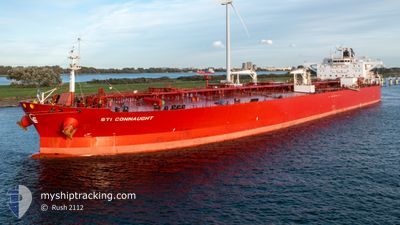
STI CONNAUGHT
Tanker
Current Trip
| Time Travelled | 24 days |
|---|---|
| Remaining Time | --- |
| Distance Travelled | 7213.81 nm |
| Remaining Distance | --- |
| AVG Speed | 12.3 Knots |
| MAX Speed | 14 Knots |
| AVG Wind | 14.6 knots |
| MAX Wind | 25 knots |
| MIN Temp | 18.2°C / 64.76°F |
| MAX Temp | 27.9°C / 82.22°F |
| Draught | 11.8 m |
| Position Received | 4 d ago |
Current Position
| Longitude | -7.52881° |
|---|---|
| Latitude | -15.68613° |
| Status | Under way using engine |
| Speed | 12.9 Knots |
| Course | 115.5° |
| Area | South Atlantic Ocean |
| Station | T-AIS |
| Position Received | 4 d ago |
Information
The current position of STI CONNAUGHT is in South Atlantic Ocean with coordinates -15.68613° / -7.52881° as reported on 2025-02-28 06:19 by AIS to our vessel tracker app. The vessel's current speed is 12.9 Knots and is heading at the port of GEELONG. The estimated time of arrival as calculated by MyShipTracking vessel tracking app is 2025-03-25 01:00 LT
The vessel STI CONNAUGHT (IMO: 9697600, MMSI: 538005391) is a Tanker It's sailing under the flag of [MH] Marshall Is.
In this page you can find informations about the vessels current position, last detected port calls, and current voyage information. If the vessels is not in coverage by AIS you will find the latest position.
The current position of STI CONNAUGHT is detected by our AIS receivers and we are not responsible for the reliability of the data. The last position was recorded while the vessel was in Coverage by the Ais receivers of our vessel tracking app.
The current draught of STI CONNAUGHT as reported by AIS is 11.8 meters
Weather
| Temperature | 18.2°C / 64.76°F |
|---|---|
| Wind Speed | 4 knots |
| Direction | 222° SW |
| Pressure | 1009.3 hPa |
| Humidity | 86.2 % |
| Cloud Coverage | 49 % |
Featured Company
Last Port Calls
| Port | Arrival | Departure | Time In Port |
|---|---|---|---|
| 2025-02-06 22:22 | 2025-02-08 14:58 | 1 d | |
| 2025-01-28 22:53 | 2025-01-31 13:35 | 2 d | |
| 2025-01-18 10:25 | 2025-01-20 09:57 | 1 d | |
| 2025-01-05 06:32 | 2025-01-07 04:32 | 1 d |
Most Visited Ports (Last year)
| Port | Arrivals | |
|---|---|---|
| 7 | ||
| 3 | ||
| 2 | ||
| 1 | ||
| 1 | ||
| 1 |
Last Trips
| Origin | Departure | Destination | Arrival | Distance | |
|---|---|---|---|---|---|
| 2025-01-31 07:35 | 2025-02-06 16:22 | 285.68 nm | |||
| 2025-01-20 03:57 | 2025-01-28 16:53 | 393.71 nm | |||
| 2025-01-06 22:32 | 2025-01-18 04:25 | 1399.94 nm | |||
| 2024-12-17 02:48 | 2025-01-05 00:32 | 2447.73 nm |
Events
| Time | Event | Details | Position / Dest | Info |
|---|---|---|---|---|
| 2025-03-04 19:17 | STOP Moving | 5.12 nm, North of WALVIS BAY |
-22.85941 / 14.46789
GEELONG
|
Speed: 0.2 kn Course: 183° |
| 2025-02-28 06:25 | Status Changed | Default Under way using engine |
-15.69501 / -7.50914
GEELONG
|
Speed: 12.9 kn Course: 115.5° |
| 2025-02-28 06:19 | OUT of Coverage |
-15.68613 / -7.52881
South Atlantic Ocean
GEELONG
|
Speed: 12.9 kn Course: 115.5° |
|
| 2025-02-28 06:12 | Status Changed | Under way using engine Default |
-15.67604 / -7.55133
GEELONG
|
Speed: 12.9 kn Course: 115° |
| 2025-02-28 05:57 | Status Changed | Default Under way using engine |
-15.65251 / -7.60479
GEELONG
|
Speed: 13 kn Course: 115.3° |
| 2025-02-28 04:57 | Status Changed | Under way using engine Default |
-15.56306 / -7.80894
GEELONG
|
Speed: 12.8 kn Course: 114° |
| 2025-02-28 04:49 | Status Changed | Default Under way using engine |
-15.55135 / -7.83592
GEELONG
|
Speed: 12.7 kn Course: 113.4° |
| 2025-02-28 04:39 | Detected in Sea | St. Helena part of the South Atlantic Ocean |
-15.53698 / -7.86962
South Atlantic Ocean
GEELONG
|
Speed: 12.7 kn Course: 113.4° |
| 2025-02-28 04:38 | Status Changed | Under way using engine Default |
-15.53581 / -7.87237
GEELONG
|
Speed: 12.6 kn Course: 114° |
| 2025-02-28 04:38 | IN Coverage |
-15.53698 / -7.86962
South Atlantic Ocean
GEELONG
|
Speed: 12.7 kn Course: 113.4° |