
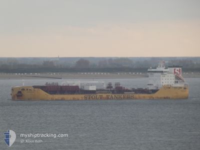
STOLT SINCERITY
Tanker A
Current Trip
| Time Travelled | 2 days |
|---|---|
| Remaining Time | --- |
| Distance Travelled | 681.55 nm |
| Remaining Distance | --- |
| AVG Speed | 11.8 Knots |
| MAX Speed | 14.5 Knots |
| AVG Wind | 11.9 knots |
| MAX Wind | 21 knots |
| MIN Temp | -0.8°C / 30.56°F |
| MAX Temp | 21.8°C / 71.24°F |
| Draught | 10.5 m |
| Position Received | 2 d ago |
Current Position
| Longitude | -76.67715° |
|---|---|
| Latitude | 34.64558° |
| Status | Under way using engine |
| Speed | 9.6 Knots |
| Course | 191.5° |
| Area | North Atlantic Ocean |
| Station | T-AIS |
| Position Received | 2 d ago |
Info
Information
The current position of STOLT SINCERITY is in North Atlantic Ocean with coordinates 34.64558° / -76.67715° as reported on 2025-12-15 16:17 by AIS to our vessel tracker app. The vessel's current speed is 9.6 Knots and is heading at the port of KAKINADA. The estimated time of arrival as calculated by MyShipTracking vessel tracking app is 2026-01-26 10:00 LT
The vessel STOLT SINCERITY (IMO: 9680085, MMSI: 319103800) is a Tanker A It's sailing under the flag of [KY] Cayman Is.
In this page you can find informations about the vessels current position, last detected port calls, and current voyage information. If the vessels is not in coverage by AIS you will find the latest position.
The current position of STOLT SINCERITY is detected by our AIS receivers and we are not responsible for the reliability of the data. The last position was recorded while the vessel was in Coverage by the Ais receivers of our vessel tracking app.
The current draught of STOLT SINCERITY as reported by AIS is 10.5 meters
Weather
| Temperature | 21.3°C / 70.34°F |
|---|---|
| Wind Speed | 11 knots |
| Direction | 32° NNE |
| Pressure | 1020 hPa |
| Humidity | 71.5 % |
| Cloud Coverage | 4 % |
Featured Company
Last Port Calls
| Port | Arrival | Departure | Time In Port |
|---|---|---|---|
| 2025-12-11 20:05 | 2025-12-15 10:45 | 3 d | |
| 2025-12-04 06:31 | 2025-12-06 20:03 | 2 d | |
| 2025-11-26 20:32 | 2025-11-30 23:39 | 4 d | |
| 2025-10-15 20:51 | 2025-11-07 05:23 | 22 d | |
| 2025-10-08 02:42 | 2025-10-08 03:44 | 1 h | |
| 2025-10-04 22:44 | 2025-10-05 00:11 | 1 h |
Most Visited Ports (Last year)
| Port | Arrivals | |
|---|---|---|
| 9 | ||
| 5 | ||
| 3 | ||
| 2 | ||
| 2 | ||
| 2 |
Last Trips
| Origin | Departure | Destination | Arrival | Distance | |
|---|---|---|---|---|---|
| 2025-12-06 20:03 | 2025-12-11 20:05 | 1563.78 nm | |||
| 2025-11-30 23:39 | 2025-12-04 06:31 | 439.34 nm | |||
| 2025-11-07 05:23 | 2025-11-26 20:32 | 5418.83 nm | |||
| 2025-10-08 03:44 | 2025-10-15 20:51 | 390.06 nm | |||
| 2025-10-05 00:11 | 2025-10-08 02:42 | 2.78 nm | |||
| 2025-09-17 08:34 | 2025-10-04 22:44 | 4673.23 nm |
Events
| Time | Event | Details | Position / Dest | Info |
|---|---|---|---|---|
| 2025-12-15 16:24 | Status Changed | Default Under way using engine |
34.62987 / -76.67334
INKAK
|
Speed: 9.6 kn Course: 191.5° |
| 2025-12-15 16:17 | OUT of Coverage |
34.64558 / -76.67715
North Atlantic Ocean
|
Speed: 9.6 kn Course: 191.5° |
|
| 2025-12-15 16:13 | Status Changed | Under way using engine Default |
34.65668 / -76.67434
INKAK
|
Speed: 8 kn Course: 191° |
| 2025-12-15 16:12 | Status Changed | Default Under way using engine |
34.65938 / -76.67367
INKAK
|
Speed: 8 kn Course: 190.2° |
| 2025-12-15 16:00 | Status Changed | Under way using engine Default |
34.68723 / -76.66811
INKAK
|
Speed: 9.1 kn Course: 140° |
| 2025-12-15 15:52 | Status Changed | Default Under way using engine |
34.70401 / -76.68239
INKAK
|
Speed: 6.6 kn Course: 153.9° |
| 2025-12-15 15:45 | PORT DEPARTURE |
|
34.71342 / -76.69291
INKAK
|
Speed: 5.6 kn Course: 155° |
| 2025-12-15 15:42 | START Moving |
34.71754 / -76.69429
[US] MOREHEAD CITY
|
Speed: 3.1 kn Course: 167° |
|
| 2025-12-15 15:25 | Status Changed | Under way using engine Moored |
34.71962 / -76.69456
[US] MOREHEAD CITY
|
Speed: Course: 221° |
| 2025-12-15 15:16 | Status Changed | Moored Default |
34.71963 / -76.69455
[US] MOREHEAD CITY
|
Speed: Course: 221° |