
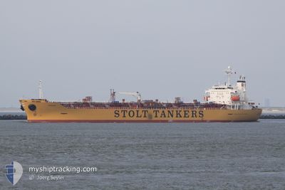
STOLT STRENGTH
Oil/Chemical Tanker
Current Trip
| Time Travelled | 11 days |
|---|---|
| Remaining Time | --- |
| Distance Travelled | 3900.39 nm |
| Remaining Distance | --- |
| AVG Speed | 13.2 Knots |
| MAX Speed | 17.1 Knots |
| AVG Wind | 12.9 knots |
| MAX Wind | 23.3 knots |
| MIN Temp | 13.5°C / 56.3°F |
| MAX Temp | 28.3°C / 82.94°F |
| Draught | 10.1 m |
| Position Received | 4 d ago |
Current Position
| Longitude | -17.71792° |
|---|---|
| Latitude | 12.56189° |
| Status | Under way using engine |
| Speed | 14.3 Knots |
| Course | 171.3° |
| Area | North Atlantic Ocean |
| Station | T-AIS |
| Position Received | 4 d ago |
Information
The current position of STOLT STRENGTH is in North Atlantic Ocean with coordinates 12.56189° / -17.71792° as reported on 2025-06-06 10:48 by AIS to our vessel tracker app. The vessel's current speed is 14.3 Knots and is heading at the port of DURBAN. The estimated time of arrival as calculated by MyShipTracking vessel tracking app is 2025-06-20 08:00 LT
The vessel STOLT STRENGTH (IMO: 9311024, MMSI: 636014974) is a Oil/Chemical Tanker that was built in 2005 ( 20 years old ). It's sailing under the flag of [LR] Liberia.
In this page you can find informations about the vessels current position, last detected port calls, and current voyage information. If the vessels is not in coverage by AIS you will find the latest position.
The current position of STOLT STRENGTH is detected by our AIS receivers and we are not responsible for the reliability of the data. The last position was recorded while the vessel was in Coverage by the Ais receivers of our vessel tracking app.
The current draught of STOLT STRENGTH as reported by AIS is 10.1 meters
Weather
| Temperature | 25.6°C / 78.08°F |
|---|---|
| Wind Speed | 18 knots |
| Direction | 137° SE |
| Pressure | 1012.8 hPa |
| Humidity | 70.1 % |
| Cloud Coverage | 2 % |
Featured Company
Last Port Calls
| Port | Arrival | Departure | Time In Port |
|---|---|---|---|
| 2025-05-28 03:28 | 2025-05-29 21:42 | 1 d | |
| 2025-05-16 14:22 | 2025-05-26 04:51 | 9 d | |
| 2025-05-09 01:53 | 2025-05-10 22:30 | 1 d | |
| 2025-04-30 22:27 | 2025-05-04 14:41 | 3 d | |
| 2025-04-25 19:39 | 2025-04-29 22:55 | 4 d | |
| 2025-04-05 05:46 | 2025-04-07 02:01 | 1 d |
Most Visited Ports (Last year)
| Port | Arrivals | |
|---|---|---|
| 2 | ||
| 2 | ||
| 2 | ||
| 2 | ||
| 2 | ||
| 1 |
Last Trips
| Origin | Departure | Destination | Arrival | Distance | |
|---|---|---|---|---|---|
| 2025-05-26 04:51 | 2025-05-28 03:28 | 273.69 nm | |||
| 2025-05-10 22:30 | 2025-05-16 14:22 | 116.55 nm | |||
| 2025-05-04 14:41 | 2025-05-09 01:53 | 684.83 nm | |||
| 2025-04-29 22:55 | 2025-04-30 22:27 | 305.07 nm | |||
| 2025-04-07 02:01 | 2025-04-25 19:39 | 5334.99 nm | |||
| 2025-03-19 21:18 | 2025-04-05 05:46 | 3259.14 nm |
Events
| Time | Event | Details | Position / Dest | Info |
|---|---|---|---|---|
| 2025-06-06 10:52 | Status Changed | Default Under way using engine |
12.54391 / -17.71526
ZADUR (DURBAN)
|
Speed: 14.3 kn Course: 171.3° |
| 2025-06-06 10:48 | OUT of Coverage |
12.56189 / -17.71792
North Atlantic Ocean
ZADUR (DURBAN)
|
Speed: 14.3 kn Course: 171.3° |
|
| 2025-06-06 10:04 | Status Changed | Under way using engine Default |
12.73315 / -17.74624
ZADUR (DURBAN)
|
Speed: 14 kn Course: 169° |
| 2025-06-06 09:56 | Status Changed | Default Under way using engine |
12.76252 / -17.75203
ZADUR (DURBAN)
|
Speed: 14 kn Course: 169.3° |
| 2025-06-06 09:39 | Status Changed | Under way using engine Default |
12.83149 / -17.76553
ZADUR (DURBAN)
|
Speed: 13.9 kn Course: 166° |
| 2025-06-06 09:18 | Status Changed | Default Under way using engine |
12.90785 / -17.78423
ZADUR (DURBAN)
|
Speed: 13.8 kn Course: 166.6° |
| 2025-06-06 09:06 | Status Changed | Under way using engine Default |
12.95288 / -17.79535
ZADUR (DURBAN)
|
Speed: 13.6 kn Course: 176° |
| 2025-06-06 08:55 | Status Changed | Default Under way using engine |
12.99809 / -17.79722
ZADUR (DURBAN)
|
Speed: 13.8 kn Course: 176.5° |
| 2025-06-06 08:40 | Change Sea Area | Senegalese part of the North Atlantic Ocean Gambian part of the North Atlantic Ocean |
13.05277 / -17.79985
North Atlantic Ocean
ZADUR (DURBAN)
|
Speed: 13.8 kn Course: 176.9° |
| 2025-06-06 06:22 | Change Sea Area | Gambian part of the North Atlantic Ocean Senegalese part of the North Atlantic Ocean |
13.58660 / -17.88942
North Atlantic Ocean
ZADUR (DURBAN)
|
Speed: 14.5 kn Course: 170.8° |