

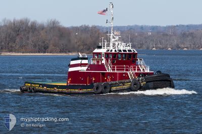
SUZANNE MCALLISTER
Towing
Current Trip
| Trip Time | 21 h, 27 mins |
|---|---|
| Trip Distance | 218.52 nm |
| AVG Speed | 9.9 Knots |
| MAX Speed | 12.1 Knots |
| Draught | 6 m |
| AVG Wind | 11 knots |
| MAX Wind | 16 knots |
| MIN Temp | 15.9°C / 60.62°F |
| MAX Temp | 22.2°C / 71.96°F |
| Position Received | 11 h, 6 m ago |
Current Position
| Longitude | -74.07077° |
|---|---|
| Latitude | 40.66127° |
| Status | Under way using engine |
| Speed | |
| Course | --- |
| Area | North Atlantic Ocean |
| Station | T-AIS |
| Position Received | 11 h, 6 m ago |
Information
The current position of SUZANNE MCALLISTER is in North Atlantic Ocean with coordinates 40.66127° / -74.07077° as reported on 2025-06-10 12:02 by AIS to our vessel tracker app. The vessel's current speed is 0 Knots and is currently inside the port of NEW YORK.
The vessel SUZANNE MCALLISTER (IMO: 9103300, MMSI: 366943460) is a Towing It's sailing under the flag of [US] USA.
In this page you can find informations about the vessels current position, last detected port calls, and current voyage information. If the vessels is not in coverage by AIS you will find the latest position.
The current position of SUZANNE MCALLISTER is detected by our AIS receivers and we are not responsible for the reliability of the data. The last position was recorded while the vessel was in Coverage by the Ais receivers of our vessel tracking app.
The current draught of SUZANNE MCALLISTER as reported by AIS is 6 meters
Weather
| Temperature | 17.8°C / 64.04°F |
|---|---|
| Wind Speed | 3 knots |
| Direction | 143° SE |
| Pressure | 1011.7 hPa |
| Humidity | 96.7 % |
| Cloud Coverage | 100 % |
Featured Company
Last Port Calls
| Port | Arrival | Departure | Time In Port |
|---|---|---|---|
| 2025-06-09 05:25 | |||
| 2025-06-07 13:01 | 2025-06-08 07:58 | 18 h | |
| 2025-06-07 11:34 | 2025-06-07 12:49 | 1 h | |
| 2025-06-06 21:01 | 2025-06-07 11:23 | 14 h | |
| 2025-06-06 20:38 | 2025-06-06 20:47 | 8 m | |
| 2025-06-06 15:08 | 2025-06-06 20:06 | 4 h | |
| 2025-06-06 14:04 | 2025-06-06 14:40 | 36 m | |
| 2025-06-06 11:41 | 2025-06-06 13:45 | 2 h | |
| 2025-06-05 19:45 | 2025-06-06 10:13 | 14 h | |
| 2025-06-05 15:40 | 2025-06-05 18:36 | 2 h |
Most Visited Ports (Last year)
| Port | Arrivals | |
|---|---|---|
| 1019 | ||
| 103 | ||
| 67 | ||
| 33 | ||
| 28 | ||
| 21 |
Last Trips
| Origin | Departure | Destination | Arrival | Distance | |
|---|---|---|---|---|---|
| 2025-06-08 07:58 | 2025-06-09 05:25 | 218.52 nm | |||
| 2025-06-07 12:49 | 2025-06-07 13:01 | 1.94 nm | |||
| 2025-06-07 11:23 | 2025-06-07 11:34 | 2.23 nm | |||
| 2025-06-06 20:47 | 2025-06-06 21:01 | 2.08 nm | |||
| 2025-06-06 20:06 | 2025-06-06 20:38 | 0.96 nm | |||
| 2025-06-06 14:40 | 2025-06-06 15:08 | 5.38 nm | |||
| 2025-06-06 13:45 | 2025-06-06 14:04 | 0.94 nm | |||
| 2025-06-06 10:13 | 2025-06-06 11:41 | 8.40 nm | |||
| 2025-06-05 18:36 | 2025-06-05 19:45 | 9.39 nm | |||
| 2025-06-05 15:11 | 2025-06-05 15:40 | 3.33 nm |
Events
| Time | Event | Details | Position / Dest | Info |
|---|---|---|---|---|
| 2025-06-10 12:02 | OUT of Coverage |
40.66127 / -74.07077
North Atlantic Ocean
[US] NEW YORK
|
Speed: Course: 343.8° |
|
| 2025-06-09 09:34 | STOP Moving |
40.66097 / -74.07140
[US] NEW YORK
|
Speed: 0.2 kn Course: 511° |
|
| 2025-06-09 09:25 | PORT ARRIVAL |
|
40.65536 / -74.04975
[US] NEW YORK
|
Speed: 0.6 kn Course: 511° |
| 2025-06-09 05:02 | Status Changed | Under way using engine Default |
39.98255 / -73.91772
BAYONNE
|
Speed: 10.9 kn Course: 4° |
| 2025-06-09 04:58 | Status Changed | Default Under way using engine |
39.96873 / -73.92226
BAYONNE
|
Speed: 10.9 kn Course: 13.4° |
| 2025-06-09 02:08 | Status Changed | Under way using engine Default |
39.51487 / -74.17017
BAYONNE
|
Speed: 10.4 kn Course: 34° |
| 2025-06-09 01:56 | IN Coverage |
39.51487 / -74.17017
North Atlantic Ocean
BAYONNE
|
Speed: 10 kn Course: 26.8° |
|
| 2025-06-08 22:07 | Status Changed | Default Under way using engine |
38.97205 / -74.70623
BAYONNE
|
Speed: 10.3 kn Course: 33.7° |
| 2025-06-08 22:00 | OUT of Coverage |
38.95753 / -74.72057
North Atlantic Ocean
BAYONNE
|
Speed: 10.3 kn Course: 33.7° |
|
| 2025-06-08 19:59 | Status Changed | Under way using engine Default |
38.82221 / -75.03604
BAYONNE
|
Speed: 9.2 kn Course: 123° |