
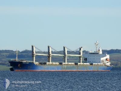
TEAL BAY
General Cargo
Current Trip
| Time Travelled | 6 days |
|---|---|
| Remaining Time | 10 days |
| Distance Travelled | 1194.23 nm |
| Remaining Distance | 2980.56 nm |
| AVG Speed | 11.5 Knots |
| MAX Speed | 14.2 Knots |
| AVG Wind | 7.8 knots |
| MAX Wind | 17.9 knots |
| MIN Temp | 22.4°C / 72.32°F |
| MAX Temp | 27.6°C / 81.68°F |
| Draught | 8.9 m |
| Position Received | 4 d ago |
Current Position
| Longitude | -46.19282° |
|---|---|
| Latitude | -24.05794° |
| Status | Under way using engine |
| Speed | 12.5 Knots |
| Course | 82° |
| Area | South Atlantic Ocean |
| Station | T-AIS |
| Position Received | 4 d ago |
Information
The current position of TEAL BAY is in South Atlantic Ocean with coordinates -24.05794° / -46.19282° as reported on 2025-05-20 19:34 by AIS to our vessel tracker app. The vessel's current speed is 12.5 Knots and is heading at the port of BARRANQUILLA. The estimated time of arrival as calculated by MyShipTracking vessel tracking app is 2025-06-03 20:55 LT
The vessel TEAL BAY (IMO: 9343637, MMSI: 235102851) is a General Cargo that was built in 2007 ( 18 years old ). It's sailing under the flag of [GB] United Kingdom.
In this page you can find informations about the vessels current position, last detected port calls, and current voyage information. If the vessels is not in coverage by AIS you will find the latest position.
The current position of TEAL BAY is detected by our AIS receivers and we are not responsible for the reliability of the data. The last position was recorded while the vessel was in Coverage by the Ais receivers of our vessel tracking app.
The current draught of TEAL BAY as reported by AIS is 8.9 meters
Weather
| Temperature | 26.9°C / 80.42°F |
|---|---|
| Wind Speed | 17 knots |
| Direction | 121° ESE |
| Pressure | 1015.5 hPa |
| Humidity | 78.8 % |
| Cloud Coverage | 23 % |
Featured Company
Last Port Calls
| Port | Arrival | Departure | Time In Port |
|---|---|---|---|
| 2025-05-18 17:06 | 2025-05-18 17:18 | 11 m | |
| 2025-05-13 21:10 | 2025-05-17 02:34 | 3 d | |
| 2025-04-26 11:49 | 2025-04-29 11:50 | 3 d | |
| 2025-04-22 01:54 | 2025-04-24 10:38 | 2 d | |
| 2025-03-09 01:33 | 2025-03-11 23:31 | 2 d |
Most Visited Ports (Last year)
| Port | Arrivals | |
|---|---|---|
| 2 | ||
| 2 | ||
| 1 | ||
| 1 | ||
| 1 | ||
| 1 |
Last Trips
| Origin | Departure | Destination | Arrival | Distance | |
|---|---|---|---|---|---|
| 2025-05-16 23:34 | 2025-05-18 14:06 | 467.99 nm | |||
| 2025-04-29 08:50 | 2025-05-13 18:10 | 695.95 nm | |||
| 2025-04-24 07:38 | 2025-04-26 08:49 | 76.27 nm | |||
| 2025-03-11 23:31 | 2025-04-21 22:54 | 8365.52 nm | |||
| 2025-02-23 07:07 | 2025-03-09 01:33 | 3067.51 nm |
Events
| Time | Event | Details | Position / Dest | Info |
|---|---|---|---|---|
| 2025-05-20 19:35 | Status Changed | Default Under way using engine |
-24.05708 / -46.18577
CO BAQ
|
Speed: 12.5 kn Course: 82° |
| 2025-05-20 19:34 | OUT of Coverage |
-24.05794 / -46.19282
South Atlantic Ocean
CO BAQ
|
Speed: 12.5 kn Course: 82° |
|
| 2025-05-20 19:30 | Status Changed | Under way using engine Default |
-24.05953 / -46.20598
CO BAQ
|
Speed: 12.4 kn Course: 80° |
| 2025-05-20 19:30 | IN Coverage |
-24.05953 / -46.20598
South Atlantic Ocean
CO BAQ
|
Speed: 12.5 kn Course: 82.9° |
|
| 2025-05-20 19:03 | START Moving | 7.41 nm, South of SANTOS |
-24.08746 / -46.29088
CO BAQ
|
Speed: 7.4 kn Course: 47° |
| 2025-05-20 17:22 | STOP Moving | 7.82 nm, South of SANTOS |
-24.09490 / -46.29243
CO BAQ
|
Speed: 0.3 kn Course: 200° |
| 2025-05-20 15:59 | Status Changed | Default Under way using engine |
-23.98650 / -46.29099
CO BAQ
|
Speed: 8.8 kn Course: 181.2° |
| 2025-05-20 15:56 | OUT of Coverage |
-23.98069 / -46.28886
South Atlantic Ocean
CO BAQ
|
Speed: 8.8 kn Course: 181.2° |
|
| 2025-05-20 15:35 | Draught Changed | 8.9 8.7 |
-23.93214 / -46.31398
CO BAQ
|
Speed: 8 kn Course: 143.8° |
| 2025-05-20 15:35 | Destination Changed | CO BAQ BR SSZ |
-23.93214 / -46.31398
CO BAQ
|
Speed: 8 kn Course: 143.8° |