

THEBEN
Cargo

Current Trip
KRMAS>>CNSHG
| Time Travelled | 15 days |
|---|---|
| Remaining Time | --- |
| Distance Travelled | 5935.05 nm |
| Remaining Distance | --- |
| AVG Speed | 15.7 Knots |
| MAX Speed | 19.2 Knots |
| AVG Wind | 13.3 knots |
| MAX Wind | 19 knots |
| MIN Temp | 13.1°C / 55.58°F |
| MAX Temp | 28.7°C / 83.66°F |
| Draught | 9.4 m |
| Position Received | 1 h, 9 m ago |
Current Position
| Longitude | -147.33316° |
|---|---|
| Latitude | -11.24420° |
| Status | Under way using engine |
| Speed | 15 Knots |
| Course | 120° |
| Area | South Pacific Ocean |
| Station | T-AIS |
| Position Received | 1 h, 9 m ago |
Information
The current position of THEBEN is in South Pacific Ocean with coordinates -11.24420° / -147.33316° as reported on 2025-05-28 11:53 by AIS to our vessel tracker app. The vessel's current speed is 15 Knots
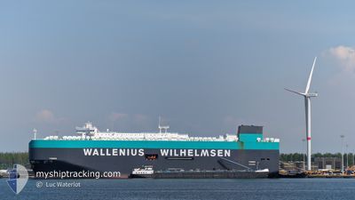
The vessel THEBEN (IMO: 9722302, MMSI: 566044000) is a Cargo It's sailing under the flag of [SG] Singapore.
In this page you can find informations about the vessels current position, last detected port calls, and current voyage information. If the vessels is not in coverage by AIS you will find the latest position.
The current position of THEBEN is detected by our AIS receivers and we are not responsible for the reliability of the data. The last position was recorded while the vessel was in Coverage by the Ais receivers of our vessel tracking app.
The current draught of THEBEN as reported by AIS is 9.4 meters
Weather
| Temperature | 27.6°C / 81.68°F |
|---|---|
| Wind Speed | 14 knots |
| Direction | 103° ESE |
| Pressure | 1013.5 hPa |
| Humidity | 72 % |
| Cloud Coverage | 46 % |


Featured Company
Last Port Calls
| Port | Arrival | Departure | Time In Port |
|---|---|---|---|
| 2025-05-12 03:47 | 2025-05-13 05:23 | 1 d | |
| 2025-05-11 12:45 | 2025-05-11 18:50 | 6 h | |
| 2025-05-09 18:46 | 2025-05-10 09:14 | 14 h | |
| 2025-05-02 06:43 | 2025-05-02 16:24 | 9 h | |
| 2025-04-30 10:50 | 2025-04-30 19:32 | 8 h | |
| 2025-04-14 23:55 | 2025-04-16 00:24 | 1 d | |
| 2025-04-12 20:43 | 2025-04-13 22:53 | 1 d | |
| 2025-04-09 02:54 | 2025-04-09 22:42 | 19 h | |
| 2025-04-06 16:13 | 2025-04-07 08:46 | 16 h | |
| 2025-04-03 18:41 | 2025-04-06 12:38 | 2 d |
Most Visited Ports (Last year)
| Port | Arrivals | |
|---|---|---|
| 6 | ||
| 4 | ||
| 3 | ||
| 3 | ||
| 2 | ||
| 2 |
Last Trips
| Origin | Departure | Destination | Arrival | Distance | |
|---|---|---|---|---|---|
| 2025-05-11 18:50 | 2025-05-12 03:47 | 127.59 nm | |||
| 2025-05-10 09:14 | 2025-05-11 12:45 | 450.12 nm | |||
| 2025-05-02 16:24 | 2025-05-09 18:46 | 1400.02 nm | |||
| 2025-04-30 19:32 | 2025-05-02 06:43 | 449.35 nm | |||
| 2025-04-16 00:24 | 2025-04-30 10:50 | 5352.75 nm | |||
| 2025-04-13 22:53 | 2025-04-14 23:55 | 434.26 nm | |||
| 2025-04-09 22:42 | 2025-04-12 20:43 | 1230.24 nm | |||
| 2025-04-07 08:46 | 2025-04-09 02:54 | 370.94 nm | |||
| 2025-04-06 12:38 | 2025-04-06 16:13 | 41.26 nm | |||
| 2025-04-02 01:42 | 2025-04-03 18:41 | 279.16 nm |
Events
| Time | Event | Details | Position / Dest | Info |
|---|---|---|---|---|
| 2025-05-28 12:10 | Status Changed | Default Under way using engine |
-11.29652 / -147.24252
KRMAS>>CNSHG
|
Speed: 15 kn Course: 120° |
| 2025-05-28 11:53 | Status Changed | Under way using engine Default |
-11.24420 / -147.33316
KRMAS>>CNSHG
|
Speed: 15 kn Course: 121° |
| 2025-05-28 11:53 | OUT of Coverage |
-11.24420 / -147.33316
South Pacific Ocean
|
Speed: 15 kn Course: 120° |
|
| 2025-05-28 11:42 | Status Changed | Default Under way using engine |
-11.23722 / -147.34521
KRMAS>>CNSHG
|
Speed: 15.1 kn Course: 119.8° |
| 2025-05-28 09:31 | Status Changed | Under way using engine Default |
-10.96160 / -147.82908
KRMAS>>CNSHG
|
Speed: 14.7 kn Course: 119° |
| 2025-05-28 09:22 | Status Changed | Default Under way using engine |
-10.94547 / -147.85892
KRMAS>>CNSHG
|
Speed: 14.9 kn Course: 119.1° |
| 2025-05-28 09:04 | Change Sea Area | Kiribati (Line Group) part of the South Pacific Ocean Joint Japan - Korea part of the Eastern China Sea |
-10.90338 / -147.93448
South Pacific Ocean
|
Speed: 14.5 kn Course: 121.4° |
| 2025-05-28 09:04 | Status Changed | Under way using engine Default |
-10.90338 / -147.93448
KRMAS>>CNSHG
|
Speed: 14.6 kn Course: 121° |
| 2025-05-28 09:02 | IN Coverage |
-10.90338 / -147.93448
South Pacific Ocean
|
Speed: 14.5 kn Course: 121.4° |