
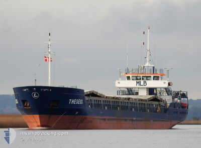
THESEUS
General Cargo
Current Trip
| Time Travelled | 4 days |
|---|---|
| Remaining Time | 1 day |
| Distance Travelled | 819.07 nm |
| Remaining Distance | 387.41 nm |
| AVG Speed | 9.2 Knots |
| MAX Speed | 13.2 Knots |
| AVG Wind | 9.8 knots |
| MAX Wind | 14.7 knots |
| MIN Temp | -4.3°C / 24.26°F |
| MAX Temp | 3.9°C / 39.02°F |
| Draught | 4.2 m |
| Position Received | 1 m ago |
Current Position
| Longitude | 15.89019° |
|---|---|
| Latitude | 68.33210° |
| Status | Under way using engine |
| Speed | 9.9 Knots |
| Course | 44.8° |
| Area | Norwegian Sea |
| Station | T-AIS |
| Position Received | 1 m ago |
Info
Information
The current position of THESEUS is in Norwegian Sea with coordinates 68.33210° / 15.89019° as reported on 2025-02-03 00:05 by AIS to our vessel tracker app. The vessel's current speed is 9.9 Knots and is heading at the port of AVEROY. The estimated time of arrival as calculated by MyShipTracking vessel tracking app is 2025-02-04 17:16 LT
The vessel THESEUS (IMO: 9199256, MMSI: 304011027) is a General Cargo that was built in 2000 ( 25 years old ). It's sailing under the flag of [AG] Antigua Barbuda.
In this page you can find informations about the vessels current position, last detected port calls, and current voyage information. If the vessels is not in coverage by AIS you will find the latest position.
The current position of THESEUS is detected by our AIS receivers and we are not responsible for the reliability of the data. The last position was recorded while the vessel was in Coverage by the Ais receivers of our vessel tracking app.
The current draught of THESEUS as reported by AIS is 4.2 meters
Weather
| Temperature | -3.4°C / 25.88°F |
|---|---|
| Wind Speed | 11 knots |
| Direction | 105° ESE |
| Pressure | 1023.4 hPa |
| Humidity | 66.2 % |
| Cloud Coverage | --- |
Featured Company
Last Port Calls
| Port | Arrival | Departure | Time In Port |
|---|---|---|---|
| 2025-01-28 19:42 | 2025-01-29 21:08 | 1 d | |
| 2025-01-26 10:23 | 2025-01-27 22:17 | 1 d | |
| 2025-01-17 05:53 | 2025-01-20 18:57 | 3 d | |
| 2025-01-12 05:51 | 2025-01-14 06:47 | 2 d | |
| 2025-01-03 07:05 | 2025-01-06 20:38 | 3 d | |
| 2024-12-26 08:23 | 2024-12-28 07:54 | 1 d | |
| 2024-12-22 13:58 | 2024-12-23 16:13 | 1 d | |
| 2024-12-20 09:35 | 2024-12-21 12:23 | 1 d | |
| 2024-12-18 07:02 | 2024-12-19 03:39 | 20 h | |
| 2024-12-04 05:17 |
Last Trips
| Origin | Departure | Destination | Arrival | Distance | |
|---|---|---|---|---|---|
| 2025-01-27 22:17 | 2025-01-28 19:42 | 196.95 nm | |||
| 2025-01-20 18:57 | 2025-01-26 10:23 | 1225.16 nm | |||
| 2025-01-14 06:47 | 2025-01-17 05:53 | 654.21 nm | |||
| 2025-01-06 21:38 | 2025-01-12 05:51 | 996.24 nm | |||
| 2024-12-28 08:54 | 2025-01-03 08:05 | 200.15 nm | |||
| 2024-12-23 17:13 | 2024-12-26 09:23 | 516.47 nm | |||
| 2024-12-21 12:23 | 2024-12-22 14:58 | 230.84 nm | |||
| 2024-12-19 04:39 | 2024-12-20 09:35 | 211.52 nm | |||
| 2024-12-04 06:17 | 2024-12-18 08:02 | 1314.52 nm |
Events
| Time | Event | Details | Position / Dest | Info |
|---|---|---|---|---|
| 2025-02-03 00:01 | Draught Changed | 4.2 4.5 |
68.32393 / 15.86815
NOAVE
|
Speed: 9.9 kn Course: 45° |
| 2025-02-02 18:55 | START Moving | 0.93 nm, North East of STOKMARKNES |
68.57751 / 14.94793
NOAVE
|
Speed: 3.7 kn Course: 90° |
| 2025-02-02 18:35 | Status Changed | Under way using engine Moored |
68.57498 / 14.94811
NOAVE
|
Speed: Course: 285° |
| 2025-02-02 12:25 | Destination Changed | NOAVE NOSKN |
68.57477 / 14.94843
NOAVE
|
Speed: Course: 285° |
| 2025-02-02 12:21 | ETA Changed | 2025/02/04 10:00 2025/02/02 10:00 |
68.57484 / 14.94843
NOSKN
|
Speed: Course: 285° |
| 2025-02-02 08:23 | Status Changed | Moored Under way using engine |
68.57498 / 14.94833
NOSKN
|
Speed: Course: 285° |
| 2025-02-02 08:09 | STOP Moving | 0.85 nm, North East of STOKMARKNES |
68.57499 / 14.94839
NOSKN
|
Speed: Course: 285° |
| 2025-02-01 10:42 | Draught Changed | 4.5 4.6 |
67.18268 / 10.19154
NOSKN
|
Speed: 9.7 kn Course: 80.9° |
| 2025-02-01 10:42 | Destination Changed | NOSKN ISAKU |
67.18268 / 10.19154
NOSKN
|
Speed: 9.7 kn Course: 80.9° |
| 2025-02-01 10:42 | ETA Changed | 2025/02/02 10:00 2025/01/27 10:00 |
67.18268 / 10.19154
NOSKN
|
Speed: 9.7 kn Course: 80.9° |