
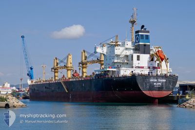
UNION TRADER
Bulk Carrier
Current Trip
VNPHU
| Time Travelled | 2 days |
|---|---|
| Remaining Time | --- |
| Distance Travelled | 793.94 nm |
| Remaining Distance | --- |
| AVG Speed | 13 Knots |
| MAX Speed | 14.6 Knots |
| AVG Wind | 10.2 knots |
| MAX Wind | 22.8 knots |
| MIN Temp | 23.9°C / 75.02°F |
| MAX Temp | 28.3°C / 82.94°F |
| Draught | 13.2 m |
| Position Received | 13 d ago |
Current Position
| Longitude | 114.45338° |
|---|---|
| Latitude | -3.76421° |
| Status | Under way using engine |
| Speed | 5.6 Knots |
| Course | 226.8° |
| Area | Java Sea |
| Station | T-AIS |
| Position Received | 13 d ago |
Info
Information
The current position of UNION TRADER is in Java Sea with coordinates -3.76421° / 114.45338° as reported on 2025-11-29 12:45 by AIS to our vessel tracker app. The vessel's current speed is 5.6 Knots
The vessel UNION TRADER (IMO: 9445710, MMSI: 538007144) is a Bulk Carrier that was built in 2010 ( 15 years old ). It's sailing under the flag of [MH] Marshall Is.
In this page you can find informations about the vessels current position, last detected port calls, and current voyage information. If the vessels is not in coverage by AIS you will find the latest position.
The current position of UNION TRADER is detected by our AIS receivers and we are not responsible for the reliability of the data. The last position was recorded while the vessel was in Coverage by the Ais receivers of our vessel tracking app.
The current draught of UNION TRADER as reported by AIS is 13.2 meters
Weather
| Temperature | 28.4°C / 83.12°F |
|---|---|
| Wind Speed | 11 knots |
| Direction | 289° WNW |
| Pressure | 1006 hPa |
| Humidity | 73.4 % |
| Cloud Coverage | 99 % |
Featured Company
Last Port Calls
| Port | Arrival | Departure | Time In Port |
|---|---|---|---|
| 2025-12-05 19:34 | 2025-12-11 01:17 | 5 d | |
| 2025-11-14 03:04 | 2025-11-17 13:32 | 3 d | |
| 2025-11-03 13:37 | 2025-11-13 10:00 | 9 d |
Most Visited Ports (Last year)
| Port | Arrivals | |
|---|---|---|
| 2 | ||
| 2 | ||
| 2 | ||
| 1 | ||
| 1 | ||
| 1 |
Last Trips
| Origin | Departure | Destination | Arrival | Distance | |
|---|---|---|---|---|---|
| 2025-11-17 13:32 | 2025-12-05 19:34 | 2459.04 nm | |||
| 2025-11-13 10:00 | 2025-11-14 03:04 | 201.50 nm | |||
| 2025-09-29 04:51 | 2025-11-03 13:37 | 8488.10 nm |
Events
| Time | Event | Details | Position / Dest | Info |
|---|---|---|---|---|
| 2025-12-10 18:17 | PORT DEPARTURE |
|
10.54631 / 107.01991
VNPHU
|
Speed: 8.7 kn Course: 223° |
| 2025-12-10 18:01 | START Moving |
10.57498 / 107.02174
[VN] PHU MY
|
Speed: 7.8 kn Course: 222° |
|
| 2025-12-05 12:57 | STOP Moving |
10.58138 / 107.02703
[VN] PHU MY
|
Speed: 0.2 kn Course: 24° |
|
| 2025-12-05 12:34 | PORT ARRIVAL |
|
10.57110 / 107.01890
[VN] PHU MY
|
Speed: 4.7 kn Course: 34° |
| 2025-12-05 09:33 | START Moving | 12.47 nm, South of VUNG TAU |
10.19183 / 107.05836
VNPHU
|
Speed: 5.2 kn Course: 47° |
| 2025-12-03 18:21 | STOP Moving | 12.79 nm, South of VUNG TAU |
10.18668 / 107.05703
VNPHU
|
Speed: 0.3 kn Course: 283° |