
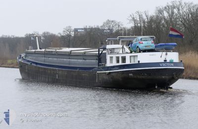
VICTUM
Cargo
Current Trip
NAR UUS
| Time Travelled | 2 days |
|---|---|
| Remaining Time | --- |
| Distance Travelled | 68.54 nm |
| Remaining Distance | --- |
| AVG Speed | 7.3 Knots |
| MAX Speed | 9.2 Knots |
| AVG Wind | 6.8 knots |
| MAX Wind | 11.3 knots |
| MIN Temp | 7.3°C / 45.14°F |
| MAX Temp | 16.8°C / 62.24°F |
| Draught | 0.3 m |
| Position Received | Now |
Current Position
| Longitude | 5.54456° |
|---|---|
| Latitude | 51.79504° |
| Status | Under way using engine |
| Speed | |
| Course | --- |
| Area | North Sea |
| Station | T-AIS |
| Position Received | Now |
Info
Information
The current position of VICTUM is in North Sea with coordinates 51.79504° / 5.54456° as reported on 2025-03-09 16:23 by AIS to our vessel tracker app. The vessel's current speed is 0 Knots
The vessel VICTUM (MMSI: 244750272) is a Cargo It's sailing under the flag of [NL] Netherlands.
In this page you can find informations about the vessels current position, last detected port calls, and current voyage information. If the vessels is not in coverage by AIS you will find the latest position.
The current position of VICTUM is detected by our AIS receivers and we are not responsible for the reliability of the data. The last position was recorded while the vessel was in Coverage by the Ais receivers of our vessel tracking app.
The current draught of VICTUM as reported by AIS is 0.3 meters
Weather
| Temperature | 15.5°C / 59.9°F |
|---|---|
| Wind Speed | 5 knots |
| Direction | 66° ENE |
| Pressure | 1003.3 hPa |
| Humidity | 58.5 % |
| Cloud Coverage | 93 % |
Featured Company
Last Port Calls
| Port | Arrival | Departure | Time In Port |
|---|---|---|---|
| 2025-03-06 21:25 | 2025-03-07 05:23 | 7 h | |
| 2025-03-06 09:25 | 2025-03-06 17:08 | 7 h | |
| 2025-03-05 19:18 | 2025-03-06 05:19 | 10 h | |
| 2025-03-05 16:05 | 2025-03-05 16:31 | 26 m | |
| 2025-03-05 15:29 | 2025-03-05 15:54 | 25 m | |
| 2025-03-05 09:00 | 2025-03-05 12:08 | 3 h | |
| 2025-03-04 15:56 | 2025-03-05 08:27 | 16 h | |
| 2025-03-04 12:09 | 2025-03-04 12:38 | 29 m | |
| 2025-03-03 13:29 | 2025-03-03 14:00 | 31 m | |
| 2025-02-28 11:03 | 2025-03-03 12:06 | 3 d |
Most Visited Ports (Last year)
| Port | Arrivals | |
|---|---|---|
| 36 | ||
| 23 | ||
| 16 | ||
| 14 | ||
| 11 | ||
| 10 |
Last Trips
| Origin | Departure | Destination | Arrival | Distance | |
|---|---|---|---|---|---|
| 2025-03-06 18:08 | 2025-03-06 22:25 | 33.79 nm | |||
| 2025-03-06 06:19 | 2025-03-06 10:25 | 21.53 nm | |||
| 2025-03-05 17:31 | 2025-03-05 20:18 | 11.01 nm | |||
| 2025-03-05 16:54 | 2025-03-05 17:05 | 0.74 nm | |||
| 2025-03-05 13:08 | 2025-03-05 16:29 | 23.64 nm | |||
| 2025-03-05 09:27 | 2025-03-05 10:00 | 2.80 nm | |||
| 2025-03-04 13:38 | 2025-03-04 16:56 | 22.75 nm | |||
| 2025-03-03 15:00 | 2025-03-04 13:09 | 62.25 nm | |||
| 2025-03-03 13:06 | 2025-03-03 14:29 | 5.26 nm | |||
| 2025-02-28 10:00 | 2025-02-28 12:03 | 8.00 nm |
Events
| Time | Event | Details | Position / Dest | Info |
|---|---|---|---|---|
| 2025-03-07 16:23 | STOP Moving | 0.92 nm, North of OSS |
51.79567 / 5.54485
NAR UUS
|
Speed: 0.2 kn Course: 511° |
| 2025-03-07 15:26 | START Moving | 0.74 nm, North West of LITHOIJEN |
51.80873 / 5.45658
NAR UUS
|
Speed: 5.4 kn Course: 83.9° |
| 2025-03-07 15:12 | IN Coverage |
51.80850 / 5.45320
North Sea
|
Speed: 0.1 kn Course: 75.7° |
|
| 2025-03-07 13:37 | OUT of Coverage |
51.81648 / 5.39812
North Sea
|
Speed: 6.4 kn Course: 19° |
|
| 2025-03-07 11:40 | Destination Changed | NAR UUS SCHROOT |
51.73683 / 5.12564
NAR UUS
|
Speed: 6.8 kn Course: 71.9° |
| 2025-03-07 10:04 | Status Changed | Under way using engine Default |
51.71519 / 4.85049
SCHROOT
|
Speed: 6.8 kn Course: 100° |
| 2025-03-07 09:50 | IN Coverage |
51.71519 / 4.85049
North Sea
|
Speed: 6.9 kn Course: 69.6° |
|
| 2025-03-07 08:46 | Status Changed | Default Under way using engine |
51.72599 / 4.62502
SCHROOT
|
Speed: 9 kn Course: 182.9° |
| 2025-03-07 08:38 | OUT of Coverage |
51.74488 / 4.63085
North Sea
|
Speed: 9 kn Course: 182.9° |
|
| 2025-03-07 08:30 | Status Changed | Under way using engine Default |
51.76460 / 4.62546
SCHROOT
|
Speed: 9 kn Course: 185° |