
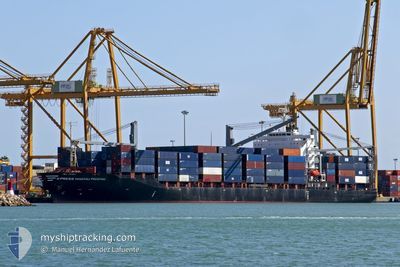
X-PRESS MACHU PICCHU
Container Ship
Current Trip
| Trip Time | 5 days |
|---|---|
| Trip Distance | 1363.18 nm |
| AVG Speed | 10.8 Knots |
| MAX Speed | 10.8 Knots |
| Draught | 7.7 m |
| AVG Wind | 16.6 knots |
| MAX Wind | 26 knots |
| MIN Temp | 23.5°C / 74.3°F |
| MAX Temp | 29.1°C / 84.38°F |
| Position Received | Now |
Current Position
| Longitude | -79.89032° |
|---|---|
| Latitude | 9.37475° |
| Status | Under way using engine |
| Speed | |
| Course | 326° |
| Area | Caribbean Sea |
| Station | T-AIS |
| Position Received | Now |
Info
Information
The current position of X-PRESS MACHU PICCHU is in Caribbean Sea with coordinates 9.37475° / -79.89032° as reported on 2025-02-07 12:03 by AIS to our vessel tracker app. The vessel's current speed is 0 Knots and is currently inside the port of COLON.
The vessel X-PRESS MACHU PICCHU (IMO: 9325441, MMSI: 563058900) is a Container Ship that was built in 2006 ( 19 years old ). It's sailing under the flag of [SG] Singapore.
In this page you can find informations about the vessels current position, last detected port calls, and current voyage information. If the vessels is not in coverage by AIS you will find the latest position.
The current position of X-PRESS MACHU PICCHU is detected by our AIS receivers and we are not responsible for the reliability of the data. The last position was recorded while the vessel was in Coverage by the Ais receivers of our vessel tracking app.
The current draught of X-PRESS MACHU PICCHU as reported by AIS is 7.7 meters
Weather
| Temperature | 24.3°C / 75.74°F |
|---|---|
| Wind Speed | 6 knots |
| Direction | 25° NNE |
| Pressure | 1010.1 hPa |
| Humidity | 82.3 % |
| Cloud Coverage | 38 % |
Featured Company
Last Port Calls
| Port | Arrival | Departure | Time In Port |
|---|---|---|---|
| 2025-02-07 03:06 | |||
| 2025-01-30 12:18 | 2025-02-01 12:03 | 1 d | |
| 2025-01-26 06:55 | 2025-01-27 23:08 | 1 d | |
| 2025-01-22 14:05 | 2025-01-24 17:00 | 2 d | |
| 2025-01-16 18:59 | 2025-01-19 15:21 | 2 d | |
| 2025-01-05 09:44 | 2025-01-11 04:59 | 5 d | |
| 2024-12-30 20:16 | 2024-12-31 17:29 | 21 h | |
| 2024-12-27 07:46 | 2024-12-28 00:25 | 16 h | |
| 2024-12-18 20:06 | 2024-12-24 08:52 | 5 d | |
| 2024-12-10 15:57 | 2024-12-11 18:46 | 1 d |
Most Visited Ports (Last year)
| Port | Arrivals | |
|---|---|---|
| 27 | ||
| 23 | ||
| 19 | ||
| 9 | ||
| 2 | ||
| 2 |
Last Trips
| Origin | Departure | Destination | Arrival | Distance | |
|---|---|---|---|---|---|
| 2025-02-01 12:03 | 2025-02-07 03:06 | 1363.18 nm | |||
| 2025-01-27 23:08 | 2025-01-30 12:18 | 523.88 nm | |||
| 2025-01-24 17:00 | 2025-01-26 06:55 | 462.70 nm | |||
| 2025-01-19 15:21 | 2025-01-22 14:05 | 528.52 nm | |||
| 2025-01-11 04:59 | 2025-01-16 18:59 | 1167.85 nm | |||
| 2024-12-31 17:29 | 2025-01-05 09:44 | 1087.30 nm | |||
| 2024-12-28 00:25 | 2024-12-30 20:16 | 356.43 nm | |||
| 2024-12-24 08:52 | 2024-12-27 07:46 | 1021.06 nm | |||
| 2024-12-11 18:46 | 2024-12-18 20:06 | 1191.74 nm | |||
| 2024-12-02 19:34 | 2024-12-10 15:57 | 701.08 nm |
Events
| Time | Event | Details | Position / Dest | Info |
|---|---|---|---|---|
| 2025-02-07 08:06 | STOP Moving |
9.37467 / -79.89064
[PA] COLON
|
Speed: 0.3 kn Course: 324° |
|
| 2025-02-07 08:06 | PORT ARRIVAL |
|
9.37464 / -79.89070
[PA] COLON
|
Speed: 0.8 kn Course: 327° |
| 2025-02-07 04:49 | Status Changed | Under way using engine Default |
9.78924 / -79.74856
HTPAP>DOCAU
|
Speed: 16.6 kn Course: 234° |
| 2025-02-07 04:46 | Status Changed | Default Under way using engine |
9.79435 / -79.74179
HTPAP>DOCAU
|
Speed: 16.7 kn Course: 232.9° |
| 2025-02-07 04:42 | Change Sea Area | Panamanian part of the Caribbean Sea Domican Republic part of the Caribbean Sea |
9.80766 / -79.72379
Caribbean Sea
|
Speed: 16.7 kn Course: 232.9° |
| 2025-02-07 04:42 | Status Changed | Under way using engine Default |
9.80766 / -79.72379
HTPAP>DOCAU
|
Speed: 16.7 kn Course: 235° |
| 2025-02-07 04:33 | IN Coverage |
9.80766 / -79.72379
Caribbean Sea
|
Speed: 16.7 kn Course: 232.9° |
|
| 2025-02-04 21:32 | Status Changed | Default Under way using engine |
18.11190 / -69.77372
HTPAP>DOCAU
|
Speed: 14.4 kn Course: 237° |
| 2025-02-04 21:26 | Status Changed | Under way using engine Default |
18.12478 / -69.75197
HTPAP>DOCAU
|
Speed: 14.3 kn Course: 238° |
| 2025-02-04 21:26 | OUT of Coverage |
18.12478 / -69.75197
Caribbean Sea
|
Speed: 14.4 kn Course: 237° |