
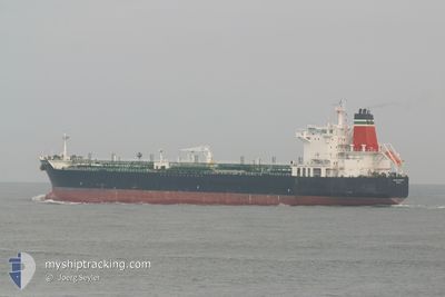
YONGAN OCEAN
Crude Oil Tanker
Current Trip
| Time Travelled | 21 days |
|---|---|
| Remaining Time | 5 h, 28 mins |
| Distance Travelled | 5816.68 nm |
| Remaining Distance | 171.90 nm |
| AVG Speed | 11.6 Knots |
| MAX Speed | 14.4 Knots |
| AVG Wind | 12.8 knots |
| MAX Wind | 33 knots |
| MIN Temp | 14.6°C / 58.28°F |
| MAX Temp | 28°C / 82.4°F |
| Draught | 8.5 m |
| Position Received | 20 h, 0 m ago |
Current Position
| Longitude | 55.29254° |
|---|---|
| Latitude | 26.32540° |
| Status | Under way using engine |
| Speed | 11.3 Knots |
| Course | 259° |
| Area | Persian Gulf |
| Station | T-AIS |
| Position Received | 20 h, 0 m ago |
Info
Information
The current position of YONGAN OCEAN is in Persian Gulf with coordinates 26.32540° / 55.29254° as reported on 2025-12-21 13:33 by AIS to our vessel tracker app. The vessel's current speed is 11.3 Knots and is heading at the port of AL JUBAIL. The estimated time of arrival as calculated by MyShipTracking vessel tracking app is 2025-12-22 18:02 LT
The vessel YONGAN OCEAN (IMO: 9288758, MMSI: 373336000) is a Crude Oil Tanker that was built in 2004 ( 21 years old ). It's sailing under the flag of [PA] Panama.
In this page you can find informations about the vessels current position, last detected port calls, and current voyage information. If the vessels is not in coverage by AIS you will find the latest position.
The current position of YONGAN OCEAN is detected by our AIS receivers and we are not responsible for the reliability of the data. The last position was recorded while the vessel was in Coverage by the Ais receivers of our vessel tracking app.
The current draught of YONGAN OCEAN as reported by AIS is 8.5 meters
Weather
| Temperature | 21.6°C / 70.88°F |
|---|---|
| Wind Speed | 1 knots |
| Direction | 97° E |
| Pressure | 1022.1 hPa |
| Humidity | 37.5 % |
| Cloud Coverage | 27 % |
Featured Company
Last Trips
| Origin | Departure | Destination | Arrival | Distance | |
|---|---|---|---|---|---|
| 2025-10-24 03:00 | 2025-11-29 08:52 | 6183.49 nm | |||
| 2025-09-11 13:32 | 2025-10-22 13:13 | 9289.08 nm |
Events
| Time | Event | Details | Position / Dest | Info |
|---|---|---|---|---|
| 2025-12-21 13:38 | Status Changed | Default Under way using engine |
26.32223 / 55.27409
JUBAIL
|
Speed: 11.3 kn Course: 259° |
| 2025-12-21 13:33 | OUT of Coverage |
26.32540 / 55.29254
Persian Gulf
JUBAIL
|
Speed: 11.3 kn Course: 259° |
|
| 2025-12-21 12:34 | Change Sea Area | Iranian part of the Persian Gulf Indian part of the Laccadive Sea |
26.36275 / 55.49453
Persian Gulf
JUBAIL
|
Speed: 11.3 kn Course: 257.7° |
| 2025-12-21 12:34 | IN Coverage |
26.36275 / 55.49453
Persian Gulf
JUBAIL
|
Speed: 11.3 kn Course: 257.7° |
|
| 2025-12-21 12:33 | Status Changed | Under way using engine Default |
26.36317 / 55.49682
JUBAIL
|
Speed: 11.3 kn Course: 257° |
| 2025-12-15 09:30 | Status Changed | Default Under way using engine |
7.38684 / 76.34586
JUBAIL
|
Speed: 12.4 kn Course: 295.4° |
| 2025-12-15 09:22 | Status Changed | Under way using engine Default |
7.37510 / 76.37175
JUBAIL
|
Speed: 12 kn Course: 294° |
| 2025-12-15 09:22 | OUT of Coverage |
7.37510 / 76.37175
Laccadive Sea
JUBAIL
|
Speed: 12.4 kn Course: 295.4° |
|
| 2025-12-15 08:29 | Status Changed | Default Under way using engine |
7.28833 / 76.53500
JUBAIL
|
Speed: 12.7 kn Course: 300.9° |
| 2025-12-15 08:22 | Status Changed | Under way using engine Default |
7.27793 / 76.55834
JUBAIL
|
Speed: 12.8 kn Course: 296° |