
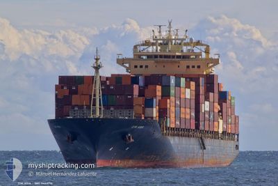
ZIM ASIA
Container Ship
Current Trip
| Time Travelled | 1 day |
|---|---|
| Remaining Time | 4 h, 10 mins |
| Distance Travelled | 586.92 nm |
| Remaining Distance | 96.55 nm |
| AVG Speed | 18.4 Knots |
| MAX Speed | 19.2 Knots |
| AVG Wind | 9.7 knots |
| MAX Wind | 20 knots |
| MIN Temp | 7.8°C / 46.04°F |
| MAX Temp | 11.5°C / 52.7°F |
| Draught | 10.9 m |
| Position Received | 1 h, 25 m ago |
Current Position
| Longitude | 25.76539° |
|---|---|
| Latitude | 37.84407° |
| Status | Under way using engine |
| Speed | 19.3 Knots |
| Course | 356° |
| Area | Aegean Sea |
| Station | T-AIS |
| Position Received | 1 h, 25 m ago |
Info
Information
The current position of ZIM ASIA is in Aegean Sea with coordinates 37.84407° / 25.76539° as reported on 2025-02-24 22:24 by AIS to our vessel tracker app. The vessel's current speed is 19.3 Knots and is heading at the port of ALIAGA. The estimated time of arrival as calculated by MyShipTracking vessel tracking app is 2025-02-25 04:00 LT
The vessel ZIM ASIA (IMO: 9464716, MMSI: 636021664) is a Container Ship that was built in 2010 ( 15 years old ). It's sailing under the flag of [LR] Liberia.
In this page you can find informations about the vessels current position, last detected port calls, and current voyage information. If the vessels is not in coverage by AIS you will find the latest position.
The current position of ZIM ASIA is detected by our AIS receivers and we are not responsible for the reliability of the data. The last position was recorded while the vessel was in Coverage by the Ais receivers of our vessel tracking app.
The current draught of ZIM ASIA as reported by AIS is 10.9 meters
Weather
| Temperature | 9.5°C / 49.1°F |
|---|---|
| Wind Speed | 1 knots |
| Direction | 318° NW |
| Pressure | 1027.1 hPa |
| Humidity | 55.4 % |
| Cloud Coverage | 100 % |
Featured Company
Last Port Calls
| Port | Arrival | Departure | Time In Port |
|---|---|---|---|
| 2025-02-20 20:32 | 2025-02-23 14:59 | 2 d | |
| 2025-02-18 21:26 | 2025-02-20 07:31 | 1 d | |
| 2025-02-16 20:20 | 2025-02-18 00:37 | 1 d | |
| 2025-02-10 11:53 | 2025-02-11 11:49 | 23 h | |
| 2025-02-08 16:17 | 2025-02-09 16:18 | 1 d | |
| 2025-01-28 09:54 | 2025-01-29 19:07 | 1 d | |
| 2025-01-21 20:19 | 2025-01-24 06:21 | 2 d | |
| 2025-01-17 09:45 | 2025-01-18 22:04 | 1 d | |
| 2025-01-03 15:14 | 2025-01-04 11:45 | 20 h | |
| 2025-01-02 04:42 | 2025-01-02 20:09 | 15 h |
Last Trips
| Origin | Departure | Destination | Arrival | Distance | |
|---|---|---|---|---|---|
| 2025-02-20 09:31 | 2025-02-20 22:32 | 103.19 nm | |||
| 2025-02-18 03:37 | 2025-02-18 23:26 | 264.54 nm | |||
| 2025-02-11 12:49 | 2025-02-16 23:20 | 1696.15 nm | |||
| 2025-02-09 17:18 | 2025-02-10 12:53 | 172.13 nm | |||
| 2025-01-29 14:07 | 2025-02-08 17:17 | 4235.51 nm | |||
| 2025-01-24 01:21 | 2025-01-28 04:54 | 713.39 nm | |||
| 2025-01-18 18:04 | 2025-01-21 15:19 | 646.41 nm | |||
| 2025-01-04 12:45 | 2025-01-17 05:45 | 4148.69 nm | |||
| 2025-01-02 21:09 | 2025-01-03 16:14 | 178.31 nm | |||
| 2024-12-30 01:15 | 2025-01-02 05:42 | 463.19 nm |
Events
| Time | Event | Details | Position / Dest | Info |
|---|---|---|---|---|
| 2025-02-24 22:28 | Status Changed | Default Under way using engine |
37.86056 / 25.76411
ALIAGA
|
Speed: 19.3 kn Course: 356° |
| 2025-02-24 22:24 | OUT of Coverage |
37.84407 / 25.76539
Aegean Sea
ALIAGA
|
Speed: 19.3 kn Course: 356° |
|
| 2025-02-24 21:45 | Status Changed | Under way using engine Default |
37.64363 / 25.82044
ALIAGA
|
Speed: 18.5 kn Course: 345° |
| 2025-02-24 21:36 | Status Changed | Default Under way using engine |
37.59531 / 25.83643
ALIAGA
|
Speed: 18.7 kn Course: 343.3° |
| 2025-02-24 14:02 | Change Sea Area | Greek part of the Aegean Sea Greek part of the Mediterranean Sea - Eastern Basin |
35.84200 / 27.68097
Aegean Sea
ALIAGA
|
Speed: 17.8 kn Course: 307.1° |
| 2025-02-24 11:13 | Change Sea Area | Greek part of the Mediterranean Sea - Eastern Basin Israeli part of the Mediterranean Sea - Eastern Basin |
35.34009 / 28.52855
Mediterranean Sea - Eastern Basin
ALIAGA
|
Speed: 18.4 kn Course: 305.5° |
| 2025-02-24 11:13 | IN Coverage |
35.34009 / 28.52855
Mediterranean Sea - Eastern Basin
ALIAGA
|
Speed: 18.4 kn Course: 305.5° |
|
| 2025-02-23 15:34 | Status Changed | Default Under way using engine |
31.91244 / 34.47340
ALIAGA
|
Speed: 17.6 kn Course: 293.4° |
| 2025-02-23 15:29 | OUT of Coverage |
31.90287 / 34.49877
Mediterranean Sea - Eastern Basin
ALIAGA
|
Speed: 17.6 kn Course: 293.4° |
|
| 2025-02-23 15:24 | ETA Changed | 2025/02/25 06:00 2025/02/25 05:30 |
31.89218 / 34.52911
ALIAGA
|
Speed: 17.4 kn Course: 293.7° |