
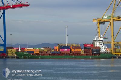
ANITA A
Container Ship
Current Trip
| Time Travelled | 1 day |
|---|---|
| Remaining Time | --- |
| Distance Travelled | 324.49 nm |
| Remaining Distance | --- |
| AVG Speed | 10.6 Knots |
| MAX Speed | 11.3 Knots |
| AVG Wind | 9.8 knots |
| MAX Wind | 16.9 knots |
| MIN Temp | 3.4°C / 38.12°F |
| MAX Temp | 15.4°C / 59.72°F |
| Dybgang | 7.5 m |
| Position Modtaget | 4 m siden |
Current Position
| Longitude | 34.62324° |
|---|---|
| Latitude | 31.84704° |
| Status | At anchor |
| Fart | |
| Kurs | 188° |
| Område | Mediterranean Sea - Eastern Basin |
| Station | T-AIS |
| Position Modtaget | 4 m siden |
Info
Information
The current position of ANITA A is in Mediterranean Sea - Eastern Basin with coordinates 31.84704° / 34.62324° as reported on 2025-02-10 00:30 by AIS to our vessel tracker app. The vessel's current speed is 0 Knots
The vessel ANITA A (IMO: 9532343, MMSI: 636021307) is a Container Ship that was built in 2009 ( 16 år gamle ). It's sailing under the flag of [LR] Liberia.
In this page you can find informations about the vessels current position, last detected port calls, and current voyage information. If the vessels is not in coverage by AIS you will find the latest position.
The current position of ANITA A is detected by our AIS receivers and we are not responsible for the reliability of the data. The last position was recorded while the vessel was in Coverage by the Ais receivers of our vessel tracking app.
The current draught of ANITA A as reported by AIS is 7.5 meters
Weather
| Temperature | 15.1°C / 59.18°F |
|---|---|
| Wind Speed | 14 knots |
| Direction | 264° W |
| Pressure | 1016.7 hPa |
| Humidity | 57.2 % |
| Cloud Coverage | 35 % |
Featured Company
Last Port Calls
| Port | Arrival | Departure | Time In Port |
|---|---|---|---|
| 2025-02-07 14:07 | 2025-02-08 04:41 | 14 h | |
| 2025-02-04 20:43 | 2025-02-05 02:51 | 6 h | |
| 2025-02-04 05:32 | 2025-02-04 13:50 | 8 h | |
| 2025-02-03 06:51 | 2025-02-03 16:13 | 9 h | |
| 2025-02-01 17:40 | 2025-02-02 08:00 | 14 h | |
| 2025-02-01 01:17 | 2025-02-01 14:31 | 13 h | |
| 2025-01-31 02:07 | 2025-01-31 11:05 | 8 h | |
| 2025-01-28 20:56 | 2025-01-29 10:30 | 13 h | |
| 2025-01-26 21:01 | 2025-01-27 21:21 | 1 d | |
| 2025-01-24 20:58 | 2025-01-26 02:47 | 1 d |
Most Visited Ports (Last year)
| Port | Arrivals | |
|---|---|---|
| 42 | ||
| 42 | ||
| 25 | ||
| 19 | ||
| 18 | ||
| 6 |
Last Trips
| Origin | Departure | Destination | Arrival | Distance | |
|---|---|---|---|---|---|
| 2025-02-05 02:51 | 2025-02-07 14:07 | 264.66 nm | |||
| 2025-02-04 13:50 | 2025-02-04 20:43 | 78.68 nm | |||
| 2025-02-02 08:00 | 2025-02-04 05:32 | 251.79 nm | |||
| 2025-02-02 08:00 | 2025-02-03 06:51 | 27.22 nm | |||
| 2025-01-31 11:05 | 2025-02-01 17:40 | 272.89 nm | |||
| 2025-01-31 11:05 | 2025-02-01 01:17 | 168.87 nm | |||
| 2025-01-29 10:30 | 2025-01-31 02:07 | 270.44 nm | |||
| 2025-01-27 21:21 | 2025-01-28 20:56 | 328.28 nm | |||
| 2025-01-26 02:47 | 2025-01-26 21:01 | 255.52 nm | |||
| 2025-01-24 13:52 | 2025-01-24 20:58 | 79.59 nm |
Events
| Tid | Hændelsen | Detaljer | Position / Dest | Info |
|---|---|---|---|---|
| 2025-02-09 21:12 | Status er ændret | At anchor Default |
31.84660 / 34.62365
ILASH
|
Fart: 0.1 kn Kurs: 203° |
| 2025-02-09 21:03 | Status er ændret | Default At anchor |
31.84665 / 34.62374
ILASH
|
Fart: 0.1 kn Kurs: 202° |
| 2025-02-09 13:18 | Status er ændret | At anchor Default |
31.84594 / 34.62448
ILASH
|
Fart: Kurs: 250° |
| 2025-02-09 13:08 | Status er ændret | Default At anchor |
31.84579 / 34.62449
ILASH
|
Fart: 0.1 kn Kurs: 252° |
| 2025-02-09 08:12 | Status er ændret | At anchor Under way using engine |
31.84654 / 34.62349
ILASH
|
Fart: 0.5 kn Kurs: 221° |
| 2025-02-09 08:00 | STOP Sejllads | 1.14 nm, North West of ASHDOD |
31.84535 / 34.62284
ILASH
|
Fart: 0.2 kn Kurs: 218° |
| 2025-02-09 07:06 | Status er ændret | Under way using engine Default |
31.90597 / 34.51486
ILASH
|
Fart: 10.5 kn Kurs: 170° |
| 2025-02-09 07:06 | Indenfor Dækning |
31.90597 / 34.51486
Mediterranean Sea - Eastern Basin
ILASH
|
Fart: 10.6 kn Kurs: 171.3° |
|
| 2025-02-09 06:46 | ETA er ændret | 2025/02/09 07:00 2025/02/09 06:00 |
32.05569 / 34.48811
ILASH
|
Fart: 10.5 kn Kurs: 172° |
| 2025-02-09 01:45 | Udenfor Dækning |
32.84375 / 34.46078
Mediterranean Sea - Eastern Basin
ILASH
|
Fart: 11 kn Kurs: 178.8° |