
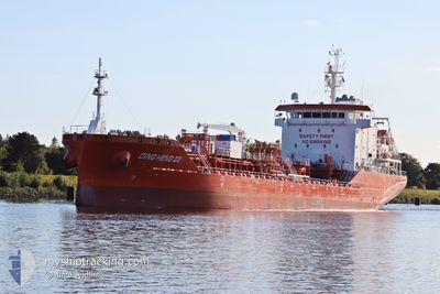
DING HENG 23
Tanker
Current Trip
| Time Travelled | 1 day |
|---|---|
| Remaining Time | 12 h, 21 mins |
| Distance Travelled | 362.04 nm |
| Remaining Distance | 181.77 nm |
| AVG Speed | 12.4 Knots |
| MAX Speed | 14 Knots |
| AVG Wind | 12.5 knots |
| MAX Wind | 21.6 knots |
| MIN Temp | 21.3°C / 70.34°F |
| MAX Temp | 26°C / 78.8°F |
| Dybgang | 6.3 m |
| Position Modtaget | 2 h, 11 m siden |
Current Position
| Longitude | 39.40597° |
|---|---|
| Latitude | 18.34706° |
| Status | Under way using engine |
| Fart | 12.5 Knots |
| Kurs | 161.6° |
| Område | Red Sea |
| Station | T-AIS |
| Position Modtaget | 2 h, 11 m siden |
Info
Information
The current position of DING HENG 23 is in Red Sea with coordinates 18.34706° / 39.40597° as reported on 2025-02-14 09:00 by AIS to our vessel tracker app. The vessel's current speed is 12.5 Knots and is heading at the port of JEDDAH. The estimated time of arrival as calculated by MyShipTracking vessel tracking app is 2025-02-14 23:33 LT
The vessel DING HENG 23 (IMO: 9841421, MMSI: 477931300) is a Tanker It's sailing under the flag of [HK] Hong Kong.
In this page you can find informations about the vessels current position, last detected port calls, and current voyage information. If the vessels is not in coverage by AIS you will find the latest position.
The current position of DING HENG 23 is detected by our AIS receivers and we are not responsible for the reliability of the data. The last position was recorded while the vessel was in Coverage by the Ais receivers of our vessel tracking app.
The current draught of DING HENG 23 as reported by AIS is 6.3 meters
Weather
| Temperature | 26°C / 78.8°F |
|---|---|
| Wind Speed | 3 knots |
| Direction | 345° NNW |
| Pressure | 1012.1 hPa |
| Humidity | 81.4 % |
| Cloud Coverage | 98 % |
Featured Company
Last Port Calls
| Port | Arrival | Departure | Time In Port |
|---|---|---|---|
| 2025-02-12 01:41 | 2025-02-13 05:22 | 1 d | |
| 2025-02-10 14:39 | 2025-02-11 09:00 | 18 h | |
| 2025-02-07 04:53 | 2025-02-07 13:43 | 8 h | |
| 2025-01-28 11:20 | 2025-01-29 15:44 | 1 d | |
| 2025-01-27 09:31 | 2025-01-28 06:56 | 21 h | |
| 2025-01-24 06:11 | 2025-01-24 15:25 | 9 h | |
| 2025-01-22 10:38 | 2025-01-23 03:45 | 17 h | |
| 2024-12-24 06:06 | 2024-12-25 07:28 | 1 d | |
| 2024-12-12 09:01 | 2024-12-12 23:13 | 14 h | |
| 2024-12-07 02:47 | 2024-12-08 06:13 | 1 d |
Most Visited Ports (Last year)
| Port | Arrivals | |
|---|---|---|
| 6 | ||
| 3 | ||
| 3 | ||
| 3 | ||
| 2 | ||
| 2 |
Last Trips
| Origin | Departure | Destination | Arrival | Distance | |
|---|---|---|---|---|---|
| 2025-02-11 12:00 | 2025-02-12 04:41 | 171.26 nm | |||
| 2025-01-29 18:44 | 2025-02-10 17:39 | 1848.21 nm | |||
| 2025-01-29 18:44 | 2025-02-07 06:53 | 1078.55 nm | |||
| 2025-01-28 09:56 | 2025-01-28 14:20 | 16.11 nm | |||
| 2025-01-23 05:45 | 2025-01-27 12:31 | 935.84 nm | |||
| 2025-01-23 05:45 | 2025-01-24 08:11 | 15.28 nm | |||
| 2024-12-25 15:28 | 2025-01-22 12:38 | 7453.52 nm | |||
| 2024-12-13 07:13 | 2024-12-24 14:06 | 2557.59 nm | |||
| 2024-12-08 14:13 | 2024-12-12 17:01 | 334.88 nm | |||
| 2024-12-05 09:25 | 2024-12-07 10:47 | 11.32 nm |
Events
| Tid | Hændelsen | Detaljer | Position / Dest | Info |
|---|---|---|---|---|
| 2025-02-14 09:16 | Status er ændret | Default Under way using engine |
18.29441 / 39.42312
JEDDAH
|
Fart: 12.5 kn Kurs: 161.6° |
| 2025-02-14 09:00 | Status er ændret | Under way using engine Default |
18.34706 / 39.40597
JEDDAH
|
Fart: 12.2 kn Kurs: 162° |
| 2025-02-14 09:00 | Udenfor Dækning |
18.34706 / 39.40597
Red Sea
|
Fart: 12.5 kn Kurs: 161.6° |
|
| 2025-02-14 08:35 | Status er ændret | Default Under way using engine |
18.42886 / 39.37864
JEDDAH
|
Fart: 12.1 kn Kurs: 163.2° |
| 2025-02-14 08:32 | Status er ændret | Under way using engine Default |
18.43741 / 39.37586
JEDDAH
|
Fart: 11.7 kn Kurs: 164° |
| 2025-02-14 08:32 | Indenfor Dækning |
18.43741 / 39.37586
Red Sea
|
Fart: 12.1 kn Kurs: 163.2° |
|
| 2025-02-14 08:32 | Fundet i havområde | Sudanese part of the Red Sea |
18.43741 / 39.37586
Red Sea
|
Fart: 12.1 kn Kurs: 163.2° |
| 2025-02-13 05:23 | START Sejllads | 4.98 nm, South East of YANBU |
23.90389 / 38.28332
JEDDAH
|
Fart: 8.9 kn Kurs: 175° |
| 2025-02-13 05:22 | Afsejlet fra sidste havn |
|
23.90389 / 38.28332
JEDDAH
|
Fart: 0.4 kn Kurs: 100° |
| 2025-02-12 01:41 | STOP Sejllads |
23.91828 / 38.28334
[SA] YANBU
|
Fart: 0.3 kn Kurs: 103° |