
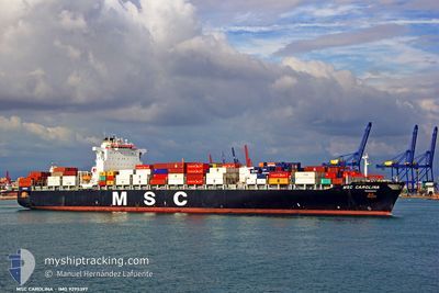
MSC CAROLINA
Container Ship
Current Trip
| Time Travelled | 1 day |
|---|---|
| Remaining Time | --- |
| Distance Travelled | 648.77 nm |
| Remaining Distance | --- |
| AVG Speed | 15.7 Knots |
| MAX Speed | 19.3 Knots |
| AVG Wind | 10.9 knots |
| MAX Wind | 16.8 knots |
| MIN Temp | 11.6°C / 52.88°F |
| MAX Temp | 24.6°C / 76.28°F |
| Dybgang | 12.5 m |
| Position Modtaget | 1 d siden |
Current Position
| Longitude | -94.68789° |
|---|---|
| Latitude | 29.33911° |
| Status | Under way using engine |
| Fart | 15 Knots |
| Kurs | 112.9° |
| Område | Gulf of Mexico |
| Station | T-AIS |
| Position Modtaget | 1 d siden |
Info
Information
The current position of MSC CAROLINA is in Gulf of Mexico with coordinates 29.33911° / -94.68789° as reported on 2026-01-04 14:42 by AIS to our vessel tracker app. The vessel's current speed is 15 Knots
The vessel MSC CAROLINA (IMO: 9295397, MMSI: 371475000) is a Container Ship that was built in 2005 ( 21 år gamle ). It's sailing under the flag of [PA] Panama.
In this page you can find informations about the vessels current position, last detected port calls, and current voyage information. If the vessels is not in coverage by AIS you will find the latest position.
The current position of MSC CAROLINA is detected by our AIS receivers and we are not responsible for the reliability of the data. The last position was recorded while the vessel was in Coverage by the Ais receivers of our vessel tracking app.
The current draught of MSC CAROLINA as reported by AIS is 12.5 meters
Weather
| Temperature | 19.3°C / 66.74°F |
|---|---|
| Wind Speed | 5 knots |
| Direction | 204° SSW |
| Pressure | 1013.8 hPa |
| Humidity | 92.9 % |
| Cloud Coverage | 1 % |
Featured Company
Last Port Calls
| Port | Arrival | Departure | Time In Port |
|---|---|---|---|
| 2026-01-01 20:17 | 2026-01-04 06:56 | 2 d | |
| 2025-12-20 05:38 | 2025-12-20 23:44 | 18 h | |
| 2025-12-19 03:36 | 2025-12-19 18:28 | 14 h | |
| 2025-12-16 06:08 | 2025-12-17 05:40 | 23 h | |
| 2025-11-12 19:50 | 2025-11-13 23:18 | 1 d | |
| 2025-11-08 13:14 | 2025-11-09 11:55 | 22 h | |
| 2025-11-06 16:34 | 2025-11-07 11:18 | 18 h | |
| 2025-11-03 11:00 | 2025-11-04 02:14 | 15 h | |
| 2025-11-01 10:41 | 2025-11-02 05:55 | 19 h |
Last Trips
| Origin | Departure | Destination | Arrival | Distance | |
|---|---|---|---|---|---|
| 2025-12-20 23:44 | 2026-01-01 20:17 | 1446.48 nm | |||
| 2025-12-19 18:28 | 2025-12-20 05:38 | 120.46 nm | |||
| 2025-12-17 05:40 | 2025-12-19 03:36 | 633.66 nm | |||
| 2025-11-13 23:18 | 2025-12-16 06:08 | 11722.64 nm | |||
| 2025-11-09 11:55 | 2025-11-12 19:50 | 936.69 nm | |||
| 2025-11-07 11:18 | 2025-11-08 13:14 | 418.20 nm | |||
| 2025-11-04 02:14 | 2025-11-06 16:34 | 976.99 nm | |||
| 2025-11-02 05:55 | 2025-11-03 11:00 | 54.39 nm | |||
| 2025-09-30 20:22 | 2025-11-01 10:41 | 11433.89 nm |
Events
| Tid | Hændelsen | Detaljer | Position / Dest | Info |
|---|---|---|---|---|
| 2026-01-06 06:50 | STOP Sejllads | 3.21 nm, North West of VERACRUZ |
19.23690 / -96.16935
USHOU-MXVER
|
Fart: Kurs: 349° |
| 2026-01-04 14:43 | Status er ændret | Default Under way using engine |
29.33896 / -94.68752
USHOU-MXVER
|
Fart: 15 kn Kurs: 112.9° |
| 2026-01-04 14:42 | Status er ændret | Under way using engine Default |
29.33911 / -94.68789
USHOU-MXVER
|
Fart: 14.5 kn Kurs: 102° |
| 2026-01-04 14:42 | Udenfor Dækning |
29.33911 / -94.68789
Gulf of Mexico
USHOU-MXVER
|
Fart: 15 kn Kurs: 112.9° |
|
| 2026-01-04 14:19 | Status er ændret | Default Under way using engine |
29.35208 / -94.78622
USHOU-MXVER
|
Fart: 11.5 kn Kurs: 148.7° |
| 2026-01-04 12:56 | Afsejlet fra sidste havn |
|
29.59012 / -94.93989
USHOU-MXVER
|
Fart: 11.5 kn Kurs: 144° |
| 2026-01-04 12:24 | START Sejllads |
29.61336 / -95.00591
[US] HOUSTON
|
Fart: 3.2 kn Kurs: 82° |
|
| 2026-01-04 12:18 | ETA er ændret | 2026/01/06 17:00 2026/01/06 10:00 |
29.61298 / -95.00862
[US] HOUSTON
|
Fart: 0.3 kn Kurs: 84° |
| 2026-01-04 12:11 | Status er ændret | Under way using engine Moored |
29.61252 / -95.00805
[US] HOUSTON
|
Fart: Kurs: 88° |
| 2026-01-04 09:45 | Dybgangen er ændret | 12.5 12.3 |
29.61249 / -95.00796
[US] HOUSTON
|
Fart: Kurs: 87° |