

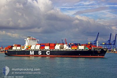
MSC CAROLINA
Container Ship

Current Trip
| Time Travelled | 2 days |
|---|---|
| Remaining Time | 1 day |
| Distance Travelled | 904.04 nm |
| Remaining Distance | 474.96 nm |
| AVG Speed | 13.2 Noeuds |
| MAX Speed | 17 Noeuds |
| AVG Wind | 7.5 knots |
| MAX Wind | 14.4 knots |
| MIN Temp | 21.3°C / 70.34°F |
| MAX Temp | 28.8°C / 83.84°F |
| Tirant d eau | 13 m |
| Position reçue | 1 d depuis |
Current Position
| Longitude | -80.48264° |
|---|---|
| Latitude | 24.60741° |
| Etat | Under way using engine |
| Vitesse | 14.7 Noeuds |
| Parcours | 251.4° |
| Zone | North Atlantic Ocean |
| Station | T-AIS |
| Position reçue | 1 d depuis |
Information
The current position of MSC CAROLINA is in North Atlantic Ocean with coordinates 24.60741° / -80.48264° as reported on 2025-06-07 20:18 by AIS to our vessel tracker app. The vessel's current speed is 14.7 Noeuds and is heading at the port of HOUSTON. The estimated time of arrival as calculated by MyShipTracking vessel tracking app is 2025-06-10 03:34 LT
The vessel MSC CAROLINA (IMO: 9295397, MMSI: 371475000) is a Container Ship that was built in 2005 ( 20 Age ). It's sailing under the flag of [PA] Panama.
In this page you can find informations about the vessels current position, last detected port calls, and current voyage information. If the vessels is not in coverage by AIS you will find the latest position.
The current position of MSC CAROLINA is detected by our AIS receivers and we are not responsible for the reliability of the data. The last position was recorded while the vessel was in Coverage by the Ais receivers of our vessel tracking app.
The current draught of MSC CAROLINA as reported by AIS is 13 meters
Weather
| Temperature | 28.4°C / 83.12°F |
|---|---|
| Wind Speed | 9 knots |
| Direction | 131° SE |
| Pressure | 1014.9 hPa |
| Humidity | 72 % |
| Cloud Coverage | --- |


Featured Company
Last Port Calls
| Port | Arrival | Departure | Time In Port |
|---|---|---|---|
| 2025-06-05 02:33 | 2025-06-06 05:37 | 1 d | |
| 2025-06-04 03:00 | 2025-06-04 15:51 | 12 h | |
| 2025-06-01 09:08 | 2025-06-02 03:26 | 18 h | |
| 2025-05-01 15:16 | 2025-05-02 22:04 | 1 d | |
| 2025-04-27 12:27 | 2025-04-28 18:51 | 1 d | |
| 2025-04-25 15:09 | 2025-04-26 10:04 | 18 h | |
| 2025-04-20 22:53 | 2025-04-22 00:58 | 1 d | |
| 2025-04-17 16:02 | 2025-04-18 21:05 | 1 d |
Most Visited Ports (Last year)
| Port | Arrivals | |
|---|---|---|
| 7 | ||
| 5 | ||
| 3 | ||
| 3 | ||
| 3 | ||
| 3 |
Last Trips
| Origin | Departure | Destination | Arrival | Distance | |
|---|---|---|---|---|---|
| 2025-06-04 15:51 | 2025-06-05 02:33 | 116.43 nm | |||
| 2025-06-02 03:26 | 2025-06-04 03:00 | 632.97 nm | |||
| 2025-05-02 22:04 | 2025-06-01 09:08 | 11359.69 nm | |||
| 2025-04-28 18:51 | 2025-05-01 15:16 | 1249.11 nm | |||
| 2025-04-26 10:04 | 2025-04-27 12:27 | 422.95 nm | |||
| 2025-04-22 00:58 | 2025-04-25 15:09 | 1230.56 nm | |||
| 2025-04-18 21:05 | 2025-04-20 22:53 | 120.32 nm | |||
| 2025-03-18 02:14 | 2025-04-17 16:02 | 12156.86 nm |
Events
| Heure | Evenement | Détails | Position/ Destination | Info |
|---|---|---|---|---|
| 2025-06-07 20:32 | Etat Changé | Default Under way using engine |
24.58900 / -80.54387
USSAV-USHOU
|
Vitesse: 14.7 kn Parcours: 251.4° |
| 2025-06-07 20:18 | Hors de la zone couverte |
24.60741 / -80.48264
North Atlantic Ocean
USSAV-USHOU
|
Vitesse: 14.7 kn Parcours: 251.4° |
|
| 2025-06-07 17:45 | Etat Changé | Under way using engine Default |
25.04205 / -80.03696
USSAV-USHOU
|
Vitesse: 14.1 kn Parcours: 216° |
| 2025-06-07 17:32 | Dans la zone couverte |
25.04205 / -80.03696
North Atlantic Ocean
USSAV-USHOU
|
Vitesse: 14 kn Parcours: 215.1° |
|
| 2025-06-07 16:44 | Etat Changé | Default Under way using engine |
25.25987 / -79.92069
USSAV-USHOU
|
Vitesse: 15.2 kn Parcours: 194.3° |
| 2025-06-07 16:43 | Hors de la zone couverte |
25.26487 / -79.91925
North Atlantic Ocean
USSAV-USHOU
|
Vitesse: 15.2 kn Parcours: 194.3° |
|
| 2025-06-07 13:52 | Tirant d'eau modifié | 13 13.1 |
26.01150 / -79.78237
USSAV-USHOU
|
Vitesse: 15.7 kn Parcours: 182.7° |
| 2025-06-07 12:16 | Etat Changé | Under way using engine Default |
26.42697 / -79.77874
USSAV-USHOU
|
Vitesse: 15.3 kn Parcours: 180° |
| 2025-06-07 12:16 | Dans la zone couverte |
26.42697 / -79.77874
North Atlantic Ocean
USSAV-USHOU
|
Vitesse: 15.5 kn Parcours: 178.2° |
|
| 2025-06-07 10:11 | Hors de la zone couverte |
26.96585 / -79.75479
North Atlantic Ocean
USSAV-USHOU
|
Vitesse: 15.1 kn Parcours: 178.4° |