
NAGUAL
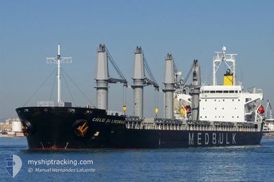
Bulk Carrier
Current Trip
| Trip Time | 63 days |
|---|---|
| Trip Distance | 8733.68 nm |
| AVG Speed | 10.5 Knots |
| MAX Speed | 14.4 Knots |
| Dybgang | 11 m |
| AVG Wind | 16.9 knots |
| MAX Wind | 40.7 knots |
| MIN Temp | -0.4°C / 31.28°F |
| MAX Temp | 30.6°C / 87.08°F |
| Position Modtaget | 7 m siden |
Current Position
| Longitude | -123.17398° |
|---|---|
| Latitude | 49.68512° |
| Status | Moored |
| Fart | |
| Kurs | 13° |
| Område | The Coastal Waters of Southeast Alaska and British Columbia |
| Station | T-AIS |
| Position Modtaget | 7 m siden |
Info
Information
The current position of NAGUAL is in The Coastal Waters of Southeast Alaska and British Columbia with coordinates 49.68512° / -123.17398° as reported on 2025-02-24 06:22 by AIS to our vessel tracker app. The vessel's current speed is 0 Knots and is currently inside the port of SQUAMISH.
The vessel NAGUAL (IMO: 9380829, MMSI: 538007314) is a Bulk Carrier that was built in 2008 ( 17 år gamle ). It's sailing under the flag of [MH] Marshall Is.
In this page you can find informations about the vessels current position, last detected port calls, and current voyage information. If the vessels is not in coverage by AIS you will find the latest position.
The current position of NAGUAL is detected by our AIS receivers and we are not responsible for the reliability of the data. The last position was recorded while the vessel was in Coverage by the Ais receivers of our vessel tracking app.
The current draught of NAGUAL as reported by AIS is 11 meters
Weather
| Temperature | 0.3°C / 32.54°F |
|---|---|
| Wind Speed | 6 knots |
| Direction | 192° SSW |
| Pressure | 1009.6 hPa |
| Humidity | 99.8 % |
| Cloud Coverage | 100 % |
Featured Company
Most Visited Ports (Last year)
| Port | Arrivals | |
|---|---|---|
| 4 | ||
| 2 | ||
| 2 | ||
| 1 | ||
| 1 | ||
| 1 |
Events
| Tid | Hændelsen | Detaljer | Position / Dest | Info |
|---|---|---|---|---|
| 2025-02-24 05:31 | Status er ændret | Moored Default |
49.68500 / -123.17382
[CA] SQUAMISH
|
Fart: Kurs: 13° |
| 2025-02-24 05:22 | Status er ændret | Default Moored |
49.68495 / -123.17385
[CA] SQUAMISH
|
Fart: Kurs: 13° |
| 2025-02-24 04:28 | Status er ændret | Moored Under way using engine |
49.68515 / -123.17407
[CA] SQUAMISH
|
Fart: Kurs: 13° |
| 2025-02-24 04:14 | STOP Sejllads |
49.68450 / -123.17427
[CA] SQUAMISH
|
Fart: 0.3 kn Kurs: 12° |
|
| 2025-02-24 04:08 | Skibe i havn |
|
49.68165 / -123.17555
[CA] SQUAMISH
|
Fart: 2.7 kn Kurs: 17° |
| 2025-02-23 23:52 | Ændre havområde | Canadian part of the The Coastal Waters of Southeast Alaska and British Columbia United States part of the The Coastal Waters of Southeast Alaska and British Columbia |
49.00443 / -123.24510
The Coastal Waters of Southeast Alaska and British Columbia
SQUAMISH
|
Fart: 11.8 kn Kurs: 314° |
| 2025-02-23 22:46 | Ændre havområde | United States part of the The Coastal Waters of Southeast Alaska and British Columbia Canadian part of the The Coastal Waters of Southeast Alaska and British Columbia |
48.84362 / -123.02803
The Coastal Waters of Southeast Alaska and British Columbia
SQUAMISH
|
Fart: 11.7 kn Kurs: 335° |
| 2025-02-23 22:37 | Ændre havområde | Canadian part of the The Coastal Waters of Southeast Alaska and British Columbia United States part of the The Coastal Waters of Southeast Alaska and British Columbia |
48.81803 / -123.01217
The Coastal Waters of Southeast Alaska and British Columbia
SQUAMISH
|
Fart: 10.6 kn Kurs: 341° |
| 2025-02-23 22:28 | Ændre havområde | United States part of the The Coastal Waters of Southeast Alaska and British Columbia Canadian part of the The Coastal Waters of Southeast Alaska and British Columbia |
48.79365 / -123.00433
The Coastal Waters of Southeast Alaska and British Columbia
SQUAMISH
|
Fart: 10 kn Kurs: 11° |
| 2025-02-23 21:55 | Ændre havområde | Canadian part of the The Coastal Waters of Southeast Alaska and British Columbia United States part of the The Coastal Waters of Southeast Alaska and British Columbia |
48.73440 / -123.12205
The Coastal Waters of Southeast Alaska and British Columbia
SQUAMISH
|
Fart: 11.2 kn Kurs: 62° |