
NAGUAL
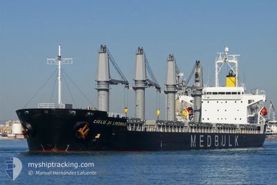
Bulk Carrier
Current Trip
| Trip Time | 63 days |
|---|---|
| Trip Distance | 8733.68 nm |
| AVG Speed | 10.5 Knoten |
| MAX Speed | 14.4 Knoten |
| Tiefgang | 11 m |
| AVG Wind | 16.9 knots |
| MAX Wind | 40.7 knots |
| MIN Temp | -0.4°C / 31.28°F |
| MAX Temp | 30.6°C / 87.08°F |
| Position erhalten | 10 m alt |
Current Position
| Länge | -123.17398° |
|---|---|
| Breite | 49.68512° |
| Zustand | Moored |
| Geschwindigkeit | |
| Kurs | 13° |
| Gebiet | The Coastal Waters of Southeast Alaska and British Columbia |
| Station | T-AIS |
| Position erhalten | 10 m alt |
Info
Information
Die aktuelle Position von NAGUAL befindet sich in The Coastal Waters of Southeast Alaska and British Columbia mit den Koordinaten 49.68512° / -123.17398°, wie von AIS am 2025-02-24 06:22 an unsere Schiffsverfolgungs-App. Die aktuelle Geschwindigkeit des Schiffes betragt 0 Knoten und befindet sich derzeit im Port von SQUAMISH .
Das Schiff NAGUAL (IMO: 9380829, MMSI: 538007314) ist Bulk Carrier das wurde im Jahr 2008 ( 17 Jahre alt ) gebaut. Es segelt unter der Flagge [MH] Marshall Is.
Auf dieser Seite finden Sie Informationen zur aktuellen Position des Schiffes, zu den zuletzt erkannten Hafenanlaufen und zu aktuellen Reiseinformationen. Wenn die Schiffe nicht von AIS abgedeckt werden, finden Sie die neueste Position.
Die aktuelle Position von NAGUAL wird von unseren AIS-Empfangern erkannt und wir sind nicht fur die Zuverlassigkeit der Daten verantwortlich. Die letzte Position wurde von den Ais-Empfangern unserer Schiffsverfolgungs-App aufgezeichnet, wahrend sich das Schiff in Deckung befand.
Der aktuelle Entwurf von NAGUAL, wie von AIS gemeldet, betragt 11 meter
Weather
| Temperature | 0.3°C / 32.54°F |
|---|---|
| Wind Speed | 6 knots |
| Direction | 192° SSW |
| Pressure | 1009.6 hPa |
| Humidity | 99.8 % |
| Cloud Coverage | 100 % |
Featured Company
Most Visited Ports (Last year)
| Port | Arrivals | |
|---|---|---|
| 4 | ||
| 2 | ||
| 2 | ||
| 1 | ||
| 1 | ||
| 1 |
Events
| Zeit | Ereignis | Details | Position / Ziel | Information |
|---|---|---|---|---|
| 2025-02-24 05:31 | geänderter Status | Moored Default |
49.68500 / -123.17382
[CA] SQUAMISH
|
Geschwindigkeit: Kurs: 13° |
| 2025-02-24 05:22 | geänderter Status | Default Moored |
49.68495 / -123.17385
[CA] SQUAMISH
|
Geschwindigkeit: Kurs: 13° |
| 2025-02-24 04:28 | geänderter Status | Moored Under way using engine |
49.68515 / -123.17407
[CA] SQUAMISH
|
Geschwindigkeit: Kurs: 13° |
| 2025-02-24 04:14 | STOP Bewegung |
49.68450 / -123.17427
[CA] SQUAMISH
|
Geschwindigkeit: 0.3 kn Kurs: 12° |
|
| 2025-02-24 04:08 | ZIELHAFEN |
|
49.68165 / -123.17555
[CA] SQUAMISH
|
Geschwindigkeit: 2.7 kn Kurs: 17° |
| 2025-02-23 23:52 | Ändere Seegebiet | Canadian part of the The Coastal Waters of Southeast Alaska and British Columbia United States part of the The Coastal Waters of Southeast Alaska and British Columbia |
49.00443 / -123.24510
The Coastal Waters of Southeast Alaska and British Columbia
SQUAMISH
|
Geschwindigkeit: 11.8 kn Kurs: 314° |
| 2025-02-23 22:46 | Ändere Seegebiet | United States part of the The Coastal Waters of Southeast Alaska and British Columbia Canadian part of the The Coastal Waters of Southeast Alaska and British Columbia |
48.84362 / -123.02803
The Coastal Waters of Southeast Alaska and British Columbia
SQUAMISH
|
Geschwindigkeit: 11.7 kn Kurs: 335° |
| 2025-02-23 22:37 | Ändere Seegebiet | Canadian part of the The Coastal Waters of Southeast Alaska and British Columbia United States part of the The Coastal Waters of Southeast Alaska and British Columbia |
48.81803 / -123.01217
The Coastal Waters of Southeast Alaska and British Columbia
SQUAMISH
|
Geschwindigkeit: 10.6 kn Kurs: 341° |
| 2025-02-23 22:28 | Ändere Seegebiet | United States part of the The Coastal Waters of Southeast Alaska and British Columbia Canadian part of the The Coastal Waters of Southeast Alaska and British Columbia |
48.79365 / -123.00433
The Coastal Waters of Southeast Alaska and British Columbia
SQUAMISH
|
Geschwindigkeit: 10 kn Kurs: 11° |
| 2025-02-23 21:55 | Ändere Seegebiet | Canadian part of the The Coastal Waters of Southeast Alaska and British Columbia United States part of the The Coastal Waters of Southeast Alaska and British Columbia |
48.73440 / -123.12205
The Coastal Waters of Southeast Alaska and British Columbia
SQUAMISH
|
Geschwindigkeit: 11.2 kn Kurs: 62° |