
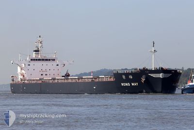
RONG MAY
Cargo
Current Trip
| Time Travelled | 11 days |
|---|---|
| Remaining Time | --- |
| Distance Travelled | 3145.68 nm |
| Remaining Distance | --- |
| AVG Speed | 11.3 Knots |
| MAX Speed | 14.6 Knots |
| AVG Wind | 7.9 knots |
| MAX Wind | 20 knots |
| MIN Temp | 21.8°C / 71.24°F |
| MAX Temp | 28.6°C / 83.48°F |
| Dybgang | 7.3 m |
| Position Modtaget | 9 d siden |
Current Position
| Longitude | 56.88732° |
|---|---|
| Latitude | 25.10719° |
| Status | Under way using engine |
| Fart | 13.4 Knots |
| Kurs | 111.8° |
| Område | Gulf of Oman |
| Station | T-AIS |
| Position Modtaget | 9 d siden |
Info
Information
The current position of RONG MAY is in Gulf of Oman with coordinates 25.10719° / 56.88732° as reported on 2025-12-05 05:58 by AIS to our vessel tracker app. The vessel's current speed is 13.4 Knots and is heading at the port of RICHARDS BAY. The estimated time of arrival as calculated by MyShipTracking vessel tracking app is 2025-12-19 12:00 LT
The vessel RONG MAY (IMO: 9774484, MMSI: 636017370) is a Cargo It's sailing under the flag of [LR] Liberia.
In this page you can find informations about the vessels current position, last detected port calls, and current voyage information. If the vessels is not in coverage by AIS you will find the latest position.
The current position of RONG MAY is detected by our AIS receivers and we are not responsible for the reliability of the data. The last position was recorded while the vessel was in Coverage by the Ais receivers of our vessel tracking app.
The current draught of RONG MAY as reported by AIS is 7.3 meters
Weather
| Temperature | 28.3°C / 82.94°F |
|---|---|
| Wind Speed | 3 knots |
| Direction | 269° W |
| Pressure | 1010.2 hPa |
| Humidity | 70.3 % |
| Cloud Coverage | 10 % |
Featured Company
Last Port Calls
| Port | Arrival | Departure | Time In Port |
|---|---|---|---|
| 2025-11-27 22:13 | 2025-12-03 05:12 | 5 d | |
| 2025-10-06 12:14 | 2025-10-08 07:50 | 1 d |
Last Trips
| Origin | Departure | Destination | Arrival | Distance | |
|---|---|---|---|---|---|
| 2025-10-08 07:50 | 2025-11-27 22:13 | 6612.05 nm | |||
| 2025-09-27 12:32 | 2025-10-06 12:14 | 1393.18 nm |
Events
| Tid | Hændelsen | Detaljer | Position / Dest | Info |
|---|---|---|---|---|
| 2025-12-05 05:59 | Status er ændret | Default Under way using engine |
25.10557 / 56.89177
ZA RCB
|
Fart: 13.4 kn Kurs: 111.8° |
| 2025-12-05 05:58 | Udenfor Dækning |
25.10719 / 56.88732
Gulf of Oman
ZA RCB
|
Fart: 13.4 kn Kurs: 111.8° |
|
| 2025-12-05 03:08 | START Sejllads | 8.1 nm, North East of FUJAIRAH |
25.25082 / 56.46260
ZA RCB
|
Fart: 3.1 kn Kurs: 154° |
| 2025-12-05 03:05 | Destination er ændret | ZA RCB AE FJR |
25.25268 / 56.46141
ZA RCB
|
Fart: 2.2 kn Kurs: 152° |
| 2025-12-05 03:05 | ETA er ændret | 2025/12/19 10:00 2026/04/12 12:30 |
25.25268 / 56.46141
ZA RCB
|
Fart: 2.2 kn Kurs: 152° |
| 2025-12-05 03:05 | Status er ændret | Under way using engine At anchor |
25.25268 / 56.46141
AE FJR
|
Fart: 1.9 kn Kurs: 152° |
| 2025-12-04 12:43 | Status er ændret | At anchor Under way using engine |
25.25110 / 56.46022
AE FJR
|
Fart: 0.2 kn Kurs: 22° |
| 2025-12-04 12:40 | STOP Sejllads | 8.03 nm, North East of FUJAIRAH |
25.25098 / 56.46043
AE FJR
|
Fart: 0.3 kn Kurs: 25° |