
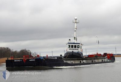
VALDEMAR
Tug
Current Trip
| Time Travelled | 2 days |
|---|---|
| Remaining Time | 3 days |
| Distance Travelled | 180.25 nm |
| Remaining Distance | 488.46 nm |
| AVG Speed | 4.4 Knots |
| MAX Speed | 6.2 Knots |
| AVG Wind | 16.5 knots |
| MAX Wind | 23 knots |
| MIN Temp | -0.1°C / 31.82°F |
| MAX Temp | 4.4°C / 39.92°F |
| Dybgang | 4.2 m |
| Position Modtaget | 1 m siden |
Current Position
| Longitude | 12.14229° |
|---|---|
| Latitude | 56.72827° |
| Status | Restricted manoeuverability |
| Fart | 5.2 Knots |
| Kurs | 161.7° |
| Område | Kattegat |
| Station | T-AIS |
| Position Modtaget | 1 m siden |
Info
Information
The current position of VALDEMAR is in Kattegat with coordinates 56.72827° / 12.14229° as reported on 2025-02-09 11:18 by AIS to our vessel tracker app. The vessel's current speed is 5.2 Knots and is heading at the port of STOCKHOLM. The estimated time of arrival as calculated by MyShipTracking vessel tracking app is 2025-02-13 09:00 LT
The vessel VALDEMAR (IMO: 8108121, MMSI: 219025221) is a Tug that was built in 1981 ( 44 år gamle ). It's sailing under the flag of [DK] Denmark.
In this page you can find informations about the vessels current position, last detected port calls, and current voyage information. If the vessels is not in coverage by AIS you will find the latest position.
The current position of VALDEMAR is detected by our AIS receivers and we are not responsible for the reliability of the data. The last position was recorded while the vessel was in Coverage by the Ais receivers of our vessel tracking app.
The current draught of VALDEMAR as reported by AIS is 4.2 meters
Weather
| Temperature | 1.8°C / 35.24°F |
|---|---|
| Wind Speed | 11 knots |
| Direction | 58° ENE |
| Pressure | 1037.6 hPa |
| Humidity | 76.9 % |
| Cloud Coverage | 92 % |
Featured Company
Last Port Calls
| Port | Arrival | Departure | Time In Port |
|---|---|---|---|
| 2025-02-07 07:29 | 2025-02-07 10:49 | 3 h | |
| 2025-02-06 07:51 | 2025-02-06 15:06 | 7 h | |
| 2025-02-04 10:32 | 2025-02-04 12:40 | 2 h | |
| 2025-02-02 08:40 | 2025-02-02 14:15 | 5 h | |
| 2025-01-30 01:45 | 2025-02-01 18:18 | 2 d | |
| 2025-01-29 20:54 | 2025-01-29 22:11 | 1 h | |
| 2025-01-26 19:57 | 2025-01-29 16:05 | 2 d | |
| 2025-01-24 11:52 | 2025-01-26 17:30 | 2 d | |
| 2025-01-22 16:14 | 2025-01-22 18:28 | 2 h | |
| 2025-01-14 17:02 | 2025-01-18 16:08 | 3 d |
Most Visited Ports (Last year)
| Port | Arrivals | |
|---|---|---|
| 8 | ||
| 5 | ||
| 4 | ||
| 3 | ||
| 3 | ||
| 2 |
Last Trips
| Origin | Departure | Destination | Arrival | Distance | |
|---|---|---|---|---|---|
| 2025-02-06 15:06 | 2025-02-07 07:29 | 125.18 nm | |||
| 2025-02-04 12:40 | 2025-02-06 07:51 | 403.69 nm | |||
| 2025-02-02 14:15 | 2025-02-04 10:32 | 208.67 nm | |||
| 2025-02-01 18:18 | 2025-02-02 08:40 | 130.40 nm | |||
| 2025-01-29 22:11 | 2025-01-30 01:45 | 31.79 nm | |||
| 2025-01-29 16:05 | 2025-01-29 20:54 | 32.17 nm | |||
| 2025-01-26 17:30 | 2025-01-26 19:57 | 13.05 nm | |||
| 2025-01-22 18:28 | 2025-01-24 11:52 | 291.94 nm | |||
| 2025-01-18 16:08 | 2025-01-22 16:14 | 379.27 nm | |||
| 2025-01-06 15:49 | 2025-01-14 17:02 | 934.91 nm |
Events
| Tid | Hændelsen | Detaljer | Position / Dest | Info |
|---|---|---|---|---|
| 2025-02-08 23:17 | Ændre havområde | Swedish part of the Kattegat Danish part of the Kattegat |
57.58865 / 11.26815
Kattegat
STOKHOLM
|
Fart: 4.2 kn Kurs: 139.5° |
| 2025-02-08 21:37 | Ændre havområde | Danish part of the Kattegat Swedish part of the Kattegat |
57.69353 / 11.16629
Kattegat
STOKHOLM
|
Fart: 3.7 kn Kurs: 161.8° |
| 2025-02-08 19:20 | Ændre havområde | Swedish part of the Kattegat Swedish part of the Skaggerak |
57.82395 / 11.06324
Kattegat
STOKHOLM
|
Fart: 3.7 kn Kurs: 153.1° |
| 2025-02-08 17:55 | Fundet i havområde | Swedish part of the Skaggerak |
57.88459 / 10.94400
Skaggerak
STOKHOLM
|
Fart: 4.7 kn Kurs: 99° |
| 2025-02-08 08:24 | Status er ændret | Restricted manoeuverability Under way using engine |
58.02245 / 9.92618
STOKHOLM
|
Fart: 2.2 kn Kurs: 114° |
| 2025-02-08 04:31 | START Sejllads |
58.06021 / 9.67050
STOKHOLM
|
Fart: 3.1 kn Kurs: 107° |
|
| 2025-02-08 04:22 | STOP Sejllads |
58.06071 / 9.65889
STOKHOLM
|
Fart: 0.2 kn Kurs: 106° |
|
| 2025-02-08 03:06 | Fundet i havområde | Danish part of the Skaggerak |
58.06570 / 9.56732
Skaggerak
STOKHOLM
|
Fart: 3.1 kn Kurs: 106.9° |
| 2025-02-07 19:54 | ETA er ændret | 2025/02/14 07:00 2025/02/17 07:00 |
58.09521 / 8.91579
STOKHOLM
|
Fart: 3.4 kn Kurs: 103° |
| 2025-02-07 12:26 | START Sejllads | 5.41 nm, South East of KYSTVEIEN |
58.06688 / 8.24759
STOKHOLM
|
Fart: 3.4 kn Kurs: 342° |