

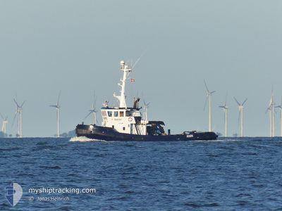
VALDEMAR
Tug
Current Trip
| Time Travelled | 4 days |
|---|---|
| Remaining Time | 6 days |
| Distance Travelled | 498.52 nm |
| Remaining Distance | 614.28 nm |
| AVG Speed | 4.5 Knopen |
| MAX Speed | 6.6 Knopen |
| AVG Wind | 11 knots |
| MAX Wind | 29 knots |
| MIN Temp | -0.5°C / 31.1°F |
| MAX Temp | 9.5°C / 49.1°F |
| Diepgang | 4.2 M |
| Positie ontvangen | 1 m geleden |
Current Position
| Lengtegraad | 5.50200° |
|---|---|
| Breedtegraat | 62.20373° |
| Status | Restricted manoeuverability |
| Snelheid | 4 Knopen |
| Koers | 99° |
| Gebied | Norwegian Sea |
| Station | T-AIS |
| Positie ontvangen | 1 m geleden |
Information
The current position of VALDEMAR is in Norwegian Sea with coordinates 62.20373° / 5.50200° as reported on 2025-04-25 13:46 by AIS to our vessel tracker app. The vessel's current speed is 4 Knopen and is heading at the port of TROMSO. The estimated time of arrival as calculated by MyShipTracking vessel tracking app is 2025-05-02 03:08 LT
The vessel VALDEMAR (IMO: 8108121, MMSI: 219025221) is a Tug that was built in 1981 ( 44 Jaar oud ). It's sailing under the flag of [DK] Denmark.
In this page you can find informations about the vessels current position, last detected port calls, and current voyage information. If the vessels is not in coverage by AIS you will find the latest position.
The current position of VALDEMAR is detected by our AIS receivers and we are not responsible for the reliability of the data. The last position was recorded while the vessel was in Coverage by the Ais receivers of our vessel tracking app.
The current draught of VALDEMAR as reported by AIS is 4.2 meters
Weather
| Temperature | 6.1°C / 42.98°F |
|---|---|
| Wind Speed | 11 knots |
| Direction | 39° NE |
| Pressure | 1026.6 hPa |
| Humidity | 54.5 % |
| Cloud Coverage | 11 % |
Featured Company
Last Port Calls
| Port | Arrival | Departure | Time In Port |
|---|---|---|---|
| 2025-04-20 07:50 | 2025-04-20 17:23 | 9 h | |
| 2025-04-14 14:39 | 2025-04-14 18:16 | 3 h | |
| 2025-04-10 19:34 | 2025-04-11 14:20 | 18 h | |
| 2025-04-07 13:49 | 2025-04-07 15:01 | 1 h | |
| 2025-03-27 14:47 | 2025-03-31 06:56 | 3 d | |
| 2025-03-20 07:52 | 2025-03-20 16:49 | 8 h | |
| 2025-03-16 21:29 | 2025-03-18 09:18 | 1 d | |
| 2025-02-27 08:25 | 2025-03-13 16:34 | 14 d | |
| 2025-02-24 05:57 | 2025-02-24 16:48 | 10 h | |
| 2025-02-21 01:59 | 2025-02-23 08:58 | 2 d |
Most Visited Ports (Last year)
| Port | Arrivals | |
|---|---|---|
| 10 | ||
| 5 | ||
| 4 | ||
| 3 | ||
| 3 | ||
| 3 |
Last Trips
| Origin | Departure | Destination | Arrival | Distance | |
|---|---|---|---|---|---|
| 2025-04-14 18:16 | 2025-04-20 07:50 | 647.69 nm | |||
| 2025-04-11 14:20 | 2025-04-14 14:39 | 719.90 nm | |||
| 2025-04-07 15:01 | 2025-04-10 19:34 | 797.18 nm | |||
| 2025-03-31 06:56 | 2025-04-07 13:49 | 875.16 nm | |||
| 2025-03-20 16:49 | 2025-03-27 14:47 | 741.83 nm | |||
| 2025-03-18 09:18 | 2025-03-20 07:52 | 281.50 nm | |||
| 2025-03-13 16:34 | 2025-03-16 21:29 | 166.27 nm | |||
| 2025-02-24 16:48 | 2025-02-27 08:25 | 274.11 nm | |||
| 2025-02-23 08:58 | 2025-02-24 05:57 | 169.58 nm | |||
| 2025-02-19 15:07 | 2025-02-21 01:59 | 333.43 nm |
Events
| Tijd | Evenement | Details | Positie / Bestemming | Info |
|---|---|---|---|---|
| 2025-04-23 21:42 | Wijzig zee gebeid | Norwegian part of the Norwegian Sea Norwegian part of the North Sea |
61.00190 / 4.81247
Norwegian Sea
NOTOS
|
Snelheid: 4 kn Koers: 47.8° |
| 2025-04-23 13:44 | Status Changed | Restricted manoeuverability Default |
60.52023 / 4.96112
NOTOS
|
Snelheid: 4.5 kn Koers: 339° |
| 2025-04-23 13:41 | Status Changed | Default Restricted manoeuverability |
60.51774 / 4.96316
NOTOS
|
Snelheid: 4.5 kn Koers: 339° |
| 2025-04-21 23:04 | Gevonden in zee | Norwegian part of the North Sea |
57.96987 / 7.03684
North Sea
NOTOS
|
Snelheid: 5.9 kn Koers: 287° |
| 2025-04-21 09:55 | Gevonden in zee | Norwegian part of the Skaggerak |
57.90740 / 9.24159
Skaggerak
NOTOS
|
Snelheid: 4.4 kn Koers: 274.2° |
| 2025-04-20 21:58 | Wijzig zee gebeid | Danish part of the Skaggerak Danish part of the Kattegat |
57.79716 / 10.92815
Skaggerak
NOTOS
|
Snelheid: 5 kn Koers: 321.2° |
| 2025-04-20 15:27 | Start beweging | 0.5 nm, South East of FREDERIKSHAVN |
57.42938 / 10.55918
NOTOS
|
Snelheid: 3.1 kn Koers: 135° |
| 2025-04-20 15:23 | Vertrekhaven |
|
57.43126 / 10.55572
NOTOS
|
Snelheid: 3 kn Koers: 136° |
| 2025-04-20 15:17 | Status Changed | Restricted manoeuverability Moored |
57.43466 / 10.54778
[DK] FREDERIKSHAVN
|
Snelheid: 2.8 kn Koers: 133° |
| 2025-04-20 07:20 | Status Changed | Moored Default |
57.43662 / 10.54875
[DK] FREDERIKSHAVN
|
Snelheid: Koers: 47° |