
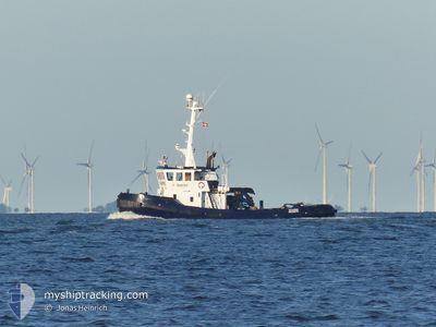
VALDEMAR
Tug
Current Trip
| Trip Time | 7 h, 37 mins |
|---|---|
| Trip Distance | 7.76 nm |
| AVG Speed | 3.2 Noeuds |
| MAX Speed | 6.1 Noeuds |
| Tirant d eau | 4.2 m |
| AVG Wind | 15.7 knots |
| MAX Wind | 20 knots |
| MIN Temp | 10.5°C / 50.9°F |
| MAX Temp | 11.9°C / 53.42°F |
| Position reçue | 6 m depuis |
Current Position
| Longitude | 5.10391° |
|---|---|
| Latitude | 60.44597° |
| Etat | Moored |
| Vitesse | |
| Parcours | 149° |
| Zone | North Sea |
| Station | T-AIS |
| Position reçue | 6 m depuis |
Information
The current position of VALDEMAR is in North Sea with coordinates 60.44597° / 5.10391° as reported on 2025-06-02 04:38 by AIS to our vessel tracker app. The vessel's current speed is 0 Noeuds and is currently inside the port of HANOYTANGEN.
The vessel VALDEMAR (IMO: 8108121, MMSI: 219025221) is a Tug that was built in 1981 ( 44 Age ). It's sailing under the flag of [DK] Denmark.
In this page you can find informations about the vessels current position, last detected port calls, and current voyage information. If the vessels is not in coverage by AIS you will find the latest position.
The current position of VALDEMAR is detected by our AIS receivers and we are not responsible for the reliability of the data. The last position was recorded while the vessel was in Coverage by the Ais receivers of our vessel tracking app.
The current draught of VALDEMAR as reported by AIS is 4.2 meters
Weather
| Temperature | 9.5°C / 49.1°F |
|---|---|
| Wind Speed | 17 knots |
| Direction | 193° SSW |
| Pressure | 997.1 hPa |
| Humidity | 90.5 % |
| Cloud Coverage | 100 % |
Featured Company
Last Port Calls
| Port | Arrival | Departure | Time In Port |
|---|---|---|---|
| 2025-06-01 15:50 | |||
| 2025-05-31 14:46 | 2025-06-01 08:13 | 17 h | |
| 2025-05-30 11:11 | 2025-05-30 12:07 | 56 m | |
| 2025-05-21 21:39 | 2025-05-23 10:47 | 1 d | |
| 2025-05-16 12:51 | 2025-05-19 13:24 | 3 d | |
| 2025-05-13 20:38 | 2025-05-14 14:55 | 18 h | |
| 2025-05-13 14:17 | 2025-05-13 18:42 | 4 h | |
| 2025-05-06 09:04 | 2025-05-12 17:14 | 6 d | |
| 2025-05-04 10:01 | 2025-05-04 11:13 | 1 h | |
| 2025-05-01 07:40 | 2025-05-01 09:49 | 2 h |
Most Visited Ports (Last year)
| Port | Arrivals | |
|---|---|---|
| 10 | ||
| 4 | ||
| 4 | ||
| 4 | ||
| 3 | ||
| 2 |
Last Trips
| Origin | Departure | Destination | Arrival | Distance | |
|---|---|---|---|---|---|
| 2025-06-01 10:13 | 2025-06-01 17:50 | 7.76 nm | |||
| 2025-05-30 14:07 | 2025-05-31 16:46 | 256.59 nm | |||
| 2025-05-23 12:47 | 2025-05-30 13:11 | 623.68 nm | |||
| 2025-05-19 15:24 | 2025-05-21 23:39 | 294.70 nm | |||
| 2025-05-14 16:55 | 2025-05-16 14:51 | 421.62 nm | |||
| 2025-05-13 20:42 | 2025-05-13 22:38 | 6.56 nm | |||
| 2025-05-12 19:14 | 2025-05-13 16:17 | 143.05 nm | |||
| 2025-05-04 13:13 | 2025-05-06 11:04 | 433.13 nm | |||
| 2025-05-01 11:49 | 2025-05-04 12:01 | 647.60 nm | |||
| 2025-04-20 17:23 | 2025-05-01 09:40 | 1125.44 nm |
Events
| Heure | Evenement | Détails | Position/ Destination | Info |
|---|---|---|---|---|
| 2025-06-02 03:44 | Etat Changé | Moored Restricted manoeuverability |
60.44598 / 5.10390
[NO] HANOYTANGEN
|
Vitesse: Parcours: 150° |
| 2025-06-01 16:02 | Arret |
60.44597 / 5.10389
[NO] HANOYTANGEN
|
Vitesse: Parcours: 161° |
|
| 2025-06-01 15:50 | Port d'arrivée |
|
60.43921 / 5.10927
[NO] HANOYTANGEN
|
Vitesse: 2.4 kn Parcours: 321° |
| 2025-06-01 15:41 | Démarrage | 0.59 nm, South East of HANOYTANGEN |
60.43462 / 5.12093
NO HOT
|
Vitesse: 3.1 kn Parcours: 354° |
| 2025-06-01 14:18 | Arret | 0.62 nm, South East of HANOYTANGEN |
60.43254 / 5.11900
NO HOT
|
Vitesse: 0.3 kn Parcours: 181° |
| 2025-06-01 14:10 | Démarrage | 0.68 nm, South East of HANOYTANGEN |
60.43458 / 5.12426
NO HOT
|
Vitesse: 3.1 kn Parcours: 237° |
| 2025-06-01 13:39 | Arret | 0.63 nm, South East of HANOYTANGEN |
60.43324 / 5.12050
NO HOT
|
Vitesse: 0.2 kn Parcours: 133° |
| 2025-06-01 13:26 | Démarrage | 0.78 nm, South East of HANOYTANGEN |
60.43412 / 5.12743
NO HOT
|
Vitesse: 3.1 kn Parcours: 33° |
| 2025-06-01 10:11 | Arret | 0.93 nm, South East of HANOYTANGEN |
60.43190 / 5.13099
NO HOT
|
Vitesse: 0.3 kn Parcours: 187° |
| 2025-06-01 09:44 | Démarrage | 0.66 nm, South East of HANOYTANGEN |
60.43267 / 5.12077
NO HOT
|
Vitesse: 3.5 kn Parcours: 39° |