
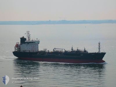
ASKARA
Oil/Chemical Tanker
Current Trip
THMAT
| Time Travelled | 10 days |
|---|---|
| Remaining Time | --- |
| Distance Travelled | 2355.91 nm |
| Remaining Distance | --- |
| AVG Speed | 10 Noeuds |
| MAX Speed | 13.4 Noeuds |
| AVG Wind | 17.8 knots |
| MAX Wind | 28 knots |
| MIN Temp | 6.8°C / 44.24°F |
| MAX Temp | 26.7°C / 80.06°F |
| Tirant d eau | 5.7 m |
| Position reçue | 24 d depuis |
Current Position
| Longitude | 136.94167° |
|---|---|
| Latitude | 34.82833° |
| Etat | Under way using engine |
| Vitesse | 11.4 Noeuds |
| Parcours | 184° |
| Zone | Philippine Sea |
| Station | T-AIS |
| Position reçue | 24 d depuis |
Info
Information
The current position of ASKARA is in Philippine Sea with coordinates 34.82833° / 136.94167° as reported on 2025-01-19 07:29 by AIS to our vessel tracker app. The vessel's current speed is 11.4 Noeuds
The vessel ASKARA (IMO: 9431886, MMSI: 249187000) is a Oil/Chemical Tanker that was built in 2008 ( 17 Age ). It's sailing under the flag of [MT] Malta.
In this page you can find informations about the vessels current position, last detected port calls, and current voyage information. If the vessels is not in coverage by AIS you will find the latest position.
The current position of ASKARA is detected by our AIS receivers and we are not responsible for the reliability of the data. The last position was recorded while the vessel was in Coverage by the Ais receivers of our vessel tracking app.
The current draught of ASKARA as reported by AIS is 5.7 meters
Weather
| Temperature | 6.7°C / 44.06°F |
|---|---|
| Wind Speed | 26 knots |
| Direction | 350° N |
| Pressure | 1026.9 hPa |
| Humidity | 75.6 % |
| Cloud Coverage | 100 % |
Featured Company
Last Port Calls
| Port | Arrival | Departure | Time In Port |
|---|---|---|---|
| 2025-01-31 20:29 | 2025-02-02 07:29 | 1 d | |
| 2025-01-19 06:20 | 2025-01-19 16:37 | 10 h | |
| 2025-01-16 10:59 | 2025-01-17 00:17 | 13 h | |
| 2025-01-12 17:29 | 2025-01-13 11:33 | 18 h | |
| 2024-12-28 12:13 | 2024-12-30 07:37 | 1 d | |
| 2024-12-17 06:03 | 2024-12-17 16:26 | 10 h | |
| 2024-12-14 14:25 | 2024-12-15 07:32 | 17 h | |
| 2024-12-10 18:52 | 2024-12-11 11:30 | 16 h |
Last Trips
| Origin | Departure | Destination | Arrival | Distance | |
|---|---|---|---|---|---|
| 2025-01-19 16:37 | 2025-01-31 20:29 | 2925.48 nm | |||
| 2025-01-17 00:17 | 2025-01-19 06:20 | 565.31 nm | |||
| 2025-01-13 11:33 | 2025-01-16 10:59 | 626.86 nm | |||
| 2024-12-30 07:37 | 2025-01-12 17:29 | 2482.96 nm | |||
| 2024-12-17 16:26 | 2024-12-28 12:13 | 2929.44 nm | |||
| 2024-12-15 07:32 | 2024-12-17 06:03 | 551.96 nm | |||
| 2024-12-11 11:30 | 2024-12-14 14:25 | 648.18 nm | |||
| 2024-11-26 10:24 | 2024-12-10 18:52 | 2456.32 nm |
Events
| Heure | Evenement | Détails | Position/ Destination | Info |
|---|---|---|---|---|
| 2025-02-12 08:32 | Arret | 19.24 nm, North East of SHENGSI |
31.02233 / 122.60150
THMAT
|
Vitesse: 0.2 kn Parcours: 338° |
| 2025-02-12 08:17 | Démarrage | 19.22 nm, North East of SHENGSI |
31.02067 / 122.60416
THMAT
|
Vitesse: 4.8 kn Parcours: 316° |
| 2025-02-12 05:32 | Arret | 19.38 nm, North East of SHENGSI |
31.02033 / 122.61134
THMAT
|
Vitesse: 0.1 kn Parcours: 302° |
| 2025-02-08 21:01 | Démarrage | 7.12 nm, North East of WAILINGDING ISLAND |
22.15500 / 114.13750
THMAT
|
Vitesse: 10.4 kn Parcours: 196° |
| 2025-02-08 14:15 | Arret | 7.36 nm, South of HONG KONG |
22.17150 / 114.14584
THMAT
|
Vitesse: 0.2 kn Parcours: 342° |