
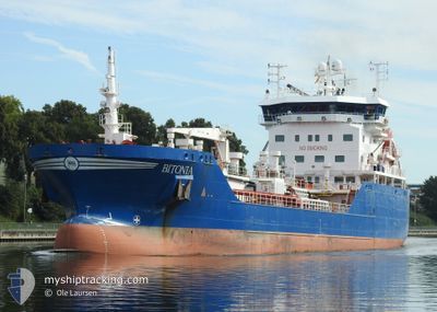
BITONIA
Asphalt/Bitumen Tanker
Current Trip
| Time Travelled | 7 h, 16 mins |
|---|---|
| Remaining Time | --- |
| Distance Travelled | 12.99 nm |
| Remaining Distance | --- |
| AVG Speed | 8.9 Noeuds |
| MAX Speed | 11.4 Noeuds |
| AVG Wind | 13.9 knots |
| MAX Wind | 17 knots |
| MIN Temp | 3.1°C / 37.58°F |
| MAX Temp | 4.9°C / 40.82°F |
| Tirant d eau | 5.6 m |
| Position reçue | 5 h, 41 m depuis |
Current Position
| Longitude | -2.45858° |
|---|---|
| Latitude | 56.47800° |
| Etat | Under way using engine |
| Vitesse | 10.4 Noeuds |
| Parcours | 90.2° |
| Zone | North Sea |
| Station | T-AIS |
| Position reçue | 5 h, 41 m depuis |
Info
Information
The current position of BITONIA is in North Sea with coordinates 56.47800° / -2.45858° as reported on 2025-02-16 05:12 by AIS to our vessel tracker app. The vessel's current speed is 10.4 Noeuds and is heading at the port of FALKENBERG. The estimated time of arrival as calculated by MyShipTracking vessel tracking app is 2025-02-18 09:00 LT
The vessel BITONIA (IMO: 9503902, MMSI: 246354000) is a Asphalt/Bitumen Tanker that was built in 2012 ( 13 Age ). It's sailing under the flag of [NL] Netherlands.
In this page you can find informations about the vessels current position, last detected port calls, and current voyage information. If the vessels is not in coverage by AIS you will find the latest position.
The current position of BITONIA is detected by our AIS receivers and we are not responsible for the reliability of the data. The last position was recorded while the vessel was in Coverage by the Ais receivers of our vessel tracking app.
The current draught of BITONIA as reported by AIS is 5.6 meters
Weather
| Temperature | 4.7°C / 40.46°F |
|---|---|
| Wind Speed | 18 knots |
| Direction | 127° SE |
| Pressure | 1024.2 hPa |
| Humidity | 66 % |
| Cloud Coverage | 90 % |
Featured Company
Last Port Calls
| Port | Arrival | Departure | Time In Port |
|---|---|---|---|
| 2025-02-15 03:58 | 2025-02-16 03:38 | 23 h | |
| 2025-02-12 00:15 | 2025-02-12 22:38 | 22 h | |
| 2025-02-04 03:23 | 2025-02-05 03:06 | 23 h | |
| 2025-02-03 14:20 | 2025-02-04 00:22 | 10 h | |
| 2025-01-26 23:11 | 2025-01-27 11:25 | 12 h | |
| 2025-01-23 09:53 | 2025-01-23 17:56 | 8 h | |
| 2025-01-22 11:22 | 2025-01-22 22:34 | 11 h | |
| 2025-01-12 12:37 | 2025-01-13 05:00 | 16 h | |
| 2025-01-09 06:38 | 2025-01-10 08:23 | 1 d | |
| 2025-01-07 15:36 | 2025-01-09 02:57 | 1 d |
Most Visited Ports (Last year)
| Port | Arrivals | |
|---|---|---|
| 31 | ||
| 11 | ||
| 8 | ||
| 7 | ||
| 7 | ||
| 6 |
Last Trips
| Origin | Departure | Destination | Arrival | Distance | |
|---|---|---|---|---|---|
| 2025-02-12 23:38 | 2025-02-15 03:58 | 557.50 nm | |||
| 2025-02-05 03:06 | 2025-02-12 01:15 | 572.69 nm | |||
| 2025-01-27 13:25 | 2025-02-04 03:23 | 1638.23 nm | |||
| 2025-01-27 13:25 | 2025-02-03 14:20 | 1610.53 nm | |||
| 2025-01-23 18:56 | 2025-01-27 01:11 | 674.47 nm | |||
| 2025-01-22 23:34 | 2025-01-23 10:53 | 137.06 nm | |||
| 2025-01-13 05:00 | 2025-01-22 12:22 | 1351.21 nm | |||
| 2025-01-10 09:23 | 2025-01-12 12:37 | 554.58 nm | |||
| 2025-01-09 03:57 | 2025-01-09 07:38 | 37.80 nm | |||
| 2024-12-20 13:28 | 2025-01-07 16:36 | 623.11 nm |
Events
| Heure | Evenement | Détails | Position/ Destination | Info |
|---|---|---|---|---|
| 2025-02-16 05:15 | Etat Changé | Default Under way using engine |
56.47802 / -2.44635
GBDUN>SEFAG
|
Vitesse: 10.4 kn Parcours: 90.2° |
| 2025-02-16 05:12 | Hors de la zone couverte |
56.47800 / -2.45858
North Sea
GBDUN>SEFAG
|
Vitesse: 10.4 kn Parcours: 90.2° |
|
| 2025-02-16 03:38 | PORT DE DEPART |
|
56.46229 / -2.92924
GBDUN>SEFAG
|
Vitesse: 9.2 kn Parcours: 89° |
| 2025-02-16 03:37 | Tirant d'eau modifié | 5.6 6.6 |
56.46250 / -2.93667
[GB] DUNDEE
|
Vitesse: 7.3 kn Parcours: 95° |
| 2025-02-16 03:37 | Changement de destination | GBDUN>SEFAG FRURO>GBDUN |
56.46250 / -2.93667
[GB] DUNDEE
|
Vitesse: 7.3 kn Parcours: 95° |
| 2025-02-16 03:37 | Changement d'ETA | 2025/02/18 09:00 2025/02/15 05:00 |
56.46250 / -2.93667
[GB] DUNDEE
|
Vitesse: 7.3 kn Parcours: 95° |
| 2025-02-16 03:36 | Démarrage |
56.46271 / -2.93821
[GB] DUNDEE
|
Vitesse: 6.6 kn Parcours: 99° |
|
| 2025-02-16 03:30 | Etat Changé | Under way using engine Default |
56.46362 / -2.94423
[GB] DUNDEE
|
Vitesse: Parcours: 69° |
| 2025-02-16 03:11 | Dans la zone couverte |
56.46362 / -2.94423
North Sea
[GB] DUNDEE
|
Vitesse: Parcours: 183° |
|
| 2025-02-15 04:14 | Hors de la zone couverte |
56.46360 / -2.94420
North Sea
[GB] DUNDEE
|
Vitesse: Parcours: 143.6° |