
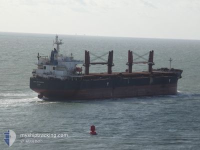
BULK INDEPENDENCE
Bulk Carrier
Current Trip
ID TAB
| Time Travelled | 1 day |
|---|---|
| Remaining Time | --- |
| Distance Travelled | 11.44 nm |
| Remaining Distance | --- |
| AVG Speed | 4.8 Noeuds |
| MAX Speed | 5.6 Noeuds |
| AVG Wind | 9.8 knots |
| MAX Wind | 14 knots |
| MIN Temp | 17.8°C / 64.04°F |
| MAX Temp | 21.4°C / 70.52°F |
| Tirant d eau | 6.3 m |
| Position reçue | 17 d depuis |
Current Position
| Longitude | 114.43623° |
|---|---|
| Latitude | -3.68833° |
| Etat | At anchor |
| Vitesse | |
| Parcours | 328° |
| Zone | Java Sea |
| Station | T-AIS |
| Position reçue | 17 d depuis |
Info
Information
The current position of BULK INDEPENDENCE is in Java Sea with coordinates -3.68833° / 114.43623° as reported on 2025-01-25 21:00 by AIS to our vessel tracker app. The vessel's current speed is 0 Noeuds
The vessel BULK INDEPENDENCE (IMO: 9374002, MMSI: 373904000) is a Bulk Carrier that was built in 2008 ( 17 Age ). It's sailing under the flag of [PA] Panama.
In this page you can find informations about the vessels current position, last detected port calls, and current voyage information. If the vessels is not in coverage by AIS you will find the latest position.
The current position of BULK INDEPENDENCE is detected by our AIS receivers and we are not responsible for the reliability of the data. The last position was recorded while the vessel was in Coverage by the Ais receivers of our vessel tracking app.
The current draught of BULK INDEPENDENCE as reported by AIS is 6.3 meters
Weather
| Temperature | 19.4°C / 66.92°F |
|---|---|
| Wind Speed | 6 knots |
| Direction | 83° E |
| Pressure | 1016.9 hPa |
| Humidity | 92.3 % |
| Cloud Coverage | 100 % |
Featured Company
Last Trips
| Origin | Departure | Destination | Arrival | Distance | |
|---|---|---|---|---|---|
| 2025-01-13 22:35 | 2025-02-07 20:45 | 2881.61 nm | |||
| 2024-12-28 07:49 | 2024-12-29 15:33 | 17.74 nm | |||
| 2024-12-08 07:19 | 2024-12-26 11:42 | 2033.15 nm | |||
| 2024-12-06 08:51 | 2024-12-07 03:00 | 197.20 nm | |||
| 2024-09-26 06:54 | 2024-12-02 09:26 | 4649.79 nm |
Events
| Heure | Evenement | Détails | Position/ Destination | Info |
|---|---|---|---|---|
| 2025-02-10 19:29 | Arret | 4.81 nm, North of MACUN |
20.04550 / 110.02856
ID TAB
|
Vitesse: 0.3 kn Parcours: 271° |
| 2025-02-10 18:17 | PORT DE DEPART |
|
19.98082 / 110.04383
ID TAB
|
Vitesse: 5.2 kn Parcours: 54° |
| 2025-02-10 18:05 | Démarrage |
19.96972 / 110.03352
[CN] MACUN
|
Vitesse: 3.1 kn Parcours: 11° |
|
| 2025-02-07 12:45 | Arret |
19.96483 / 110.03175
[CN] MACUN
|
Vitesse: 0.3 kn Parcours: 140° |
|
| 2025-02-07 12:45 | Port d'arrivée |
|
19.96483 / 110.03175
[CN] MACUN
|
Vitesse: 0.9 kn Parcours: 152° |
| 2025-02-07 11:45 | Démarrage | 4.11 nm, North of MACUN |
20.03163 / 110.04073
ID TAB
|
Vitesse: 4.9 kn Parcours: 130° |
| 2025-02-04 08:13 | Arret | 4.2 nm, North of MACUN |
20.03440 / 110.03468
ID TAB
|
Vitesse: 0.3 kn Parcours: 44° |