
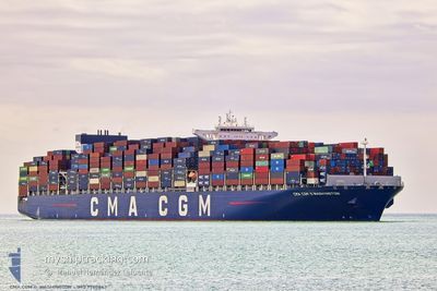
CMA CGM G.WASHINGTON
Cargo A
Current Trip
| Time Travelled | 17 h, 54 mins |
|---|---|
| Remaining Time | 18 h, 41 mins |
| Distance Travelled | 305.62 nm |
| Remaining Distance | 553.59 nm |
| AVG Speed | 13.8 Noeuds |
| MAX Speed | 19.2 Noeuds |
| AVG Wind | 14.2 knots |
| MAX Wind | 31.3 knots |
| MIN Temp | -10.1°C / 13.82°F |
| MAX Temp | 8.6°C / 47.48°F |
| Tirant d eau | 15.5 m |
| Position reçue | 15 h, 40 m depuis |
Current Position
| Longitude | -63.70306° |
|---|---|
| Latitude | 44.17699° |
| Etat | Under way using engine |
| Vitesse | 17.6 Noeuds |
| Parcours | 219.1° |
| Zone | North Atlantic Ocean |
| Station | T-AIS |
| Position reçue | 15 h, 40 m depuis |
Info
Information
The current position of CMA CGM G.WASHINGTON is in North Atlantic Ocean with coordinates 44.17699° / -63.70306° as reported on 2025-02-06 10:04 by AIS to our vessel tracker app. The vessel's current speed is 17.6 Noeuds and is heading at the port of NEW YORK. The estimated time of arrival as calculated by MyShipTracking vessel tracking app is 2025-02-07 20:26 LT
The vessel CMA CGM G.WASHINGTON (IMO: 9780847, MMSI: 215197000) is a Cargo A It's sailing under the flag of [MT] Malta.
In this page you can find informations about the vessels current position, last detected port calls, and current voyage information. If the vessels is not in coverage by AIS you will find the latest position.
The current position of CMA CGM G.WASHINGTON is detected by our AIS receivers and we are not responsible for the reliability of the data. The last position was recorded while the vessel was in Coverage by the Ais receivers of our vessel tracking app.
The current draught of CMA CGM G.WASHINGTON as reported by AIS is 15.5 meters
Weather
| Temperature | 6.7°C / 44.06°F |
|---|---|
| Wind Speed | 27 knots |
| Direction | 248° WSW |
| Pressure | 1007.9 hPa |
| Humidity | 97.8 % |
| Cloud Coverage | 100 % |
Featured Company
Last Port Calls
| Port | Arrival | Departure | Time In Port |
|---|---|---|---|
| 2025-02-05 10:25 | 2025-02-06 07:51 | 21 h | |
| 2025-01-05 13:21 | 2025-01-06 09:24 | 20 h | |
| 2024-12-29 18:05 | 2024-12-31 02:05 | 1 d | |
| 2024-12-26 18:16 | 2024-12-27 23:47 | 1 d | |
| 2024-12-20 19:13 | 2024-12-21 06:17 | 11 h | |
| 2024-12-18 11:12 | 2024-12-20 00:44 | 1 d | |
| 2024-12-17 15:32 | 2024-12-18 10:12 | 18 h | |
| 2024-12-16 02:40 | 2024-12-17 04:03 | 1 d |
Most Visited Ports (Last year)
| Port | Arrivals | |
|---|---|---|
| 5 | ||
| 3 | ||
| 3 | ||
| 3 | ||
| 3 | ||
| 3 |
Last Trips
| Origin | Departure | Destination | Arrival | Distance | |
|---|---|---|---|---|---|
| 2025-01-06 14:54 | 2025-02-05 06:25 | 11691.23 nm | |||
| 2024-12-31 10:05 | 2025-01-05 18:51 | 1426.61 nm | |||
| 2024-12-28 07:47 | 2024-12-30 02:05 | 195.79 nm | |||
| 2024-12-21 14:17 | 2024-12-27 02:16 | 1581.97 nm | |||
| 2024-12-20 08:44 | 2024-12-21 03:13 | 136.93 nm | |||
| 2024-12-18 18:12 | 2024-12-18 19:12 | 3.69 nm | |||
| 2024-12-17 12:03 | 2024-12-17 23:32 | 81.35 nm | |||
| 2024-11-14 07:24 | 2024-12-16 10:40 | 13249.20 nm |
Events
| Heure | Evenement | Détails | Position/ Destination | Info |
|---|---|---|---|---|
| 2025-02-06 10:11 | Etat Changé | Default Under way using engine |
44.15111 / -63.73190
USNYC
|
Vitesse: 17.6 kn Parcours: 219.1° |
| 2025-02-06 10:04 | Hors de la zone couverte |
44.17699 / -63.70306
North Atlantic Ocean
USNYC
|
Vitesse: 17.6 kn Parcours: 219.1° |
|
| 2025-02-06 10:04 | Etat Changé | Under way using engine Default |
44.17845 / -63.70141
USNYC
|
Vitesse: 17.6 kn Parcours: 217° |
| 2025-02-06 10:02 | Etat Changé | Default Under way using engine |
44.18541 / -63.69387
USNYC
|
Vitesse: 17.6 kn Parcours: 217.2° |
| 2025-02-06 09:43 | Etat Changé | Under way using engine Default |
44.25898 / -63.61563
USNYC
|
Vitesse: 16.8 kn Parcours: 223° |
| 2025-02-06 09:31 | Etat Changé | Default Under way using engine |
44.30325 / -63.56034
USNYC
|
Vitesse: 16.1 kn Parcours: 229.7° |
| 2025-02-06 07:51 | PORT DE DEPART |
|
44.60001 / -63.54908
USNYC
|
Vitesse: 6.9 kn Parcours: 153° |
| 2025-02-06 07:32 | Démarrage |
44.62768 / -63.55732
[CA] HALIFAX
|
Vitesse: 3.1 kn Parcours: 128° |
|
| 2025-02-06 07:24 | Etat Changé | Under way using engine Moored |
44.62882 / -63.56164
[CA] HALIFAX
|
Vitesse: 0.1 kn Parcours: 147° |
| 2025-02-06 07:18 | Etat Changé | Moored Default |
44.62879 / -63.56171
[CA] HALIFAX
|
Vitesse: Parcours: 147° |