

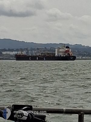
CSL FRONTIER
Self Discharging Bulk Carrier

Current Trip
US ANZ 2
| Time Travelled | 8 days |
|---|---|
| Remaining Time | --- |
| Distance Travelled | 1560.25 nm |
| Remaining Distance | --- |
| AVG Speed | 10.5 Noeuds |
| MAX Speed | 13.1 Noeuds |
| AVG Wind | 12 knots |
| MAX Wind | 22.8 knots |
| MIN Temp | 11.4°C / 52.52°F |
| MAX Temp | 30.9°C / 87.62°F |
| Tirant d eau | 9.9 m |
| Position reçue | 15 h, 21 m depuis |
Current Position
| Longitude | -121.78749° |
|---|---|
| Latitude | 38.01593° |
| Etat | Moored |
| Vitesse | |
| Parcours | 93° |
| Zone | North Pacific Ocean |
| Station | T-AIS |
| Position reçue | 15 h, 21 m depuis |
Information
The current position of CSL FRONTIER is in North Pacific Ocean with coordinates 38.01593° / -121.78749° as reported on 2025-05-28 15:05 by AIS to our vessel tracker app. The vessel's current speed is 0 Noeuds
The vessel CSL FRONTIER (IMO: 9228734, MMSI: 311000421) is a Self Discharging Bulk Carrier that was built in 2001 ( 24 Age ). It's sailing under the flag of [BS] Bahamas.
In this page you can find informations about the vessels current position, last detected port calls, and current voyage information. If the vessels is not in coverage by AIS you will find the latest position.
The current position of CSL FRONTIER is detected by our AIS receivers and we are not responsible for the reliability of the data. The last position was recorded while the vessel was in Coverage by the Ais receivers of our vessel tracking app.
The current draught of CSL FRONTIER as reported by AIS is 9.9 meters
Weather
| Temperature | 12.1°C / 53.78°F |
|---|---|
| Wind Speed | 9 knots |
| Direction | 231° SW |
| Pressure | 1014.4 hPa |
| Humidity | 78.7 % |
| Cloud Coverage | 35 % |


Featured Company
Last Port Calls
| Port | Arrival | Departure | Time In Port |
|---|---|---|---|
| 2025-05-19 08:58 | 2025-05-20 19:44 | 1 d | |
| 2025-04-25 10:37 | 2025-04-28 10:40 | 3 d | |
| 2025-04-14 09:54 | 2025-04-15 18:51 | 1 d | |
| 2025-03-28 13:17 | 2025-03-30 09:30 | 1 d | |
| 2025-03-16 07:16 | 2025-03-16 17:20 | 10 h | |
| 2025-03-15 06:22 | 2025-03-15 18:15 | 11 h | |
| 2025-03-13 08:00 | 2025-03-14 17:27 | 1 d |
Most Visited Ports (Last year)
| Port | Arrivals | |
|---|---|---|
| 9 | ||
| 5 | ||
| 4 | ||
| 4 | ||
| 1 | ||
| 1 |
Last Trips
| Origin | Departure | Destination | Arrival | Distance | |
|---|---|---|---|---|---|
| 2025-04-28 10:40 | 2025-05-19 08:58 | 4643.63 nm | |||
| 2025-04-15 18:51 | 2025-04-25 10:37 | 1569.30 nm | |||
| 2025-03-30 09:30 | 2025-04-14 09:54 | 3131.28 nm | |||
| 2025-03-16 17:20 | 2025-03-28 13:17 | 3041.34 nm | |||
| 2025-03-15 18:15 | 2025-03-16 07:16 | 108.50 nm | |||
| 2025-03-14 17:27 | 2025-03-15 06:22 | 106.93 nm | |||
| 2025-02-23 12:38 | 2025-03-13 08:00 | 2900.34 nm |
Events
| Heure | Evenement | Détails | Position/ Destination | Info |
|---|---|---|---|---|
| 2025-05-28 15:11 | Etat Changé | Default Moored |
38.01595 / -121.78750
US ANZ 2
|
Vitesse: Parcours: 93° |
| 2025-05-28 15:05 | Etat Changé | Moored Default |
38.01593 / -121.78749
US ANZ 2
|
Vitesse: Parcours: 93° |
| 2025-05-28 15:05 | Hors de la zone couverte |
38.01593 / -121.78749
North Pacific Ocean
|
Vitesse: Parcours: 257.5° |
|
| 2025-05-28 15:02 | Etat Changé | Default Moored |
38.01590 / -121.78746
US ANZ 2
|
Vitesse: Parcours: 93° |
| 2025-05-28 14:59 | Etat Changé | Moored Default |
38.01593 / -121.78751
US ANZ 2
|
Vitesse: Parcours: 93° |
| 2025-05-28 14:26 | Etat Changé | Default Moored |
38.01590 / -121.78748
US ANZ 2
|
Vitesse: Parcours: 94° |
| 2025-05-28 14:23 | Etat Changé | Moored Default |
38.01589 / -121.78746
US ANZ 2
|
Vitesse: Parcours: 94° |
| 2025-05-28 14:08 | Dans la zone couverte |
38.01589 / -121.78746
North Pacific Ocean
|
Vitesse: Parcours: 345° |
|
| 2025-05-27 01:56 | Arret | 4.7 nm, East of PITTSBURG |
38.01598 / -121.78742
US ANZ 2
|
Vitesse: Parcours: 97° |
| 2025-05-27 01:13 | Hors de la zone couverte |
38.02764 / -121.84336
North Pacific Ocean
|
Vitesse: 6.5 kn Parcours: 88.3° |