
CETI
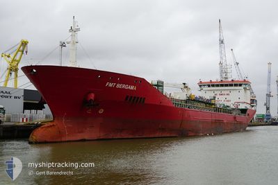
Oil/Chemical Tanker
Current Trip
GE KUL
| Time Travelled | 17 h, 21 mins |
|---|---|
| Remaining Time | --- |
| Distance Travelled | 185.14 nm |
| Remaining Distance | --- |
| AVG Speed | 10.5 Noeuds |
| MAX Speed | 11.1 Noeuds |
| AVG Wind | 5.9 knots |
| MAX Wind | 7.8 knots |
| MIN Temp | 9.6°C / 49.28°F |
| MAX Temp | 11.2°C / 52.16°F |
| Tirant d eau | 5.8 m |
| Position reçue | 10 d depuis |
Current Position
| Longitude | 29.42435° |
|---|---|
| Latitude | 41.45934° |
| Etat | Under way using engine |
| Vitesse | 13 Noeuds |
| Parcours | 59.2° |
| Zone | Black Sea |
| Station | T-AIS |
| Position reçue | 10 d depuis |
Info
Information
The current position of CETI is in Black Sea with coordinates 41.45934° / 29.42435° as reported on 2025-02-28 21:18 by AIS to our vessel tracker app. The vessel's current speed is 13 Noeuds
The vessel CETI (IMO: 9427988, MMSI: 248058000) is a Oil/Chemical Tanker that was built in 2009 ( 16 Age ). It's sailing under the flag of [MT] Malta.
In this page you can find informations about the vessels current position, last detected port calls, and current voyage information. If the vessels is not in coverage by AIS you will find the latest position.
The current position of CETI is detected by our AIS receivers and we are not responsible for the reliability of the data. The last position was recorded while the vessel was in Coverage by the Ais receivers of our vessel tracking app.
The current draught of CETI as reported by AIS is 5.8 meters
Weather
| Temperature | 9.9°C / 49.82°F |
|---|---|
| Wind Speed | 8 knots |
| Direction | 139° SE |
| Pressure | 1019.7 hPa |
| Humidity | 78.6 % |
| Cloud Coverage | 9 % |
Featured Company
Last Port Calls
| Port | Arrival | Departure | Time In Port |
|---|---|---|---|
| 2025-03-09 13:41 | 2025-03-10 19:33 | 1 d | |
| 2025-02-24 18:23 | 2025-02-26 21:52 | 2 d | |
| 2025-02-11 03:11 | 2025-02-11 23:43 | 20 h | |
| 2025-02-09 19:25 | 2025-02-10 14:50 | 19 h | |
| 2025-01-30 09:51 | 2025-02-01 17:37 | 2 d | |
| 2025-01-21 08:33 | 2025-01-21 21:54 | 13 h |
Last Trips
| Origin | Departure | Destination | Arrival | Distance | |
|---|---|---|---|---|---|
| 2025-02-26 21:52 | 2025-03-09 13:41 | 704.88 nm | |||
| 2025-02-11 23:43 | 2025-02-24 18:23 | 1309.68 nm | |||
| 2025-02-10 14:50 | 2025-02-11 03:11 | 130.98 nm | |||
| 2025-02-01 17:37 | 2025-02-09 19:25 | 1885.23 nm | |||
| 2025-01-21 21:54 | 2025-01-30 09:51 | 699.59 nm | |||
| 2024-12-27 17:41 | 2025-01-21 08:33 | 1380.75 nm |
Events
| Heure | Evenement | Détails | Position/ Destination | Info |
|---|---|---|---|---|
| 2025-03-10 15:33 | Démarrage | 0.17 nm, North West of KULEVI |
42.27696 / 41.63093
GE KUL
|
Vitesse: 3.6 kn Parcours: 302° |
| 2025-03-10 15:33 | PORT DE DEPART |
|
42.27696 / 41.63093
GE KUL
|
Vitesse: 0.3 kn Parcours: 290° |
| 2025-03-09 09:50 | Arret |
42.27508 / 41.63580
[GE] KULEVI
|
Vitesse: 0.3 kn Parcours: 288° |
|
| 2025-03-09 09:41 | Port d'arrivée |
|
42.27600 / 41.63332
[GE] KULEVI
|
Vitesse: 1.6 kn Parcours: 300° |
| 2025-03-09 07:14 | Démarrage | 3.49 nm, North West of POTI |
42.19026 / 41.58524
GE KUL
|
Vitesse: 9.5 kn Parcours: 274° |
| 2025-03-02 17:32 | Arret | 2.87 nm, North West of POTI |
42.18781 / 41.60030
GE KUL
|
Vitesse: 0.1 kn Parcours: 33° |