

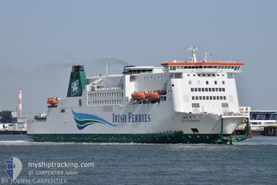
ISLE OF INISHMORE
Ro-Ro/Passenger Ship

Current Trip
| Time Travelled | 1 h, 11 mins |
|---|---|
| Remaining Time | 7 mins |
| Distance Travelled | 18.30 nm |
| Remaining Distance | 7.37 nm |
| AVG Speed | 17.2 Noeuds |
| MAX Speed | 18.5 Noeuds |
| AVG Wind | 16.8 knots |
| MAX Wind | 19.5 knots |
| MIN Temp | 15.3°C / 59.54°F |
| MAX Temp | 16.1°C / 60.98°F |
| Tirant d eau | 0 m |
| Position reçue | 1 m depuis |
Current Position
| Longitude | 1.77327° |
|---|---|
| Latitude | 50.96760° |
| Etat | Under way using engine |
| Vitesse | 14.3 Noeuds |
| Parcours | 82° |
| Zone | North Sea |
| Station | T-AIS |
| Position reçue | 1 m depuis |
Information
The current position of ISLE OF INISHMORE is in North Sea with coordinates 50.96760° / 1.77327° as reported on 2025-06-14 08:04 by AIS to our vessel tracker app. The vessel's current speed is 14.3 Noeuds and is heading at the port of CALAIS. The estimated time of arrival as calculated by MyShipTracking vessel tracking app is 2025-06-14 10:12 LT
The vessel ISLE OF INISHMORE (IMO: 9142605, MMSI: 209093000) is a Ro-Ro/Passenger Ship that was built in 1997 ( 28 Age ). It's sailing under the flag of [CY] Cyprus.
In this page you can find informations about the vessels current position, last detected port calls, and current voyage information. If the vessels is not in coverage by AIS you will find the latest position.
The current position of ISLE OF INISHMORE is detected by our AIS receivers and we are not responsible for the reliability of the data. The last position was recorded while the vessel was in Coverage by the Ais receivers of our vessel tracking app.
Weather
| Temperature | 16.1°C / 60.98°F |
|---|---|
| Wind Speed | 20 knots |
| Direction | 225° SW |
| Pressure | 1015.5 hPa |
| Humidity | 94.8 % |
| Cloud Coverage | 100 % |


Featured Company
Last Port Calls
| Port | Arrival | Departure | Time In Port |
|---|---|---|---|
| 2025-06-14 06:59 | 2025-06-14 07:54 | 55 m | |
| 2025-06-14 05:13 | 2025-06-14 06:43 | 1 h | |
| 2025-06-14 02:07 | 2025-06-14 02:59 | 52 m | |
| 2025-06-14 00:38 | 2025-06-14 01:49 | 1 h | |
| 2025-06-13 21:22 | 2025-06-13 22:31 | 1 h | |
| 2025-06-13 20:07 | 2025-06-13 21:08 | 1 h | |
| 2025-06-13 16:46 | 2025-06-13 17:50 | 1 h | |
| 2025-06-13 15:20 | 2025-06-13 16:29 | 1 h | |
| 2025-06-13 11:42 | 2025-06-13 13:10 | 1 h | |
| 2025-06-13 10:15 | 2025-06-13 11:30 | 1 h |
Last Trips
| Origin | Departure | Destination | Arrival | Distance | |
|---|---|---|---|---|---|
| 2025-06-14 06:43 | 2025-06-14 06:59 | 22.37 nm | |||
| 2025-06-14 02:59 | 2025-06-14 05:13 | 21.87 nm | |||
| 2025-06-14 01:49 | 2025-06-14 02:07 | 22.09 nm | |||
| 2025-06-13 22:31 | 2025-06-14 00:38 | 20.69 nm | |||
| 2025-06-13 21:08 | 2025-06-13 21:22 | 21.81 nm | |||
| 2025-06-13 17:50 | 2025-06-13 20:07 | 22.00 nm | |||
| 2025-06-13 16:29 | 2025-06-13 16:46 | 22.61 nm | |||
| 2025-06-13 13:10 | 2025-06-13 15:20 | 22.32 nm | |||
| 2025-06-13 11:30 | 2025-06-13 11:42 | 22.02 nm | |||
| 2025-06-13 07:58 | 2025-06-13 10:15 | 22.09 nm |
Events
| Heure | Evenement | Détails | Position/ Destination | Info |
|---|---|---|---|---|
| 2025-06-14 07:47 | Changement de zone | French part of the North Sea French part of the English Channel |
50.97898 / 1.65733
North Sea
DOVER-CALAIS-DOVER
|
Vitesse: 15.8 kn Parcours: 107.5° |
| 2025-06-14 07:25 | Changement de zone | French part of the English Channel United Kingdom part of the English Channel |
51.01820 / 1.50742
English Channel
DOVER-CALAIS-DOVER
|
Vitesse: 17.9 kn Parcours: 115.6° |
| 2025-06-14 07:04 | Etat Changé | Under way using engine Default |
51.08346 / 1.38598
DOVER-CALAIS-DOVER
|
Vitesse: 18.3 kn Parcours: 150° |
| 2025-06-14 07:04 | Dans la zone couverte |
51.07943 / 1.38968
English Channel
DOVER-CALAIS-DOVER
|
Vitesse: 18.2 kn Parcours: 150° |
|
| 2025-06-14 07:03 | Changement d'ETA | 2025/06/14 09:20 2025/06/14 07:00 |
51.10658 / 1.36476
DOVER-CALAIS-DOVER
|
Vitesse: 18.4 kn Parcours: 150° |
| 2025-06-14 06:55 | Démarrage | 0.72 nm, East of DOVER |
51.12038 / 1.34746
DOVER-CALAIS-DOVER
|
Vitesse: 12.8 kn Parcours: 105° |
| 2025-06-14 06:54 | PORT DE DEPART |
|
51.12038 / 1.34746
DOVER-CALAIS-DOVER
|
Vitesse: 1.8 kn Parcours: 158° |
| 2025-06-14 06:03 | Arret |
51.12453 / 1.33678
[GB] DOVER
|
Vitesse: 0.1 kn Parcours: 157° |
|
| 2025-06-14 05:59 | Etat Changé | Default Under way using engine |
51.12280 / 1.33725
[GB] DOVER
|
Vitesse: 18.3 kn Parcours: 280.6° |
| 2025-06-14 05:50 | Hors de la zone couverte |
51.11915 / 1.36384
English Channel
[GB] DOVER
|
Vitesse: 18.3 kn Parcours: 280.6° |