

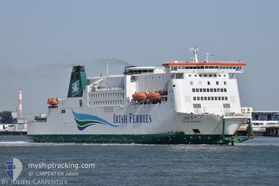
ISLE OF INISHMORE
Ro-Ro/Passenger Ship

Current Trip
| Trip Time | 1 h, 35 mins |
|---|---|
| Trip Distance | 26.03 nm |
| AVG Speed | 11.3 Knopen |
| MAX Speed | 11.3 Knopen |
| Diepgang | 6 M |
| AVG Wind | 3.3 knots |
| MAX Wind | 4.3 knots |
| MIN Temp | 8.3°C / 46.94°F |
| MAX Temp | 8.7°C / 47.66°F |
| Positie ontvangen | 1 m geleden |
Current Position
| Lengtegraad | 1.86127° |
|---|---|
| Breedtegraat | 50.96816° |
| Status | Under way using engine |
| Snelheid | |
| Koers | 85° |
| Gebied | North Sea |
| Station | T-AIS |
| Positie ontvangen | 1 m geleden |
Information
The current position of ISLE OF INISHMORE is in North Sea with coordinates 50.96816° / 1.86127° as reported on 2025-04-11 00:04 by AIS to our vessel tracker app. The vessel's current speed is 0 Knopen and is currently inside the port of CALAIS.
The vessel ISLE OF INISHMORE (IMO: 9142605, MMSI: 209093000) is a Ro-Ro/Passenger Ship that was built in 1997 ( 28 Jaar oud ). It's sailing under the flag of [CY] Cyprus.
In this page you can find informations about the vessels current position, last detected port calls, and current voyage information. If the vessels is not in coverage by AIS you will find the latest position.
The current position of ISLE OF INISHMORE is detected by our AIS receivers and we are not responsible for the reliability of the data. The last position was recorded while the vessel was in Coverage by the Ais receivers of our vessel tracking app.
The current draught of ISLE OF INISHMORE as reported by AIS is 6 meters
Weather
| Temperature | 8.2°C / 46.76°F |
|---|---|
| Wind Speed | 3 knots |
| Direction | 108° ESE |
| Pressure | 1026.6 hPa |
| Humidity | 81 % |
| Cloud Coverage | 6 % |


Featured Company
Last Port Calls
| Port | Arrival | Departure | Time In Port |
|---|---|---|---|
| 2025-04-11 01:25 | |||
| 2025-04-10 21:41 | 2025-04-10 22:50 | 1 h | |
| 2025-04-10 20:21 | 2025-04-10 21:31 | 1 h | |
| 2025-04-10 16:40 | 2025-04-10 18:04 | 1 h | |
| 2025-04-10 15:10 | 2025-04-10 16:34 | 1 h | |
| 2025-04-10 11:48 | 2025-04-10 13:01 | 1 h | |
| 2025-04-10 10:20 | 2025-04-10 11:32 | 1 h | |
| 2025-04-10 06:49 | 2025-04-10 07:58 | 1 h | |
| 2025-04-10 01:00 | 2025-04-10 06:37 | 5 h | |
| 2025-04-09 21:46 | 2025-04-09 22:52 | 1 h |
Last Trips
| Origin | Departure | Destination | Arrival | Distance | |
|---|---|---|---|---|---|
| 2025-04-10 22:50 | 2025-04-11 01:25 | 26.03 nm | |||
| 2025-04-10 21:31 | 2025-04-10 21:41 | 21.67 nm | |||
| 2025-04-10 18:04 | 2025-04-10 20:21 | 22.37 nm | |||
| 2025-04-10 16:34 | 2025-04-10 16:40 | 21.54 nm | |||
| 2025-04-10 13:01 | 2025-04-10 15:10 | 21.78 nm | |||
| 2025-04-10 11:32 | 2025-04-10 11:48 | 22.18 nm | |||
| 2025-04-10 07:58 | 2025-04-10 10:20 | 22.69 nm | |||
| 2025-04-10 06:37 | 2025-04-10 06:49 | 21.74 nm | |||
| 2025-04-09 22:52 | 2025-04-10 01:00 | 22.08 nm | |||
| 2025-04-09 21:36 | 2025-04-09 21:46 | 21.40 nm |
Events
| Tijd | Evenement | Details | Positie / Bestemming | Info |
|---|---|---|---|---|
| 2025-04-10 23:36 | ETA Changed | 2025/04/11 07:00 2025/04/10 23:50 |
50.96815 / 1.86122
[FR] CALAIS
|
Snelheid: 0.1 kn Koers: 87° |
| 2025-04-10 23:35 | Stop beweging |
50.96817 / 1.86119
[FR] CALAIS
|
Snelheid: 0.3 kn Koers: 89° |
|
| 2025-04-10 23:25 | Aankomsthaven |
|
50.97199 / 1.83986
[FR] CALAIS
|
Snelheid: 10 kn Koers: 108.7° |
| 2025-04-10 22:32 | Wijzig zee gebeid | French part of the North Sea French part of the English Channel |
50.98978 / 1.63978
North Sea
DOVER<==>CALAIS
|
Snelheid: 20 kn Koers: 117.7° |
| 2025-04-10 22:20 | Wijzig zee gebeid | French part of the English Channel United Kingdom part of the English Channel |
51.02343 / 1.55031
English Channel
DOVER<==>CALAIS
|
Snelheid: 19.4 kn Koers: 125.5° |
| 2025-04-10 22:02 | ETA Changed | 2025/04/10 23:50 2025/04/10 22:00 |
51.08048 / 1.42239
DOVER<==>CALAIS
|
Snelheid: 19.7 kn Koers: 119.3° |
| 2025-04-10 21:50 | Vertrekhaven |
|
51.11064 / 1.33257
DOVER<==>CALAIS
|
Snelheid: 12.7 kn Koers: 127° |
| 2025-04-10 21:46 | Start beweging |
51.11830 / 1.33233
[GB] DOVER
|
Snelheid: 8.7 kn Koers: 238° |
|
| 2025-04-10 21:42 | Status Changed | Under way using engine Default |
51.12458 / 1.33667
[GB] DOVER
|
Snelheid: Koers: 157° |
| 2025-04-10 21:38 | Status Changed | Default Under way using engine |
51.12464 / 1.33672
[GB] DOVER
|
Snelheid: Koers: 157° |