

LEMESSOS NAPA
Cargo

Current Trip
| Time Travelled | 1 day |
|---|---|
| Remaining Time | --- |
| Distance Travelled | 20.62 nm |
| Remaining Distance | --- |
| AVG Speed | 6.5 Noeuds |
| MAX Speed | 8.2 Noeuds |
| AVG Wind | 3.5 knots |
| MAX Wind | 8 knots |
| MIN Temp | 22.6°C / 72.68°F |
| MAX Temp | 34.9°C / 94.82°F |
| Tirant d eau | 12.3 m |
| Position reçue | 1 d depuis |
Current Position
| Longitude | -90.68047° |
|---|---|
| Latitude | 30.04308° |
| Etat | At anchor |
| Vitesse | 0.6 Noeuds |
| Parcours | 249° |
| Zone | North Pacific Ocean |
| Station | T-AIS |
| Position reçue | 1 d depuis |
Information
The current position of LEMESSOS NAPA is in North Pacific Ocean with coordinates 30.04308° / -90.68047° as reported on 2025-06-11 07:13 by AIS to our vessel tracker app. The vessel's current speed is 0.6 Noeuds
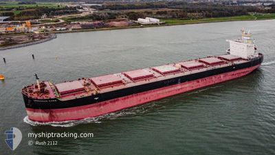
The vessel LEMESSOS NAPA (IMO: 9741293, MMSI: 212589000) is a Cargo It's sailing under the flag of [CY] Cyprus.
In this page you can find informations about the vessels current position, last detected port calls, and current voyage information. If the vessels is not in coverage by AIS you will find the latest position.
The current position of LEMESSOS NAPA is detected by our AIS receivers and we are not responsible for the reliability of the data. The last position was recorded while the vessel was in Coverage by the Ais receivers of our vessel tracking app.
The current draught of LEMESSOS NAPA as reported by AIS is 12.3 meters
Weather
| Temperature | 28.9°C / 84.02°F |
|---|---|
| Wind Speed | 3 knots |
| Direction | 161° SSE |
| Pressure | 1013.8 hPa |
| Humidity | 79.9 % |
| Cloud Coverage | 100 % |


Featured Company
Last Port Calls
| Port | Arrival | Departure | Time In Port |
|---|---|---|---|
| 2025-05-31 00:20 | 2025-06-10 22:44 | 10 d | |
| 2025-05-18 19:06 | 2025-05-20 13:54 | 1 d | |
| 2025-04-16 06:38 | 2025-04-17 14:22 | 1 d | |
| 2025-04-10 10:30 | 2025-04-12 15:06 | 2 d | |
| 2025-04-02 16:41 | 2025-04-05 07:02 | 2 d |
Last Trips
| Origin | Departure | Destination | Arrival | Distance | |
|---|---|---|---|---|---|
| 2025-05-20 13:54 | 2025-05-31 00:20 | 2387.98 nm | |||
| 2025-04-17 14:22 | 2025-05-18 19:06 | 8225.40 nm | |||
| 2025-04-12 15:06 | 2025-04-16 06:38 | 901.18 nm | |||
| 2025-04-05 07:02 | 2025-04-10 10:30 | 1103.73 nm | |||
| 2025-03-06 01:27 | 2025-04-02 16:41 | 6215.26 nm |
Events
| Heure | Evenement | Détails | Position/ Destination | Info |
|---|---|---|---|---|
| 2025-06-11 07:28 | Arret | 0.94 nm, North East of LUTCHER |
30.04417 / -90.68013
US MSY
|
Vitesse: 0.2 kn Parcours: 246° |
| 2025-06-11 07:19 | Etat Changé | Default At anchor |
30.04433 / -90.68066
US MSY
|
Vitesse: 0.6 kn Parcours: 249° |
| 2025-06-11 07:13 | Hors de la zone couverte |
30.04308 / -90.68047
North Pacific Ocean
|
Vitesse: 0.6 kn Parcours: 253.8° |
|
| 2025-06-11 07:13 | Etat Changé | At anchor Under way using engine |
30.04309 / -90.68044
US MSY
|
Vitesse: 1.1 kn Parcours: 241° |
| 2025-06-11 07:06 | Etat Changé | Under way using engine Default |
30.04433 / -90.67792
US MSY
|
Vitesse: 1.4 kn Parcours: 237° |
| 2025-06-11 07:01 | Etat Changé | Default Under way using engine |
30.04559 / -90.67535
US MSY
|
Vitesse: 2.7 kn Parcours: 242° |
| 2025-06-11 06:51 | Etat Changé | Under way using engine Default |
30.04856 / -90.66894
US MSY
|
Vitesse: 3.6 kn Parcours: 242° |
| 2025-06-11 06:25 | Etat Changé | Default Under way using engine |
30.03945 / -90.62962
US MSY
|
Vitesse: 6.2 kn Parcours: 290.9° |
| 2025-06-11 06:17 | Etat Changé | Under way using engine Default |
30.03291 / -90.61737
US MSY
|
Vitesse: 6.5 kn Parcours: 246° |
| 2025-06-11 05:53 | Etat Changé | Default Under way using engine |
30.05288 / -90.57282
US MSY
|
Vitesse: 6.1 kn Parcours: 283.3° |