

LEMESSOS NAPA
Cargo

Current Trip
| Trip Time | 3 days |
|---|---|
| Trip Distance | 901.18 nm |
| AVG Speed | 10.6 Knots |
| MAX Speed | 13.9 Knots |
| Draught | 8.9 m |
| AVG Wind | 18.8 knots |
| MAX Wind | 36 knots |
| MIN Temp | 9.3°C / 48.74°F |
| MAX Temp | 16.2°C / 61.16°F |
| Position Received | 1 d ago |
Current Position
| Longitude | 137.06636° |
|---|---|
| Latitude | 34.51758° |
| Status | Under way using engine |
| Speed | 8.7 Knots |
| Course | 318.2° |
| Area | Philippine Sea |
| Station | T-AIS |
| Position Received | 1 d ago |
Information
The current position of LEMESSOS NAPA is in Philippine Sea with coordinates 34.51758° / 137.06636° as reported on 2025-04-15 14:14 by AIS to our vessel tracker app. The vessel's current speed is 8.7 Knots and is currently inside the port of YOKKAICHI.
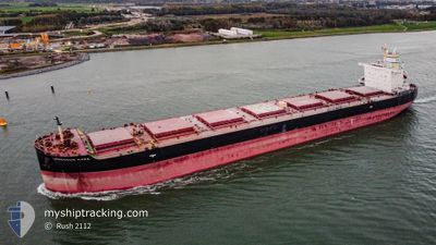
The vessel LEMESSOS NAPA (IMO: 9741293, MMSI: 212589000) is a Cargo It's sailing under the flag of [CY] Cyprus.
In this page you can find informations about the vessels current position, last detected port calls, and current voyage information. If the vessels is not in coverage by AIS you will find the latest position.
The current position of LEMESSOS NAPA is detected by our AIS receivers and we are not responsible for the reliability of the data. The last position was recorded while the vessel was in Coverage by the Ais receivers of our vessel tracking app.
The current draught of LEMESSOS NAPA as reported by AIS is 8.9 meters
Weather
| Temperature | 12.9°C / 55.22°F |
|---|---|
| Wind Speed | 6 knots |
| Direction | 4° N |
| Pressure | 1015.8 hPa |
| Humidity | 53.2 % |
| Cloud Coverage | 58 % |


Featured Company
Last Port Calls
| Port | Arrival | Departure | Time In Port |
|---|---|---|---|
| 2025-04-16 06:38 | |||
| 2025-04-10 10:30 | 2025-04-12 15:06 | 2 d | |
| 2025-04-02 16:41 | 2025-04-05 07:02 | 2 d | |
| 2025-02-26 18:21 | 2025-03-06 01:27 | 7 d | |
| 2025-02-05 13:41 | 2025-02-08 09:05 | 2 d | |
| 2025-02-03 09:23 |
Last Trips
| Origin | Departure | Destination | Arrival | Distance | |
|---|---|---|---|---|---|
| 2025-04-12 15:06 | 2025-04-16 06:38 | 901.18 nm | |||
| 2025-04-05 07:02 | 2025-04-10 10:30 | 1103.73 nm | |||
| 2025-03-06 01:27 | 2025-04-02 16:41 | 6215.26 nm | |||
| 2025-02-08 09:05 | 2025-02-26 18:21 | 5440.61 nm | |||
| 2025-02-03 09:23 | 2025-02-05 13:41 | 561.20 nm |
Events
| Time | Event | Details | Position / Dest | Info |
|---|---|---|---|---|
| 2025-04-15 22:06 | STOP Moving |
34.98772 / 136.67686
[JP] YOKKAICHI
|
Speed: Course: 295° |
|
| 2025-04-15 21:38 | PORT ARRIVAL |
|
34.99004 / 136.68948
[JP] YOKKAICHI
|
Speed: 6.1 kn Course: 278° |
| 2025-04-15 21:14 | START Moving | 2.85 nm, East of YOKKAICHI |
34.96367 / 136.73096
JP KNM
|
Speed: 3.8 kn Course: 290° |
| 2025-04-15 17:34 | STOP Moving | 3.09 nm, East of YOKKAICHI |
34.96388 / 136.73598
JP KNM
|
Speed: 0.3 kn Course: 9° |
| 2025-04-15 14:22 | Status Changed | Default Under way using engine |
34.53228 / 137.04834
JP KNM
|
Speed: 8.7 kn Course: 318.2° |
| 2025-04-15 14:14 | Change Sea Area | Japanese part of the Philippine Sea Japanese part of the Japan Sea |
34.51758 / 137.06636
Philippine Sea
|
Speed: 8.7 kn Course: 318.2° |
| 2025-04-15 14:14 | Status Changed | Under way using engine Default |
34.51758 / 137.06636
JP KNM
|
Speed: 9.5 kn Course: 353° |
| 2025-04-15 14:14 | OUT of Coverage |
34.51758 / 137.06636
Philippine Sea
|
Speed: 8.7 kn Course: 318.2° |
|
| 2025-04-15 13:57 | IN Coverage |
34.51758 / 137.06636
Philippine Sea
|
Speed: 8.7 kn Course: 318.2° |
|
| 2025-04-14 01:24 | OUT of Coverage |
34.02220 / 130.84449
Japan Sea
|
Speed: 9.8 kn Course: 135° |