
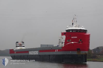
MAXIMA
Cargo
Current Trip
| Time Travelled | 13 days |
|---|---|
| Remaining Time | 1 day |
| Distance Travelled | 3362.03 nm |
| Remaining Distance | 324.70 nm |
| AVG Speed | 10.1 Noeuds |
| MAX Speed | 13.6 Noeuds |
| AVG Wind | 12.6 knots |
| MAX Wind | 23.5 knots |
| MIN Temp | 9°C / 48.2°F |
| MAX Temp | 20.7°C / 69.26°F |
| Tirant d eau | 8 m |
| Position reçue | 3 h, 42 m depuis |
Current Position
| Longitude | 29.69127° |
|---|---|
| Latitude | 35.83121° |
| Etat | Under way using engine |
| Vitesse | 10 Noeuds |
| Parcours | 88.7° |
| Zone | Mediterranean Sea - Eastern Basin |
| Station | T-AIS |
| Position reçue | 3 h, 42 m depuis |
Information
The current position of MAXIMA is in Mediterranean Sea - Eastern Basin with coordinates 35.83121° / 29.69127° as reported on 2025-05-30 03:51 by AIS to our vessel tracker app. The vessel's current speed is 10 Noeuds and is heading at the port of ISKENDERUN. The estimated time of arrival as calculated by MyShipTracking vessel tracking app is 2025-05-31 15:30 LT
The vessel MAXIMA (IMO: 9882061, MMSI: 246539000) is a Cargo It's sailing under the flag of [NL] Netherlands.
In this page you can find informations about the vessels current position, last detected port calls, and current voyage information. If the vessels is not in coverage by AIS you will find the latest position.
The current position of MAXIMA is detected by our AIS receivers and we are not responsible for the reliability of the data. The last position was recorded while the vessel was in Coverage by the Ais receivers of our vessel tracking app.
The current draught of MAXIMA as reported by AIS is 8 meters
Weather
| Temperature | 20.6°C / 69.08°F |
|---|---|
| Wind Speed | 9 knots |
| Direction | 271° W |
| Pressure | 1009.1 hPa |
| Humidity | 71.6 % |
| Cloud Coverage | 100 % |
Featured Company
Last Port Calls
| Port | Arrival | Departure | Time In Port |
|---|---|---|---|
| 2025-05-12 00:41 | 2025-05-16 18:19 | 4 d | |
| 2025-05-11 23:08 | 2025-05-12 00:02 | 54 m | |
| 2025-05-09 11:31 | 2025-05-11 00:29 | 1 d | |
| 2025-05-04 22:06 | 2025-05-06 14:05 | 1 d | |
| 2025-04-23 01:32 | 2025-05-01 05:08 | 8 d | |
| 2025-04-13 18:57 | 2025-04-17 15:07 | 3 d | |
| 2025-04-07 10:28 | 2025-04-09 19:23 | 2 d | |
| 2025-04-04 16:42 | 2025-04-05 20:18 | 1 d | |
| 2025-04-02 13:22 | 2025-04-02 19:11 | 5 h | |
| 2025-03-31 14:08 | 2025-04-02 13:10 | 1 d |
Most Visited Ports (Last year)
| Port | Arrivals | |
|---|---|---|
| 5 | ||
| 4 | ||
| 4 | ||
| 3 | ||
| 3 | ||
| 3 |
Last Trips
| Origin | Departure | Destination | Arrival | Distance | |
|---|---|---|---|---|---|
| 2025-05-12 00:02 | 2025-05-12 00:41 | 1.44 nm | |||
| 2025-05-11 00:29 | 2025-05-11 23:08 | 264.80 nm | |||
| 2025-05-06 14:05 | 2025-05-09 11:31 | 765.11 nm | |||
| 2025-05-01 05:08 | 2025-05-04 22:06 | 733.27 nm | |||
| 2025-04-17 15:07 | 2025-04-23 01:32 | 1295.82 nm | |||
| 2025-04-09 19:23 | 2025-04-13 18:57 | 974.80 nm | |||
| 2025-04-05 20:18 | 2025-04-07 10:28 | 413.91 nm | |||
| 2025-04-02 19:11 | 2025-04-04 16:42 | 493.54 nm | |||
| 2025-04-02 13:10 | 2025-04-02 13:22 | 0.58 nm | |||
| 2025-03-27 12:01 | 2025-03-31 14:08 | 490.14 nm |
Events
| Heure | Evenement | Détails | Position/ Destination | Info |
|---|---|---|---|---|
| 2025-05-30 03:55 | Etat Changé | Default Under way using engine |
35.83152 / 29.70785
TRISK
|
Vitesse: 10 kn Parcours: 88.7° |
| 2025-05-30 03:51 | Hors de la zone couverte |
35.83121 / 29.69127
Mediterranean Sea - Eastern Basin
TRISK
|
Vitesse: 10 kn Parcours: 88.7° |
|
| 2025-05-30 01:23 | Changement de zone | Greek part of the Mediterranean Sea - Eastern Basin Turkish part of the Mediterranean Sea - Eastern Basin |
35.81681 / 29.19482
Mediterranean Sea - Eastern Basin
TRISK
|
Vitesse: 9.9 kn Parcours: 88.3° |
| 2025-05-29 23:22 | Detecté en mer | Turkish part of the Mediterranean Sea - Eastern Basin |
35.80497 / 28.78188
Mediterranean Sea - Eastern Basin
TRISK
|
Vitesse: 9.9 kn Parcours: 87.3° |
| 2025-05-29 19:53 | Changement d'ETA | 2025/05/31 12:00 2025/05/31 16:00 |
35.79410 / 28.08465
TRISK
|
Vitesse: 9.6 kn Parcours: 90.3° |
| 2025-05-29 17:37 | Changement de zone | Greek part of the Mediterranean Sea - Eastern Basin Greek part of the Aegean Sea |
35.81917 / 27.63877
Mediterranean Sea - Eastern Basin
TRISK
|
Vitesse: 10 kn Parcours: 106° |
| 2025-05-28 19:49 | Detecté en mer | Greek part of the Aegean Sea |
36.02571 / 23.20610
Aegean Sea
TRISK
|
Vitesse: 10.4 kn Parcours: 92.1° |
| 2025-05-28 19:28 | Etat Changé | Under way using engine Default |
36.02757 / 23.13206
TRISK
|
Vitesse: 10.3 kn Parcours: 94° |
| 2025-05-28 19:28 | Dans la zone couverte |
36.02757 / 23.13206
Mediterranean Sea - Eastern Basin
TRISK
|
Vitesse: 10.3 kn Parcours: 90.8° |
|
| 2025-05-28 18:14 | Hors de la zone couverte |
36.04743 / 22.86974
Mediterranean Sea - Eastern Basin
TRISK
|
Vitesse: 10.4 kn Parcours: 95° |