

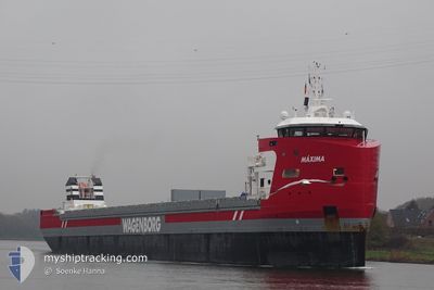
MAXIMA
Cargo

Current Trip
| Time Travelled | 12 days |
|---|---|
| Remaining Time | 2 days |
| Distance Travelled | 2996.60 nm |
| Remaining Distance | 879.07 nm |
| AVG Speed | 10.2 Knopen |
| MAX Speed | 13.6 Knopen |
| AVG Wind | 12.8 knots |
| MAX Wind | 23.5 knots |
| MIN Temp | 9°C / 48.2°F |
| MAX Temp | 20.6°C / 69.08°F |
| Diepgang | 8 M |
| Positie ontvangen | 17 m geleden |
Current Position
| Lengtegraad | 22.86974° |
|---|---|
| Breedtegraat | 36.04743° |
| Status | Under way using engine |
| Snelheid | 10.4 Knopen |
| Koers | 95° |
| Gebied | Mediterranean Sea - Eastern Basin |
| Station | T-AIS |
| Positie ontvangen | 17 m geleden |
Information
The current position of MAXIMA is in Mediterranean Sea - Eastern Basin with coordinates 36.04743° / 22.86974° as reported on 2025-05-28 18:14 by AIS to our vessel tracker app. The vessel's current speed is 10.4 Knopen and is heading at the port of ISKENDERUN. The estimated time of arrival as calculated by MyShipTracking vessel tracking app is 2025-05-31 18:35 LT
The vessel MAXIMA (IMO: 9882061, MMSI: 246539000) is a Cargo It's sailing under the flag of [NL] Netherlands.
In this page you can find informations about the vessels current position, last detected port calls, and current voyage information. If the vessels is not in coverage by AIS you will find the latest position.
The current position of MAXIMA is detected by our AIS receivers and we are not responsible for the reliability of the data. The last position was recorded while the vessel was in Coverage by the Ais receivers of our vessel tracking app.
The current draught of MAXIMA as reported by AIS is 8 meters
Weather
| Temperature | 19.8°C / 67.64°F |
|---|---|
| Wind Speed | 17 knots |
| Direction | 289° WNW |
| Pressure | 1013.2 hPa |
| Humidity | 80.6 % |
| Cloud Coverage | 25 % |


Featured Company
Last Port Calls
| Port | Arrival | Departure | Time In Port |
|---|---|---|---|
| 2025-05-12 00:41 | 2025-05-16 18:19 | 4 d | |
| 2025-05-11 23:08 | 2025-05-12 00:02 | 54 m | |
| 2025-05-09 11:31 | 2025-05-11 00:29 | 1 d | |
| 2025-05-04 22:06 | 2025-05-06 14:05 | 1 d | |
| 2025-04-23 01:32 | 2025-05-01 05:08 | 8 d | |
| 2025-04-13 18:57 | 2025-04-17 15:07 | 3 d | |
| 2025-04-07 10:28 | 2025-04-09 19:23 | 2 d | |
| 2025-04-04 16:42 | 2025-04-05 20:18 | 1 d | |
| 2025-04-02 13:22 | 2025-04-02 19:11 | 5 h | |
| 2025-03-31 14:08 | 2025-04-02 13:10 | 1 d |
Most Visited Ports (Last year)
| Port | Arrivals | |
|---|---|---|
| 5 | ||
| 4 | ||
| 4 | ||
| 3 | ||
| 3 | ||
| 3 |
Last Trips
| Origin | Departure | Destination | Arrival | Distance | |
|---|---|---|---|---|---|
| 2025-05-12 00:02 | 2025-05-12 00:41 | 1.44 nm | |||
| 2025-05-11 00:29 | 2025-05-11 23:08 | 264.80 nm | |||
| 2025-05-06 14:05 | 2025-05-09 11:31 | 765.11 nm | |||
| 2025-05-01 05:08 | 2025-05-04 22:06 | 733.27 nm | |||
| 2025-04-17 15:07 | 2025-04-23 01:32 | 1295.82 nm | |||
| 2025-04-09 19:23 | 2025-04-13 18:57 | 974.80 nm | |||
| 2025-04-05 20:18 | 2025-04-07 10:28 | 413.91 nm | |||
| 2025-04-02 19:11 | 2025-04-04 16:42 | 493.54 nm | |||
| 2025-04-02 13:10 | 2025-04-02 13:22 | 0.58 nm | |||
| 2025-03-27 12:01 | 2025-03-31 14:08 | 490.14 nm |
Events
| Tijd | Evenement | Details | Positie / Bestemming | Info |
|---|---|---|---|---|
| 2025-05-28 18:24 | Status Changed | Default Under way using engine |
36.04380 / 22.90618
TRISK
|
Snelheid: 10.4 kn Koers: 95° |
| 2025-05-28 18:14 | Status Changed | Under way using engine Default |
36.04743 / 22.86974
TRISK
|
Snelheid: 10.5 kn Koers: 91° |
| 2025-05-28 18:07 | Binnenbereik |
36.04743 / 22.86974
Mediterranean Sea - Eastern Basin
TRISK
|
Snelheid: 10.4 kn Koers: 95° |
|
| 2025-05-28 01:48 | Status Changed | Default Under way using engine |
36.21737 / 19.18643
TRISK
|
Snelheid: 10.1 kn Koers: 92.9° |
| 2025-05-28 01:39 | Buitenbereik |
36.21905 / 19.15700
Mediterranean Sea - Eastern Basin
TRISK
|
Snelheid: 10.1 kn Koers: 92.9° |
|
| 2025-05-28 01:22 | Status Changed | Under way using engine Default |
36.22183 / 19.09584
TRISK
|
Snelheid: 10 kn Koers: 95° |
| 2025-05-28 00:54 | Status Changed | Default Under way using engine |
36.22812 / 19.00119
TRISK
|
Snelheid: 10 kn Koers: 92.6° |
| 2025-05-28 00:48 | Status Changed | Under way using engine Default |
36.22899 / 18.98129
TRISK
|
Snelheid: 10 kn Koers: 93° |
| 2025-05-28 00:00 | Status Changed | Default Under way using engine |
36.23635 / 18.81542
TRISK
|
Snelheid: 10.1 kn Koers: 94.1° |
| 2025-05-27 22:50 | Status Changed | Under way using engine Default |
36.24853 / 18.57102
TRISK
|
Snelheid: 10.3 kn Koers: 94° |