

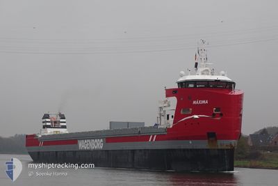
MAXIMA
Cargo

Current Trip
| Time Travelled | 5 days |
|---|---|
| Remaining Time | --- |
| Distance Travelled | 1432.05 nm |
| Remaining Distance | --- |
| AVG Speed | 9.9 Knots |
| MAX Speed | 13.6 Knots |
| AVG Wind | 13.7 knots |
| MAX Wind | 22.8 knots |
| MIN Temp | 9°C / 48.2°F |
| MAX Temp | 17.9°C / 64.22°F |
| Draught | 8 m |
| Position Received | 2 h, 26 m ago |
Current Position
| Longitude | -9.16047° |
|---|---|
| Latitude | 36.52551° |
| Status | Under way using engine |
| Speed | 9.7 Knots |
| Course | 105.4° |
| Area | North Atlantic Ocean |
| Station | T-AIS |
| Position Received | 2 h, 26 m ago |
Information
The current position of MAXIMA is in North Atlantic Ocean with coordinates 36.52551° / -9.16047° as reported on 2025-05-22 10:57 by AIS to our vessel tracker app. The vessel's current speed is 9.7 Knots and is heading at the port of ISKENDERUN. The estimated time of arrival as calculated by MyShipTracking vessel tracking app is 2025-06-01 11:00 LT
The vessel MAXIMA (IMO: 9882061, MMSI: 246539000) is a Cargo It's sailing under the flag of [NL] Netherlands.
In this page you can find informations about the vessels current position, last detected port calls, and current voyage information. If the vessels is not in coverage by AIS you will find the latest position.
The current position of MAXIMA is detected by our AIS receivers and we are not responsible for the reliability of the data. The last position was recorded while the vessel was in Coverage by the Ais receivers of our vessel tracking app.
The current draught of MAXIMA as reported by AIS is 8 meters
Weather
| Temperature | 17.8°C / 64.04°F |
|---|---|
| Wind Speed | 20 knots |
| Direction | 330° NNW |
| Pressure | 1016.3 hPa |
| Humidity | 84.5 % |
| Cloud Coverage | 5 % |


Featured Company
Last Port Calls
| Port | Arrival | Departure | Time In Port |
|---|---|---|---|
| 2025-05-12 00:41 | 2025-05-16 18:19 | 4 d | |
| 2025-05-11 23:08 | 2025-05-12 00:02 | 54 m | |
| 2025-05-09 11:31 | 2025-05-11 00:29 | 1 d | |
| 2025-05-04 22:06 | 2025-05-06 14:05 | 1 d | |
| 2025-04-23 01:32 | 2025-05-01 05:08 | 8 d | |
| 2025-04-13 18:57 | 2025-04-17 15:07 | 3 d | |
| 2025-04-07 10:28 | 2025-04-09 19:23 | 2 d | |
| 2025-04-04 16:42 | 2025-04-05 20:18 | 1 d | |
| 2025-04-02 13:22 | 2025-04-02 19:11 | 5 h | |
| 2025-03-31 14:08 | 2025-04-02 13:10 | 1 d |
Most Visited Ports (Last year)
| Port | Arrivals | |
|---|---|---|
| 5 | ||
| 4 | ||
| 4 | ||
| 3 | ||
| 3 | ||
| 3 |
Last Trips
| Origin | Departure | Destination | Arrival | Distance | |
|---|---|---|---|---|---|
| 2025-05-12 00:02 | 2025-05-12 00:41 | 1.44 nm | |||
| 2025-05-11 00:29 | 2025-05-11 23:08 | 264.80 nm | |||
| 2025-05-06 14:05 | 2025-05-09 11:31 | 765.11 nm | |||
| 2025-05-01 05:08 | 2025-05-04 22:06 | 733.27 nm | |||
| 2025-04-17 15:07 | 2025-04-23 01:32 | 1295.82 nm | |||
| 2025-04-09 19:23 | 2025-04-13 18:57 | 974.80 nm | |||
| 2025-04-05 20:18 | 2025-04-07 10:28 | 413.91 nm | |||
| 2025-04-02 19:11 | 2025-04-04 16:42 | 493.54 nm | |||
| 2025-04-02 13:10 | 2025-04-02 13:22 | 0.58 nm | |||
| 2025-03-27 12:01 | 2025-03-31 14:08 | 490.14 nm |
Events
| Time | Event | Details | Position / Dest | Info |
|---|---|---|---|---|
| 2025-05-22 11:04 | Status Changed | Default Under way using engine |
36.52097 / -9.13652
TRISK
|
Speed: 9.7 kn Course: 105.4° |
| 2025-05-22 10:57 | Status Changed | Under way using engine Default |
36.52551 / -9.16047
TRISK
|
Speed: 9.6 kn Course: 105° |
| 2025-05-22 10:57 | OUT of Coverage |
36.52551 / -9.16047
North Atlantic Ocean
TRISK
|
Speed: 9.7 kn Course: 105.4° |
|
| 2025-05-22 10:32 | Status Changed | Default Under way using engine |
36.54468 / -9.23719
TRISK
|
Speed: 9.4 kn Course: 105.8° |
| 2025-05-22 10:19 | Status Changed | Under way using engine Default |
36.55497 / -9.27758
TRISK
|
Speed: 9.4 kn Course: 106° |
| 2025-05-22 10:08 | IN Coverage |
36.55471 / -9.27661
North Atlantic Ocean
TRISK
|
Speed: 9.4 kn Course: 107.7° |
|
| 2025-05-22 08:52 | Status Changed | Default Under way using engine |
36.72716 / -9.48575
TRISK
|
Speed: 10.1 kn Course: 135.7° |
| 2025-05-22 08:45 | OUT of Coverage |
36.74287 / -9.50409
North Atlantic Ocean
TRISK
|
Speed: 10.1 kn Course: 135.7° |
|
| 2025-05-22 08:37 | Status Changed | Under way using engine Default |
36.75942 / -9.52364
TRISK
|
Speed: 10.2 kn Course: 138° |
| 2025-05-22 08:37 | IN Coverage |
36.75736 / -9.52113
North Atlantic Ocean
TRISK
|
Speed: 10.2 kn Course: 136.4° |