
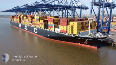
MSC FLAVIA
Container Ship
Current Trip
| Time Travelled | 2 days |
|---|---|
| Remaining Time | --- |
| Distance Travelled | 1173.55 nm |
| Remaining Distance | --- |
| AVG Speed | 15.9 Noeuds |
| MAX Speed | 20 Noeuds |
| AVG Wind | 16.3 knots |
| MAX Wind | 28 knots |
| MIN Temp | 8.1°C / 46.58°F |
| MAX Temp | 19.9°C / 67.82°F |
| Tirant d eau | 13.1 m |
| Position reçue | 2 d depuis |
Current Position
| Longitude | -123.59845° |
|---|---|
| Latitude | 37.51619° |
| Etat | Under way using engine |
| Vitesse | 15.5 Noeuds |
| Parcours | 239.2° |
| Zone | North Pacific Ocean |
| Station | T-AIS |
| Position reçue | 2 d depuis |
Info
Information
The current position of MSC FLAVIA is in North Pacific Ocean with coordinates 37.51619° / -123.59845° as reported on 2025-02-11 08:53 by AIS to our vessel tracker app. The vessel's current speed is 15.5 Noeuds and is heading at the port of BUSAN. The estimated time of arrival as calculated by MyShipTracking vessel tracking app is 2025-02-26 23:00 LT
The vessel MSC FLAVIA (IMO: 9467433, MMSI: 373004000) is a Container Ship that was built in 2012 ( 13 Age ). It's sailing under the flag of [PA] Panama.
In this page you can find informations about the vessels current position, last detected port calls, and current voyage information. If the vessels is not in coverage by AIS you will find the latest position.
The current position of MSC FLAVIA is detected by our AIS receivers and we are not responsible for the reliability of the data. The last position was recorded while the vessel was in Coverage by the Ais receivers of our vessel tracking app.
The current draught of MSC FLAVIA as reported by AIS is 13.1 meters
Weather
| Temperature | 19.9°C / 67.82°F |
|---|---|
| Wind Speed | 3 knots |
| Direction | 246° WSW |
| Pressure | 1020.9 hPa |
| Humidity | 66.2 % |
| Cloud Coverage | 100 % |
Featured Company
Last Port Calls
| Port | Arrival | Departure | Time In Port |
|---|---|---|---|
| 2025-02-09 16:48 | 2025-02-11 02:24 | 1 d | |
| 2025-01-27 12:26 | 2025-02-02 15:22 | 6 d | |
| 2025-01-10 21:04 | 2025-01-12 12:09 | 1 d | |
| 2024-12-30 03:01 | 2024-12-31 23:57 | 1 d | |
| 2024-12-25 03:34 | 2024-12-27 10:16 | 2 d | |
| 2024-12-19 06:41 | 2024-12-21 08:05 | 2 d | |
| 2024-12-13 20:00 | 2024-12-15 08:52 | 1 d |
Most Visited Ports (Last year)
| Port | Arrivals | |
|---|---|---|
| 4 | ||
| 3 | ||
| 3 | ||
| 3 | ||
| 2 | ||
| 2 |
Last Trips
| Origin | Departure | Destination | Arrival | Distance | |
|---|---|---|---|---|---|
| 2025-02-02 07:22 | 2025-02-09 08:48 | 495.74 nm | |||
| 2025-01-12 21:09 | 2025-01-27 04:26 | 6322.87 nm | |||
| 2025-01-01 06:57 | 2025-01-11 06:04 | 2744.60 nm | |||
| 2024-12-27 18:16 | 2024-12-30 10:01 | 836.18 nm | |||
| 2024-12-21 13:35 | 2024-12-25 11:34 | 1621.53 nm | |||
| 2024-12-15 14:22 | 2024-12-19 12:11 | 1310.90 nm | |||
| 2024-11-18 13:20 | 2024-12-14 01:30 | 11081.43 nm |
Events
| Heure | Evenement | Détails | Position/ Destination | Info |
|---|---|---|---|---|
| 2025-02-11 08:56 | Etat Changé | Default Under way using engine |
37.50812 / -123.61453
KRPUS
|
Vitesse: 15.5 kn Parcours: 239.2° |
| 2025-02-11 08:53 | Hors de la zone couverte |
37.51619 / -123.59845
North Pacific Ocean
KRPUS
|
Vitesse: 15.5 kn Parcours: 239.2° |
|
| 2025-02-11 08:52 | Etat Changé | Under way using engine Default |
37.51704 / -123.59666
KRPUS
|
Vitesse: 15.2 kn Parcours: 239° |
| 2025-02-11 08:45 | Dans la zone couverte |
37.51619 / -123.59845
North Pacific Ocean
KRPUS
|
Vitesse: 15.5 kn Parcours: 239.2° |
|
| 2025-02-11 07:23 | Etat Changé | Default Under way using engine |
37.56682 / -123.13846
KRPUS
|
Vitesse: 15.7 kn Parcours: 267.6° |
| 2025-02-11 07:17 | Hors de la zone couverte |
37.56767 / -123.10332
North Pacific Ocean
KRPUS
|
Vitesse: 15.7 kn Parcours: 267.6° |
|
| 2025-02-11 02:52 | Changement d'ETA | 2025/02/26 23:00 2025/02/25 23:00 |
37.84415 / -122.43191
KRPUS
|
Vitesse: 10.9 kn Parcours: 274.2° |
| 2025-02-11 02:24 | PORT DE DEPART |
|
37.80207 / -122.34364
KRPUS
|
Vitesse: 7.6 kn Parcours: 289° |
| 2025-02-11 02:06 | Démarrage |
37.79560 / -122.31812
[US] OAKLAND
|
Vitesse: 3.1 kn Parcours: 284° |
|
| 2025-02-11 02:04 | Etat Changé | Under way using engine Moored |
37.79524 / -122.31620
[US] OAKLAND
|
Vitesse: 1.7 kn Parcours: 281° |