
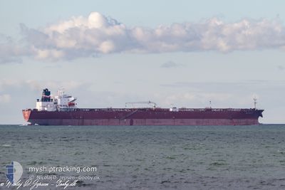
PS AMALFI
Oil Products Tanker
Current Trip
| Time Travelled | 2 days |
|---|---|
| Remaining Time | 1 day |
| Distance Travelled | 462.66 nm |
| Remaining Distance | 917.42 nm |
| AVG Speed | 11.2 Noeuds |
| MAX Speed | 16.4 Noeuds |
| AVG Wind | 9.1 knots |
| MAX Wind | 20 knots |
| MIN Temp | -2.4°C / 27.68°F |
| MAX Temp | 14.6°C / 58.28°F |
| Tirant d eau | 8.4 m |
| Position reçue | 1 d depuis |
Current Position
| Longitude | -74.71507° |
|---|---|
| Latitude | 38.43065° |
| Etat | Under way using engine |
| Vitesse | 13.6 Noeuds |
| Parcours | 131.4° |
| Zone | North Atlantic Ocean |
| Station | T-AIS |
| Position reçue | 1 d depuis |
Info
Information
The current position of PS AMALFI is in North Atlantic Ocean with coordinates 38.43065° / -74.71507° as reported on 2026-01-04 20:18 by AIS to our vessel tracker app. The vessel's current speed is 13.6 Noeuds and is heading at the port of FREEPORT (BS). The estimated time of arrival as calculated by MyShipTracking vessel tracking app is 2026-01-07 17:41 LT
The vessel PS AMALFI (IMO: 9439395, MMSI: 229869000) is a Oil Products Tanker that was built in 2010 ( 16 Age ). It's sailing under the flag of [MT] Malta.
In this page you can find informations about the vessels current position, last detected port calls, and current voyage information. If the vessels is not in coverage by AIS you will find the latest position.
The current position of PS AMALFI is detected by our AIS receivers and we are not responsible for the reliability of the data. The last position was recorded while the vessel was in Coverage by the Ais receivers of our vessel tracking app.
The current draught of PS AMALFI as reported by AIS is 8.4 meters
Weather
| Temperature | 14.6°C / 58.28°F |
|---|---|
| Wind Speed | 4 knots |
| Direction | 162° SSE |
| Pressure | 1023.4 hPa |
| Humidity | 57.3 % |
| Cloud Coverage | 28 % |
Featured Company
Last Port Calls
| Port | Arrival | Departure | Time In Port |
|---|---|---|---|
| 2026-01-02 11:38 | 2026-01-03 13:13 | 1 d | |
| 2026-01-01 00:20 | 2026-01-02 08:04 | 1 d | |
| 2025-12-20 20:13 | 2025-12-25 12:50 | 4 d | |
| 2025-11-28 18:55 | 2025-11-29 17:27 | 22 h | |
| 2025-11-27 07:41 | 2025-11-28 15:02 | 1 d | |
| 2025-11-13 12:01 | 2025-11-19 12:04 | 6 d | |
| 2025-11-01 08:05 |
Most Visited Ports (Last year)
| Port | Arrivals | |
|---|---|---|
| 7 | ||
| 6 | ||
| 5 | ||
| 2 | ||
| 1 | ||
| 1 |
Last Trips
| Origin | Departure | Destination | Arrival | Distance | |
|---|---|---|---|---|---|
| 2026-01-02 08:04 | 2026-01-02 11:38 | 27.58 nm | |||
| 2025-12-25 12:50 | 2026-01-01 00:20 | 1972.46 nm | |||
| 2025-11-29 17:27 | 2025-12-20 20:13 | 2257.28 nm | |||
| 2025-11-28 15:02 | 2025-11-28 18:55 | 27.78 nm | |||
| 2025-11-19 12:04 | 2025-11-27 07:41 | 1949.00 nm | |||
| 2025-11-01 08:05 | 2025-11-13 12:01 | 2379.03 nm |
Events
| Heure | Evenement | Détails | Position/ Destination | Info |
|---|---|---|---|---|
| 2026-01-04 20:30 | Etat Changé | Default Under way using engine |
38.40406 / -74.67265
US MAH ---> BS FPO
|
Vitesse: 13.6 kn Parcours: 131.4° |
| 2026-01-04 20:18 | Hors de la zone couverte |
38.43065 / -74.71507
North Atlantic Ocean
US MAH ---> BS FPO
|
Vitesse: 13.6 kn Parcours: 131.4° |
|
| 2026-01-04 18:18 | Etat Changé | Under way using engine Default |
38.73537 / -74.99174
US MAH ---> BS FPO
|
Vitesse: 9.6 kn Parcours: 136° |
| 2026-01-04 18:07 | Dans la zone couverte |
38.73255 / -74.98833
North Atlantic Ocean
US MAH ---> BS FPO
|
Vitesse: 9.3 kn Parcours: 136.7° |
|
| 2026-01-04 17:07 | Etat Changé | Default Under way using engine |
38.92672 / -75.10027
US MAH ---> BS FPO
|
Vitesse: 16.4 kn Parcours: 158.4° |
| 2026-01-04 16:59 | Hors de la zone couverte |
38.95817 / -75.11627
North Atlantic Ocean
US MAH ---> BS FPO
|
Vitesse: 16.4 kn Parcours: 158.4° |
|
| 2026-01-04 16:55 | Etat Changé | Under way using engine Default |
38.97415 / -75.12510
US MAH ---> BS FPO
|
Vitesse: 16.3 kn Parcours: 156° |
| 2026-01-04 16:55 | Etat Changé | Default Under way using engine |
38.97663 / -75.12655
US MAH ---> BS FPO
|
Vitesse: 16.1 kn Parcours: 155.1° |
| 2026-01-04 16:28 | Etat Changé | Under way using engine Default |
39.08384 / -75.18596
US MAH ---> BS FPO
|
Vitesse: 15 kn Parcours: 146° |
| 2026-01-04 16:23 | Etat Changé | Default Under way using engine |
39.10215 / -75.20204
US MAH ---> BS FPO
|
Vitesse: 15 kn Parcours: 146.2° |